Metadata Report for BODC Series Reference Number 2026920
Metadata Summary
Problem Reports
Data Access Policy
Narrative Documents
Project Information
Data Activity or Cruise Information
Fixed Station Information
BODC Quality Flags
SeaDataNet Quality Flags
Metadata Summary
Data Description |
|||||||||||||||||||||||||||||
|
|||||||||||||||||||||||||||||
Data Identifiers |
|||||||||||||||||||||||||||||
|
|||||||||||||||||||||||||||||
Time Co-ordinates(UT) |
|||||||||||||||||||||||||||||
|
|||||||||||||||||||||||||||||
Spatial Co-ordinates | |||||||||||||||||||||||||||||
|
|||||||||||||||||||||||||||||
Parameters |
|||||||||||||||||||||||||||||
|
|||||||||||||||||||||||||||||
|
|||||||||||||||||||||||||||||
Problem Reports
No Problem Report Found in the Database
Data Access Policy
Open Data supplied by Natural Environment Research Council (NERC)
You must always use the following attribution statement to acknowledge the source of the information: "Contains data supplied by Natural Environment Research Council."
Narrative Documents
Kongsberg EM120 Multibeam Echosounder
The EM120 is a low frequency (12 kHz) multibeam echosounder with full ocean depth capability designed for bathymetric surveys. It measures water depth by monitoring the travel time of an acoustic signal that is transmitted from the ship, reflected off the seabed and received back at the ship.
The main system units of the EM120 are transducer arrays (separate for reception and transmission), preamplifier unit, transceiver unit and operator unit. Sub-bottom profiling capability is an optional extra. For both transmit and receive arrays standard beamwidth is 1° or 2°, and 4° beamwidth is available for the receive array.
The system has 191 beams with pointing angles automatically adjusted according to achievable coverage or operator defined limits. The beam spacing is normally equidistant, corresponding to 1% of depth at 90° angular coverage, 2% at 120° and 3% at 140°. The transmit fan is split into several individual sectors, each of which is corrected independently for vessel roll, pitch and yaw, which places all soundings on a "best fit" to a line perpendicular to the survey line.
The EM120 supersedes the EM12 and was itself superseded by the EM122 in 2008.
Specifications
| Frequency | 12 kHz |
| Maximum ping rate | 5 Hz |
| Range sampling rate | 2 kHz |
| Swath coverage sector | up to 150° |
| Swath width | up to 5.5 x water depth |
| Depth resolution | 10 to 40 cm |
| Depth range | 20 to 11,000 m |
| Pulse length | 2, 5 and 15 ms |
| Number of beams | 191 |
| Beam width | 1° x 1° |
| Beam spacing (at angular coverage) | 1% of depth at 90° |
Further details can be found in the manufacturer's specification sheet.
JC035 Bathymetry BODC Processing
Data were received by BODC in .TXT format, one for the EM120 and one for the EM710. Datasets were are transferred into a common format, a netCDF subset. The following table shows how the variables within the files were mapped to the appropriate BODC parameter codes:
| Original parameter name | Original Units | BODC Parameter Code | BODC Units | Comments |
|---|---|---|---|---|
| Latitude | Degrees | ALATGP01 | Degrees | - |
| Longitude | Degrees | ALONGP01 | Degrees | - |
| Seafloor height | Metres | MBTHHGHT | Metres | - |
Following transfer, the data are screened visually, using BODC's in-house visualisation software, and any spikes or instrument malfunctions are clearly labelled with quality control flags.
JC035 Bathymetry Originator's Data Processing
Sampling Strategy
Kongsberg EM120 and EM710 multibeam bathymetry data were collected on board RRS James Cook cruise JC035 from 7th to 19th June 2009. This cruise set out to map the Whittard Canyon. The data were used as planning and a basemap for the ROV survey during JC036, which followed JC035 from 20th June to 28th July 2009.
The data collection was co-funded under the NERC Oceans 2025 programme under Theme 5: Continental Margins and the Deep Ocean, and the EU HERMIONE project.
Data Processing
The shipboard EM120 and EM710 data were logged and saved in one hour segments (.all, .ix1 and .ix2 files). Processing of these data were carried out with the CARIS HIPS software version 6.1, a commercial package running under Windows XP, provided by the science party.
The data were imported into a HIPS Project file from the raw archive format during the cruise. As the ship was generally moving slowly (2.5 kts) when towing the Towed Ocean Bottom Instrument (TOBI), the quality of bathymetric data was very good. Thus automatic filtering was omitted, and only hand editing was carried out. The swath editor was used to edit the raw bathymetry values before geographic registration. The quickest and best method was found to be using the 3D editor which allows the user to view, rotate and edit the soundings.
Zero tide was assumed for the survey as no tide gauge data were available and it was assumed that tidal variations would probably fall into the error margin of the bathymetry values. Several sound velocity profiles were taken during the survey. As no calibration patch test was performed the calibration results created at installation were used. These were:
- Roll error = -0.07 degrees
- Pitch error = 0.01 degrees
- Gyro error = 0.01 degrees
- These are applied during geographic registration.
After geographic registration on a UTM Zone 29 (WGS84) 50-metre grid, the data were viewed in colour relief. The subset editor was used to identify the points where obvious problem bathymetry data were seen, and the points were removed.
The final mosaic was exported into decimal degrees as a GeoTiff and ASCII XYZ grid and supplied to BODC. Grids for software packages such as GMT and ERDAS Imgine version 9.3 were also created. The depth values were multiplied by -1 to get proper topographic heights.
For more information, please see the cruise report.
Project Information
Oceans 2025 - The NERC Marine Centres' Strategic Research Programme 2007-2012
Who funds the programme?
The Natural Environment Research Council (NERC) funds the Oceans 2025 programme, which was originally planned in the context of NERC's 2002-2007 strategy and later realigned to NERC's subsequent strategy (Next Generation Science for Planet Earth; NERC 2007).
Who is involved in the programme?
The Oceans 2025 programme was designed by and is to be implemented through seven leading UK marine centres. The marine centres work together in coordination and are also supported by cooperation and input from government bodies, universities and other partners. The seven marine centres are:
- National Oceanography Centre, Southampton (NOCS)
- Plymouth Marine Laboratory (PML)
- Marine Biological Association (MBA)
- Sir Alister Hardy Foundation for Marine Science (SAHFOS)
- Proudman Oceanographic Laboratory (POL)
- Scottish Association for Marine Science (SAMS)
- Sea Mammal Research Unit (SMRU)
Oceans2025 provides funding to three national marine facilities, which provide services to the wider UK marine community, in addition to the Oceans 2025 community. These facilities are:
- British Oceanographic Data Centre (BODC), hosted at POL
- Permanent Service for Mean Sea Level (PSMSL), hosted at POL
- Culture Collection of Algae and Protozoa (CCAP), hosted at SAMS
The NERC-run Strategic Ocean Funding Initiative (SOFI) provides additional support to the programme by funding additional research projects and studentships that closely complement the Oceans 2025 programme, primarily through universities.
What is the programme about?
Oceans 2025 sets out to address some key challenges that face the UK as a result of a changing marine environment. The research funded through the programme sets out to increase understanding of the size, nature and impacts of these changes, with the aim to:
- improve knowledge of how the seas behave, not just now but in the future;
- help assess what that might mean for the Earth system and for society;
- assist in developing sustainable solutions for the management of marine resources for future generations;
- enhance the research capabilities and facilities available for UK marine science.
In order to address these aims there are nine science themes supported by the Oceans 2025 programme:
- Climate, circulation and sea level (Theme 1)
- Marine biogeochemical cycles (Theme 2)
- Shelf and coastal processes (Theme 3)
- Biodiversity and ecosystem functioning (Theme 4)
- Continental margins and deep ocean (Theme 5)
- Sustainable marine resources (Theme 6)
- Technology development (Theme 8)
- Next generation ocean prediction (Theme 9)
- Integration of sustained observations in the marine environment (Theme 10)
In the original programme proposal there was a theme on health and human impacts (Theme 7). The elements of this Theme have subsequently been included in Themes 3 and 9.
When is the programme active?
The programme started in April 2007 with funding for 5 years.
Brief summary of the programme fieldwork/data
Programme fieldwork and data collection are to be achieved through:
- physical, biological and chemical parameters sampling throughout the North and South Atlantic during collaborative research cruises aboard NERC's research vessels RRS Discovery, RRS James Cook and RRS James Clark Ross;
- the Continuous Plankton Recorder being deployed by SAHFOS in the North Atlantic and North Pacific on 'ships of opportunity';
- physical parameters measured and relayed in near real-time by fixed moorings and ARGO floats;
- coastal and shelf sea observatory data (Liverpool Bay Coastal Observatory (LBCO) and Western Channel Observatory (WCO)) using the RV Prince Madog and RV Quest.
The data is to be fed into models for validation and future projections. Greater detail can be found in the Theme documents.
Hotspot Ecosystem Research and Man's Impact on European seas (HERMIONE)
Background
The HERMIONE project is designed to make a major advance in our knowledge of the functioning of deep-sea ecosystems and their contribution to the production of goods and services.
The project set out to investigate ecosystems at critical sites on Europe's deep-ocean margin including submarine canyons, seamounts, cold seeps, open slopes, and deep basins in the Arctic, North Atlantic Ocean, and Mediterranean Sea. It included scientists from a wide range of disciplines (including biologists, ecologists, microbiologists, biogeochemists, sedimentologists, physical oceanographers, modelers and socio-economists) who researched the natural dynamics and interconnections of ecosystems as well as how these contribute to the goods and services we rely on, and how they are affected by natural and anthropogenic change.
A major aim of HERMIONE was to use the knowledge gained during the project to contribute to EU environmental policies, by integrating socio-economic research with natural science. This information can be used to create effective management plans that will help to protect our oceans for the future.
The objectives of HERMIONE were:
- To investigate the dimensions, distribution and interconnection of deep-sea ecosystems;
- To understand changes in deep-sea ecosystems related to key factors including climate change, human impacts and the impact of large-scale episodic events;
- To understand the biological capacities and specific adaptations of deep-sea organisms, and investigate the importance of biodiversity in the functioning of deep-water ecosystems;
- To provide stakeholders and policy-makers with scientific knowledge to support deep-sea governance aimed at the sustainable management of resources and the conservation of ecosystems.
HERMIONE will enhance the education and public perception of the deep-ocean issues, assisted by the involvement of some of the major EU aquaria and through GEOSS databases that will create a platform for discussion between a range of stakeholders, and contribute to EU environmental policies.
Fieldwork
Fieldwork was carried out on 93 research cruises of which 69 were longer than 5 days. The project in total consisted of 1094 days of ship time.
Participants
- Natural Environment Research Council, United Kingdom
- Institut Francais De Recherche Pour L'exploitation De La Mer, France
- Stichting Nioz, Koninklijk Nederlands Instituut Voor Onderzoek Der Zee, Netherlands
- Universitat De Barcelona, Spain
- Hellenic Centre For Marine Research, Greece
- Leibniz-Institut Fuer Meereswissenschaften An Der Universitaet Kiel, Germany
- Consiglio Nazionale Delle Ricerche, Italy
- Alfred-Wegener-Institut Helmholtz-Zentrum Fur Polar- Und Meeresforschung, Germany
- Universitetet I Tromsoe - Norges Arktiske Universitet, Norway
- National University Of Ireland Galway, Ireland
- Friedrich-Alexander-Universitaet Erlangen-Nuernberg , Germany
- Universiteit Gent, Belgium
- Agencia Estatal Consejo Superior De Investigaciones Cientificas, Spain
- Consorzio Nazionale Interuniversitario Per Le Scienze Del Mare Associazione, Italy
- Max-Planck-Gesellschaft Zur Forderung Der Wissenschaften Ev, Germany
- Centre National De La Recherche Scientifique CNRS, France
- Instituto Hidrografico, Portugal
- Jacobs University Bremen GGMBH, Germany
- Universitaet Bremen, Germany
- Cardiff University, United Kingdom
- Havforskningsinstituttet, Norway
- Goeteborgs Universitet, Sweden
- University Of Southampton, United Kingdom
- Koninklijke Nederlandse Akademie Van Wetenschappen - Knaw, Netherlands
- The University Court Of The University Of Aberdeen, United Kingdom
- The University Of Liverpool, United Kingdom
- The Scottish Association For Marine Science LBG, United Kingdom
- Universidade De Aveiro, Portugal
- Universite Pierre Et Marie Curie - Paris 6, France
- P.P. Shirshov Institute Of Oceanology Of Russian Academy Of Sciences, Russia
- United Nations Environment Programme , Kenya
- Universidade Dos Acores, Portugal
- Median SCP, Spain
- Archimedix, Möckl & Munzel GbR, Germany
- Panepistimio Thessalias, Greece
- University College Cork - National University Of Ireland, Cork, Ireland
- National Marine Aquarium Ltd., United Kingdom
- Costa Edutainment S.P.A, Italy
- Heriot-Watt University, United Kingdom
- Senckenberg Gesellschaft Fur Naturforschung, Germany
- WCMC LBG, United Kingdom
Funding
The project was funded under the EU Commission Seventh Framework Programme, FP7 (2007-2013), grant agreement ID 226354. It ran from 1st April 2009 to 30th September 2012. Ship time was largely funded outside of the project by National funds. The project was coordinated by the Natural Environment Research Council (NERC), UK. More information can be found here and in the newsletters.
Data Activity or Cruise Information
Cruise
| Cruise Name | JC035 |
| Departure Date | 2009-06-07 |
| Arrival Date | 2009-06-19 |
| Principal Scientist(s) | Veerle A Huvenne (National Oceanography Centre, Southampton) |
| Ship | RRS James Cook |
Complete Cruise Metadata Report is available here
Fixed Station Information
Fixed Station Information
| Station Name | Whittard Canyon - The Canyons Marine Conservation Zone |
| Category | Offshore area |
| Latitude | 48° 6.00' N |
| Longitude | 10° 18.00' W |
| Water depth below MSL | 3600.0 m |
Fixed Station - Whittard Canyon - The Canyons Marine Conservation Zone
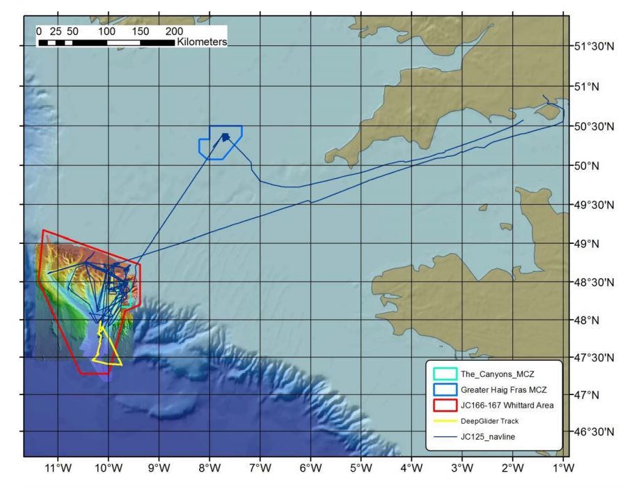
The Canyons MCZ is located in the far south-west corner of the UK continental shelf, more than 330 km from Land's End, Cornwall. It encompasses the steep part of the shelf break where the seabed drops from a depth of 100 m to the oceanic abyssal plain at 2000 m. It is unique within the context of England's largely shallow seas due to its depth, sea-bed topography and the coral features it contains.
There are two large canyons within the site, which add to its topographic complexity: the Explorer Canyon to the north and the Dangaard Canyon below it. The wider Whittard Canyon area encapsulates the Canyons MCZ and also includes a network of submarine canyons to the West. The MCZ, also known as a Marine Protected Area (MPA), was designated in November 2013 under the Marine and Coastal Access Act (2009). The Canyons MCZ covers an area of 661 km2, which extends to approximately 5200 km2 when Whittard Canyon is included.
On the northernmost wall of the Explorer Canyon is a patch of live Cold-water coral reef (Lophelia pertusa) and Coral gardens, both of which are a OSPAR threatened and/or declining habitat. This is the only known example of living Cold-water coral reef recorded within England's seas, making it unique in these waters.
Cold-water corals and Coral gardens typically support a range of other organisms. The coral provides a three-dimensional structure and a variety of microhabitats that provide shelter and an attachment surface for other species. Both Cold-water corals and Coral gardens can be long-lived but are extremely slow growing (at about 6 mm a year), making protection important for their conservation. Another reef-forming cold-water coral, Madrepora oculata, is also present in the site.
The variety of deep-sea bed communities present are indicative of the range of substrates found in and around the canyons, including bedrock, biogenic reef, coral rubble, coarse sediment, mud and sand. These biological communities include cold-water coral communities (Lophelia pertusa and Madrepora oculata), Coral gardens, feather star (Leptometra celtica) assemblages and Sea-pen and burrowing megafauna communities (including, burrowing anemone fields, squat lobster (Munida sp.) assemblages, barnacle assemblages and deep-sea sea-pen (Kophobelemnon sp.) fields).
Sampling History
| JC035 (2009) | JC125 (2015) | JC166/7 (2018) | |
|---|---|---|---|
| ROV video/photography | Y | Y | Y |
| AUV video/photography | N | Y | Y |
| Shipboard Multibeam Bathymetry | Y | Y | Y |
| AUV Multibeam Bathymetry | N | Y | Y |
| AUV Sidescan Sonar | N | Y | Y |
| TOBI Sidescan Sonar | Y | Y | Y |
| ROV vibrocorer | N | Y | N |
| CTD casts | N | Y | N |
| SAPS | N | Y | N |
Related Fixed Station activities are detailed in Appendix 1
BODC Quality Control Flags
The following single character qualifying flags may be associated with one or more individual parameters with a data cycle:
| Flag | Description |
|---|---|
| Blank | Unqualified |
| < | Below detection limit |
| > | In excess of quoted value |
| A | Taxonomic flag for affinis (aff.) |
| B | Beginning of CTD Down/Up Cast |
| C | Taxonomic flag for confer (cf.) |
| D | Thermometric depth |
| E | End of CTD Down/Up Cast |
| G | Non-taxonomic biological characteristic uncertainty |
| H | Extrapolated value |
| I | Taxonomic flag for single species (sp.) |
| K | Improbable value - unknown quality control source |
| L | Improbable value - originator's quality control |
| M | Improbable value - BODC quality control |
| N | Null value |
| O | Improbable value - user quality control |
| P | Trace/calm |
| Q | Indeterminate |
| R | Replacement value |
| S | Estimated value |
| T | Interpolated value |
| U | Uncalibrated |
| W | Control value |
| X | Excessive difference |
SeaDataNet Quality Control Flags
The following single character qualifying flags may be associated with one or more individual parameters with a data cycle:
| Flag | Description |
|---|---|
| 0 | no quality control |
| 1 | good value |
| 2 | probably good value |
| 3 | probably bad value |
| 4 | bad value |
| 5 | changed value |
| 6 | value below detection |
| 7 | value in excess |
| 8 | interpolated value |
| 9 | missing value |
| A | value phenomenon uncertain |
| B | nominal value |
| Q | value below limit of quantification |
Appendix 1: Whittard Canyon - The Canyons Marine Conservation Zone
Related series for this Fixed Station are presented in the table below. Further information can be found by following the appropriate links.
If you are interested in these series, please be aware we offer a multiple file download service. Should your credentials be insufficient for automatic download, the service also offers a referral to our Enquiries Officer who may be able to negotiate access.
| Series Identifier | Data Category | Start date/time | Start position | Cruise |
|---|---|---|---|---|
| 2026932 | Bathymetry | 2009-06-09 00:00:00 | 48.4273 N, 11.2343 W | RRS James Cook JC035 |
| 2027020 | Bathymetry | 2015-08-14 01:23:00 | 47.5404 N, 11.2236 W | RRS James Cook JC125 (JC124, JC126) |
| 2027032 | Bathymetry | 2015-08-15 02:05:00 | 48.4621 N, 9.9608 W | RRS James Cook JC125 (JC124, JC126) |
| 2026993 | Bathymetry | 2018-06-23 23:02:00 | 47.4704 N, 10.586 W | RRS James Cook JC166 (JC167) |
| 2027007 | Bathymetry | 2018-06-24 19:43:00 | 48.2761 N, 9.8577 W | RRS James Cook JC166 (JC167) |
