BODC Cruise Metadata Report for RRS Challenger (74CH) cruise CH8/78
Introduction
This report collates information from the BODC cruise inventory and oceanographic databases. It presents
- Cruise Inventory Information
- A summary of BODC data holdings for the cruise from the
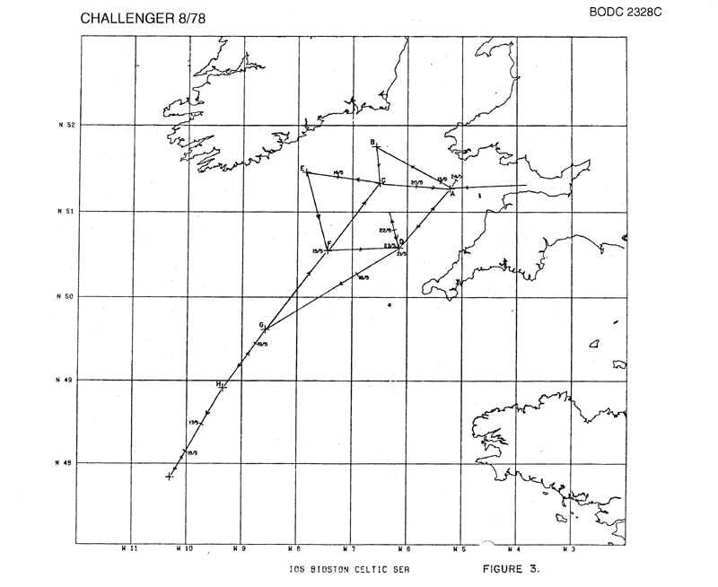
- References - including cruise tracks and cruise reports
Cruise Inventory Information
| Long name | RRS Challenger (74CH) cruise CH8/78 |
|---|---|
| Short name | CH8/78 |
| Objectives and Narrative |
The objective of this cruise was to recover the tide gauges, current meters and thermistor chain deployed on cruise CH5/78 to quantify:
(1) The coherence of non-tidal coastal water level changes in the Celtic Sea and their relationships with off-shore currents. (2) The details of tidal propagation from the deep Atlantic through the Celtic Sea. (3) Internal tides near the continental margin. (4) Thermocline development in the Celtic Sea. (5) Fluxes of mass, momentum, energy, salt and heat into and through the Celtic Sea. The station distribution was along three sections from Baginbun to St. Marys, Ilfracombe to Castletownshend and NE to SW from 51.5N, 6.5W to 47.75N, 10.5 W. Fourteen of seventeen moorings were successfully recovered with most instruments intact. Several CTD profiles were taken on each mooring location. |
| Ship | RRS Challenger |
| Departure Port | Barry, United Kingdom |
| Departure Date | 1978-05-12 |
| Arrival Port | Barry, United Kingdom |
| Arrival Date | 1978-05-24 |
| Principal Scientist(s) | Alan J Harrison (Institute of Oceanographic Sciences Bidston Laboratory) |
| Responsible Organisation | Institute of Oceanographic Sciences Bidston Laboratory |
| Associated Project(s) | |
| IHB Sea Areas Visited | English Channel, Irish Sea and St. George's Channel, Bay of Biscay |
| Marsden Squares Visited | 145;4/146;3/181;1/181;2/182;2 |
| Work Area Description | |
| Unable to lookup cruise bounds at this time | |
| Work Area Bounding Polygon | |
| Southern Limit | unknown |
| Northern Limit | unknown |
| Western Limit | unknown |
| Eastern Limit | unknown |
Cruise Inventory Datasets
| Physical oceanography | |
|---|---|
| CTD stations |
Quantity:
number of stations =
48
Description: |
| Current meters |
Quantity:
number of recoveries =
9
Description: this was for the recovery on the instruments deployed on Cr.5/78 |
| Sea level (inc. bot. press., inverted echosounder) |
Quantity:
number of recoveries =
9
Description: this was for the recovery on the instruments deployed on Cr.5/78 |
Cruise Inventory Mooring/Buoy Operations
No information on datasets is currently available
Summary of BODC Data Holdings for the Cruise
National Oceanographic Database
Summary
| # Series | Instrument Description | Parameters |
|---|---|---|
| 44 | CTD/STD cast |
Salinity of the water column Temperature of the water column Vertical spatial coordinates |
Note: Parameter terms are taken from the BODC Parameter Discovery Vocabulary XML (SKOS)
Full List
| BODC Reference | Instrument Description | Date/Time | Location | |
|---|---|---|---|---|
| 549062 | CTD/STD cast | 1978-05-13 13:21Z to 1978-05-13 13:23Z | 51° 31' N, 6° 34' W | Click for more |
| 549074 | CTD/STD cast | 1978-05-13 16:58Z to 1978-05-13 17:00Z | 51° 19' N, 6° 34' W | Click for more |
| 549086 | CTD/STD cast | 1978-05-13 20:09Z to 1978-05-13 20:11Z | 51° 21' N, 6° 54' W | Click for more |
| 549098 | CTD/STD cast | 1978-05-13 23:11Z to 1978-05-13 23:13Z | 51° 22' N, 7° 12' W | Click for more |
| 549105 | CTD/STD cast | 1978-05-14 02:19Z to 1978-05-14 02:21Z | 51° 23' N, 7° 32' W | Click for more |
| 549117 | CTD/STD cast | 1978-05-14 06:59Z to 1978-05-14 07:01Z | 51° 27' N, 7° 51' W | Click for more |
| 549129 | CTD/STD cast | 1978-05-14 08:44Z to 1978-05-14 08:46Z | 51° 15' N, 7° 44' W | Click for more |
| 549130 | CTD/STD cast | 1978-05-14 10:23Z to 1978-05-14 10:25Z | 51° 2' N, 7° 39' W | Click for more |
| 549142 | CTD/STD cast | 1978-05-14 12:16Z to 1978-05-14 12:18Z | 50° 47' N, 7° 33' W | Click for more |
| 549154 | CTD/STD cast | 1978-05-14 14:17Z to 1978-05-14 14:18Z | 50° 31' N, 7° 32' W | Click for more |
| 549166 | CTD/STD cast | 1978-05-14 16:12Z to 1978-05-14 16:13Z | 50° 31' N, 7° 32' W | Click for more |
| 549178 | CTD/STD cast | 1978-05-16 08:03Z to 1978-05-16 08:05Z | 49° 38' N, 8° 33' W | Click for more |
| 549191 | CTD/STD cast | 1978-05-16 16:50Z to 1978-05-16 16:53Z | 48° 55' N, 9° 16' W | Click for more |
| 549209 | CTD/STD cast | 1978-05-17 10:17Z to 1978-05-17 10:21Z | 47° 53' N, 10° 11' W | Click for more |
| 549210 | CTD/STD cast | 1978-05-17 19:27Z to 1978-05-17 19:36Z | 47° 48' N, 10° 18' W | Click for more |
| 549222 | CTD/STD cast | 1978-05-17 19:27Z to 1978-05-17 19:36Z | 47° 48' N, 10° 18' W | Click for more |
| 549234 | CTD/STD cast | 1978-05-17 21:17Z to 1978-05-17 21:26Z | 48° 1' N, 10° 1' W | Click for more |
| 549246 | CTD/STD cast | 1978-05-17 23:06Z to 1978-05-17 23:13Z | 48° 9' N, 9° 58' W | Click for more |
| 549258 | CTD/STD cast | 1978-05-18 00:42Z to 1978-05-18 00:53Z | 48° 20' N, 9° 54' W | Click for more |
| 549271 | CTD/STD cast | 1978-05-18 02:36Z to 1978-05-18 02:46Z | 48° 32' N, 9° 39' W | Click for more |
| 549283 | CTD/STD cast | 1978-05-18 04:53Z to 1978-05-18 05:10Z | 48° 44' N, 9° 28' W | Click for more |
| 549295 | CTD/STD cast | 1978-05-18 18:22Z to 1978-05-18 18:32Z | 48° 55' N, 9° 18' W | Click for more |
| 549302 | CTD/STD cast | 1978-05-18 20:31Z to 1978-05-18 20:40Z | 49° 6' N, 9° 3' W | Click for more |
| 549314 | CTD/STD cast | 1978-05-18 22:15Z to 1978-05-18 22:24Z | 49° 17' N, 8° 54' W | Click for more |
| 549326 | CTD/STD cast | 1978-05-19 00:01Z to 1978-05-19 00:07Z | 49° 28' N, 8° 43' W | Click for more |
| 549338 | CTD/STD cast | 1978-05-19 02:04Z to 1978-05-19 02:10Z | 49° 40' N, 8° 28' W | Click for more |
| 549351 | CTD/STD cast | 1978-05-19 04:06Z to 1978-05-19 04:11Z | 49° 49' N, 8° 15' W | Click for more |
| 549363 | CTD/STD cast | 1978-05-19 06:24Z to 1978-05-19 06:30Z | 50° 2' N, 8° 0' W | Click for more |
| 549375 | CTD/STD cast | 1978-05-19 08:53Z to 1978-05-19 09:01Z | 50° 18' N, 7° 42' W | Click for more |
| 549387 | CTD/STD cast | 1978-05-19 10:46Z to 1978-05-19 10:51Z | 50° 31' N, 7° 31' W | Click for more |
| 549399 | CTD/STD cast | 1978-05-19 14:10Z to 1978-05-19 14:22Z | 50° 43' N, 7° 15' W | Click for more |
| 549406 | CTD/STD cast | 1978-05-19 15:47Z to 1978-05-19 15:57Z | 50° 52' N, 7° 4' W | Click for more |
| 549418 | CTD/STD cast | 1978-05-19 17:12Z to 1978-05-19 17:20Z | 51° 1' N, 6° 54' W | Click for more |
| 549431 | CTD/STD cast | 1978-05-19 18:43Z to 1978-05-19 18:48Z | 51° 11' N, 6° 43' W | Click for more |
| 549443 | CTD/STD cast | 1978-05-19 20:18Z to 1978-05-19 20:23Z | 51° 21' N, 6° 31' W | Click for more |
| 549455 | CTD/STD cast | 1978-05-19 21:57Z to 1978-05-19 22:03Z | 51° 19' N, 6° 12' W | Click for more |
| 549467 | CTD/STD cast | 1978-05-19 23:37Z to 1978-05-19 23:44Z | 51° 18' N, 5° 50' W | Click for more |
| 549479 | CTD/STD cast | 1978-05-20 00:54Z to 1978-05-20 01:02Z | 51° 17' N, 5° 34' W | Click for more |
| 549480 | CTD/STD cast | 1978-05-20 16:22Z to 1978-05-20 16:28Z | 51° 12' N, 5° 19' W | Click for more |
| 549492 | CTD/STD cast | 1978-05-20 17:42Z to 1978-05-20 17:47Z | 51° 6' N, 5° 28' W | Click for more |
| 549511 | CTD/STD cast | 1978-05-20 19:26Z to 1978-05-20 19:31Z | 50° 55' N, 5° 42' W | Click for more |
| 549523 | CTD/STD cast | 1978-05-20 21:04Z to 1978-05-20 21:10Z | 50° 45' N, 5° 57' W | Click for more |
| 549535 | CTD/STD cast | 1978-05-21 21:33Z to 1978-05-21 21:40Z | 50° 36' N, 6° 10' W | Click for more |
| 549547 | CTD/STD cast | 1978-05-21 23:54Z to 1978-05-22 00:06Z | 50° 47' N, 6° 17' W | Click for more |
Project Database
No data currently held for this cruise in the BODC Project Database
