BODC Cruise Metadata Report for RRS Discovery (74E3) cruise D92
Introduction
This report collates information from the BODC cruise inventory and oceanographic databases. It presents
- Cruise Inventory Information
- A summary of BODC data holdings for the cruise from the
- References - including cruise tracks and cruise reports
Cruise Inventory Information
| Long name | RRS Discovery (74E3) cruise D92 |
|---|---|
| Short name | D92 |
| Objectives and Narrative |
Primary aims:
1. To collect a comprehensive series of midwater samples throughout the total water column including samples from within 5-20m of the sea bed at two stations at depths of about 2000m and 4000m respectively in the Porcupine Sea Bight region. 2. To collect benthic samples using a variety of samplers at these same stations to complement the midwater sampling so an assessment of the total water column ecosystem could be attempted. 3. Initial midwater studies at 42N 17W for facilitate the designing of the joint biological and physical mesoscale experiment planned for 1980/1. Secondary aims: 4. To collect a series of oblique samples along 13W and 17W to investigate the possible existence of a zoogeographical boundary between 42N and 50N. 5. To make observations on the physical structure of the water in the Porcupine Sea Bight area. 6. To make studies on the phytoplankton during the cruise by fluorometry, particle-counting and direct study of phytoplankton. 7. To develop the multiple RMT 1+8 system. 8. To use the in situ light meter mounted on the net monitor to study the relationship between light levels and the diurnal migration patters of zooplankton and nekton. 9. To collect a repeat series of hauls at 1000m to investigate a) the patchiness of organisms at such depth and b) whether these organisms undergo diurnal vertical migration. 10. To collect further benthic samples from as many depths as possible between the edge of the continental shelf and the abyssal plain in the Porcupine Sea Bight Area. |
| Ship | RRS Discovery |
| Departure Port | Southampton, United Kingdom |
| Departure Date | 1978-04-04 |
| Arrival Port | Lisbon, Portugal |
| Arrival Date | 1978-05-23 |
| Principal Scientist(s) | Martin V Angel (Institute of Oceanographic Sciences Wormley Laboratory) |
| Responsible Organisation | Institute of Oceanographic Sciences Wormley Laboratory |
| Associated Project(s) | |
| IHB Sea Areas Visited | North East Atlantic Ocean (limit 40W) |
| Marsden Squares Visited | 146;1/182 |
| Work Area Description | |
| Unable to lookup cruise bounds at this time | |
| Work Area Bounding Polygon | |
| Southern Limit | unknown |
| Northern Limit | unknown |
| Western Limit | unknown |
| Eastern Limit | unknown |
Cruise Inventory Datasets
| Physical oceanography | |
|---|---|
| CTD stations |
Quantity:
number of stations =
52
Description: |
| Optics (eg underwater light levels) |
Quantity:
3
Description: |
| Surface measurements underway (T,S) |
Quantity:
track kilometres =
2778
Description: |
| Chemical oceanography | |
| Nitrate |
Quantity:
39
Description: |
| Oxygen |
Quantity:
39
Description: |
| Biology and fisheries | |
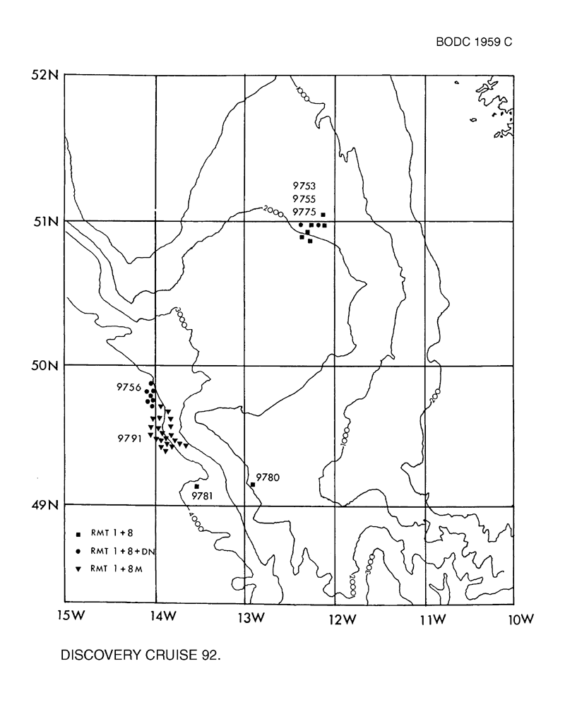
| Gear research |
Quantity:
number of hauls =
37
Description: |
| Nekton |
Quantity:
286
Description: |
| Phytoplankton |
Quantity:
3
Description: |
| Phytoplankton pigs (eg chlorophyll, fluorescence) |
Quantity:
12
Description: discrete,1000nm cont. |
| Seston |
Quantity:
12
Description: discrete,500nm cont. |
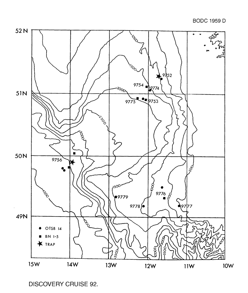
| Zoobenthos |
Quantity:
17
Description: |
| Zooplankton |
Quantity:
143
Description: population studies |
| Meteorology | |
| Routine standard measurements | Description: |
Cruise Inventory Mooring/Buoy Operations
No information on datasets is currently available
Summary of BODC Data Holdings for the Cruise
National Oceanographic Database
Summary
| # Series | Instrument Description | Parameters |
|---|---|---|
| 28 | CTD/STD cast |
Electrical conductivity of the water column Salinity of the water column Temperature of the water column Vertical spatial coordinates |
Note: Parameter terms are taken from the BODC Parameter Discovery Vocabulary XML (SKOS)
Full List
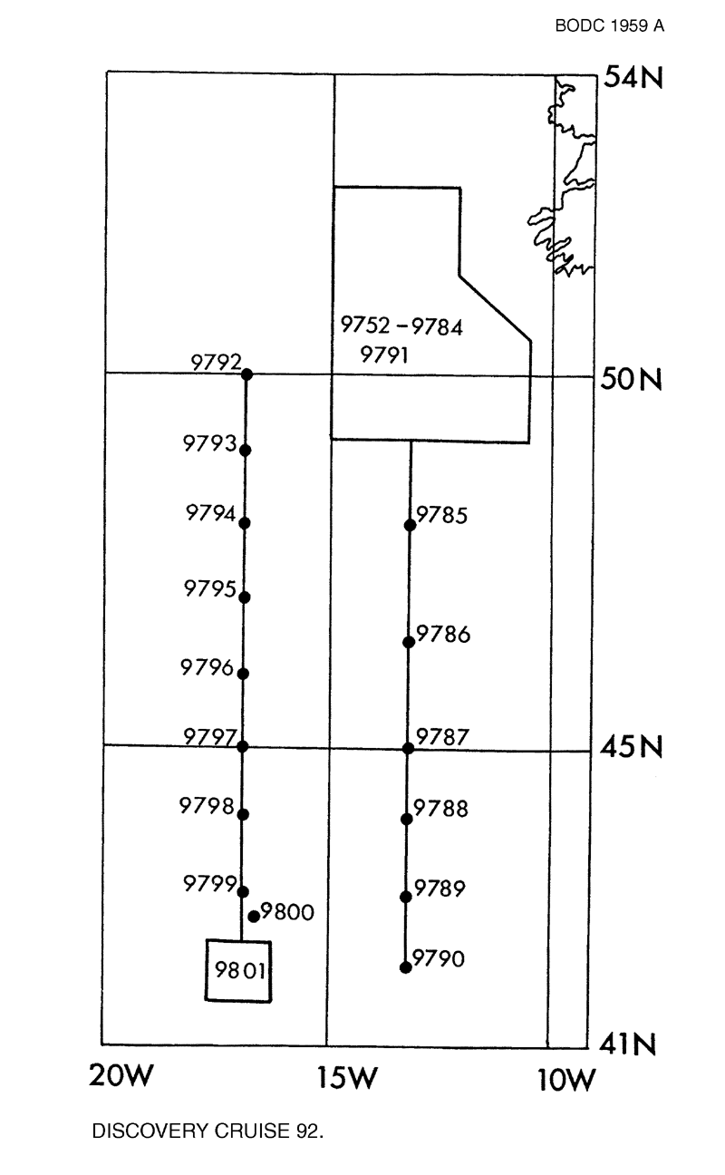
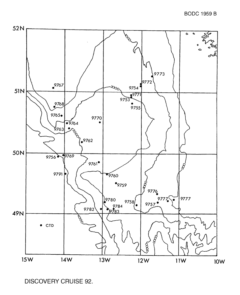
| BODC Reference | Instrument Description | Date/Time | Location | |
|---|---|---|---|---|
| 289233 | CTD/STD cast | 1978-04-27 14:46Z to 1978-04-27 16:00Z | 44° 58' N, 13° 2' W | Click for more |
| 289245 | CTD/STD cast | 1978-04-28 01:30Z to 1978-04-28 02:52Z | 44° 0' N, 13° 2' W | Click for more |
| 289257 | CTD/STD cast | 1978-04-28 11:22Z to 1978-04-28 12:33Z | 43° 0' N, 13° 1' W | Click for more |
| 289269 | CTD/STD cast | 1978-04-28 20:44Z to 1978-04-28 21:48Z | 42° 0' N, 13° 0' W | Click for more |
| 289270 | CTD/STD cast | 1978-05-06 05:09Z to 1978-05-06 06:52Z | 49° 39' N, 13° 59' W | Click for more |
| 289282 | CTD/STD cast | 1978-05-09 02:49Z to 1978-05-09 04:10Z | 50° 0' N, 17° 0' W | Click for more |
| 289294 | CTD/STD cast | 1978-05-09 19:18Z to 1978-05-09 20:32Z | 49° 1' N, 17° 1' W | Click for more |
| 289301 | CTD/STD cast | 1978-05-10 05:38Z to 1978-05-10 06:56Z | 47° 58' N, 17° 0' W | Click for more |
| 289313 | CTD/STD cast | 1978-05-10 16:38Z to 1978-05-10 17:49Z | 46° 59' N, 17° 0' W | Click for more |
| 289325 | CTD/STD cast | 1978-05-11 02:27Z to 1978-05-11 03:40Z | 46° 0' N, 16° 59' W | Click for more |
| 289337 | CTD/STD cast | 1978-05-11 13:56Z to 1978-05-11 15:07Z | 45° 0' N, 17° 0' W | Click for more |
| 289349 | CTD/STD cast | 1978-05-12 00:21Z to 1978-05-12 01:36Z | 44° 0' N, 17° 0' W | Click for more |
| 289350 | CTD/STD cast | 1978-05-12 11:56Z to 1978-05-12 13:14Z | 43° 0' N, 16° 59' W | Click for more |
| 289362 | CTD/STD cast | 1978-05-13 03:39Z to 1978-05-13 04:52Z | 41° 56' N, 16° 48' W | Click for more |
| 289374 | CTD/STD cast | 1978-05-21 10:17Z to 1978-05-21 12:54Z | 42° 10' N, 16° 46' W | Click for more |
| 289699 | CTD/STD cast | 1978-04-07 14:13Z to 1978-04-07 14:45Z | 50° 55' N, 12° 16' W | Click for more |
| 289706 | CTD/STD cast | 1978-04-07 15:44Z to 1978-04-07 16:31Z | 50° 55' N, 12° 15' W | Click for more |
| 289718 | CTD/STD cast | 1978-04-08 21:38Z to 1978-04-08 22:18Z | 51° 7' N, 12° 1' W | Click for more |
| 289731 | CTD/STD cast | 1978-04-10 09:23Z to 1978-04-10 09:39Z | 50° 50' N, 12° 17' W | Click for more |
| 289743 | CTD/STD cast | 1978-04-15 01:18Z to 1978-04-15 01:49Z | 49° 57' N, 14° 15' W | Click for more |
| 289755 | CTD/STD cast | 1978-04-24 15:46Z to 1978-04-24 16:31Z | 49° 12' N, 12° 58' W | Click for more |
| 289767 | CTD/STD cast | 1978-04-25 08:40Z to 1978-04-25 10:28Z | 49° 3' N, 13° 3' W | Click for more |
| 289779 | CTD/STD cast | 1978-04-25 13:11Z to 1978-04-25 14:24Z | 49° 4' N, 12° 52' W | Click for more |
| 289780 | CTD/STD cast | 1978-04-25 15:32Z to 1978-04-25 16:34Z | 49° 4' N, 12° 43' W | Click for more |
| 289792 | CTD/STD cast | 1978-04-25 23:52Z to 1978-04-26 00:58Z | 48° 0' N, 13° 0' W | Click for more |
| 289811 | CTD/STD cast | 1978-04-26 13:17Z to 1978-04-26 14:35Z | 46° 31' N, 12° 58' W | Click for more |
| 289823 | CTD/STD cast | 1978-04-26 18:12Z to 1978-04-26 19:22Z | 46° 37' N, 13° 3' W | Click for more |
| 289835 | CTD/STD cast | 1978-04-27 13:04Z to 1978-04-27 14:27Z | 45° 0' N, 13° 0' W | Click for more |
Project Database
No data currently held for this cruise in the BODC Project Database
