BODC Cruise Metadata Report for RRS Discovery (74E3) cruise D114
Introduction
This report collates information from the BODC cruise inventory and oceanographic databases. It presents
- Cruise Inventory Information
- A summary of BODC data holdings for the cruise from the
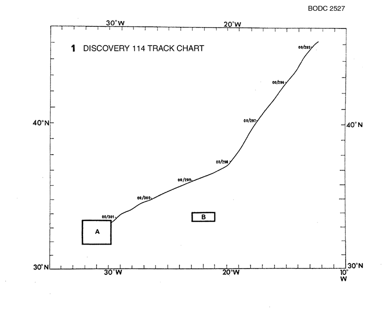
- References - including cruise tracks and cruise reports
Cruise Inventory Information
| Long name | RRS Discovery (74E3) cruise D114 |
|---|---|
| Short name | D114 |
| Objectives and Narrative |
1. To make a long transect of batfish observations southwards across the N.E. Atlantic to observe the latitudinal changes in the physical structure of the surface 300m.
2. To locate the boundary of the 18deg Sargasso Sea Water to the south-west of the Azores. 3. To investigate the physical and biological characteristics of the boundary, if it occurred as a clearly demarcated front. 4. To pick up a tide gauge laid during Cruise 112. 5. To lay current meter moorings for the benthic boundary layer experiment in the vicinity of the NEADS mooring site on the Madeiran Abyssal Plain. |
| Ship | RRS Discovery |
| Departure Port | |
| Departure Date | 1980-10-16 |
| Arrival Port | Ponta Delgada, Portugal |
| Arrival Date | 1980-11-30 |
| Principal Scientist(s) | Martin V Angel (Institute of Oceanographic Sciences Wormley Laboratory) |
| Responsible Organisation | Institute of Oceanographic Sciences Wormley Laboratory |
| Associated Project(s) | |
| IHB Sea Areas Visited | North East Atlantic Ocean (limit 40W) |
| Marsden Squares Visited | 110;4/111/112;1/146 |
| Work Area Description | North Atlantic |
| Unable to lookup cruise bounds at this time | |
| Work Area Bounding Polygon | |
| Southern Limit | unknown |
| Northern Limit | unknown |
| Western Limit | unknown |
| Eastern Limit | unknown |
Cruise Inventory Datasets
| Physical oceanography | |
|---|---|
| Bathythermograph |
Quantity:
number of profiles =
73
Description: |
| CTD stations |
Quantity:
number of stations =
26
Description: |
| Current meters |
Quantity:
number of deployments =
9
Description: Moorings laid.to be recovered on cr.119 |
| Optics (eg underwater light levels) |
Quantity:
number of stations =
3
Description: |
| Sea level (inc. bot. press., inverted echosounder) |
Quantity:
number of recoveries =
1
Description: Tide gauges recovered for D.E.Cartwright |
| Subsurface temperature and salinity measurements |
Quantity:
activity duration in days =
14
Description: |
| Surface measurements underway (T,S) |
Quantity:
activity duration in days =
14
Description: |
| Chemical oceanography | |
| Nitrate |
Quantity:
number of stations =
10
Description: |
| Silicate |
Quantity:
number of stations =
4
Description: |
| Biology and fisheries | |
| Nekton |
Quantity:
number of samples =
292
Description: |
| Phytoplankton pigs (eg chlorophyll, fluorescence) |
Quantity:
number of stations =
4
Description: |
| Primary productivity |
Quantity:
number of stations =
3
Description: |
| Zooplankton |
Quantity:
number of samples =
149
Description: survey:taxonomy,distribution |
Cruise Inventory Mooring/Buoy Operations
No information on datasets is currently available
Summary of BODC Data Holdings for the Cruise
National Oceanographic Database
Summary
| # Series | Instrument Description | Parameters |
|---|---|---|
| 4 | CTD/STD cast |
Electrical conductivity of the water column Salinity of the water column Temperature of the water column Vertical spatial coordinates |
| 19 | CTD/STD cast |
Dissolved oxygen parameters in the water column Electrical conductivity of the water column Salinity of the water column Temperature of the water column Vertical spatial coordinates |
Note: Parameter terms are taken from the BODC Parameter Discovery Vocabulary XML (SKOS)
Full List
| BODC Reference | Instrument Description | Date/Time | Location | |
|---|---|---|---|---|
| 289097 | CTD/STD cast | 1980-11-03 19:35Z to 1980-11-03 20:03Z | 32° 55' N, 31° 30' W | Click for more |
| 289104 | CTD/STD cast | 1980-11-04 06:57Z to 1980-11-04 07:18Z | 32° 54' N, 31° 11' W | Click for more |
| 289116 | CTD/STD cast | 1980-11-04 09:32Z to 1980-11-04 09:57Z | 32° 52' N, 30° 54' W | Click for more |
| 289128 | CTD/STD cast | 1980-11-17 04:03Z to 1980-11-17 05:28Z | 32° 25' N, 31° 30' W | Click for more |
| 289141 | CTD/STD cast | 1980-11-17 06:40Z to 1980-11-17 07:55Z | 32° 34' N, 31° 30' W | Click for more |
| 289153 | CTD/STD cast | 1980-11-17 09:09Z to 1980-11-17 09:48Z | 32° 45' N, 31° 29' W | Click for more |
| 289165 | CTD/STD cast | 1980-11-17 11:28Z to 1980-11-17 11:57Z | 32° 55' N, 31° 30' W | Click for more |
| 289177 | CTD/STD cast | 1980-11-17 15:47Z to 1980-11-17 16:48Z | 33° 9' N, 31° 47' W | Click for more |
| 289189 | CTD/STD cast | 1980-11-18 18:06Z to 1980-11-18 19:10Z | 33° 12' N, 31° 47' W | Click for more |
| 289190 | CTD/STD cast | 1980-11-19 17:51Z to 1980-11-19 19:01Z | 33° 0' N, 31° 30' W | Click for more |
| 289208 | CTD/STD cast | 1980-11-21 08:56Z to 1980-11-21 09:32Z | 32° 49' N, 31° 13' W | Click for more |
| 289221 | CTD/STD cast | 1980-11-21 18:05Z to 1980-11-21 19:38Z | 32° 25' N, 30° 40' W | Click for more |
| 298389 | CTD/STD cast | 1980-11-16 05:38Z to 1980-11-16 06:42Z | 32° 0' N, 31° 29' W | Click for more |
| 298390 | CTD/STD cast | 1980-11-17 01:22Z to 1980-11-17 02:30Z | 32° 15' N, 31° 30' W | Click for more |
| 298408 | CTD/STD cast | 1980-11-17 04:03Z to 1980-11-17 05:28Z | 32° 25' N, 31° 30' W | Click for more |
| 298421 | CTD/STD cast | 1980-11-17 06:40Z to 1980-11-17 07:55Z | 32° 34' N, 31° 30' W | Click for more |
| 298433 | CTD/STD cast | 1980-11-17 09:09Z to 1980-11-17 09:48Z | 32° 45' N, 31° 29' W | Click for more |
| 298445 | CTD/STD cast | 1980-11-17 11:28Z to 1980-11-17 11:57Z | 32° 55' N, 31° 30' W | Click for more |
| 298457 | CTD/STD cast | 1980-11-17 15:47Z to 1980-11-17 16:48Z | 33° 9' N, 31° 47' W | Click for more |
| 298469 | CTD/STD cast | 1980-11-18 18:06Z to 1980-11-18 19:10Z | 33° 12' N, 31° 47' W | Click for more |
| 298470 | CTD/STD cast | 1980-11-19 17:51Z to 1980-11-19 19:01Z | 33° 0' N, 31° 30' W | Click for more |
| 298482 | CTD/STD cast | 1980-11-21 08:56Z to 1980-11-21 09:32Z | 32° 49' N, 31° 13' W | Click for more |
| 298494 | CTD/STD cast | 1980-11-21 18:05Z to 1980-11-21 19:38Z | 32° 25' N, 30° 40' W | Click for more |
Project Database
No data currently held for this cruise in the BODC Project Database
