BODC Cruise Metadata Report for RRS Discovery (74E3) cruise D120
Introduction
This report collates information from the BODC cruise inventory and oceanographic databases. It presents
- Cruise Inventory Information
- A summary of BODC data holdings for the cruise from the
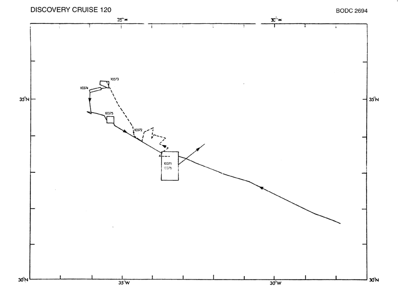
- References - including cruise tracks and cruise reports
Cruise Inventory Information
| Long name | RRS Discovery (74E3) cruise D120 |
|---|---|
| Short name | D120 |
| Objectives and Narrative |
The cruise was designed to make further physical and biological investigations of a larger meander in the frontal system separating east Atlantic from West Atlantic water in the vicinity of 32N, 32W. On Cruise 119 batfish and XBT data had suggested that his meander was in the process of forming a detached eddy and on Cruise 120 it was hoped to obtain further batfish profiles of this area.
The biological investigations were mainly centred on an investigation of the effect of the front on primary production, nutrient distribution and the fine-scale vertical distribution of zooplankton. Subsidiary experiments to be carried out were investigations on the zoogeographic distribution of Calanus helgolandicus in the area SW of the Azores, physiological studies of plankton luminescence and, if time permitted, a survey of the effect of a shallow sea-mount on chlorophyll production. |
| Ship | RRS Discovery |
| Departure Port | Ponta Delgada, Portugal |
| Departure Date | 1981-05-09 |
| Arrival Port | Ponta Delgada, Portugal |
| Arrival Date | 1981-06-01 |
| Principal Scientist(s) | Michael J R Fasham (Institute of Oceanographic Sciences Wormley Laboratory) |
| Responsible Organisation | Institute of Oceanographic Sciences Wormley Laboratory |
| Associated Project(s) | |
| IHB Sea Areas Visited | North East Atlantic Ocean (limit 40W) |
| Marsden Squares Visited | 111;2/112;1/112;245/112;246/112;455/112;456 |
| Work Area Description | Mid-Atlantic (N) |
| Unable to lookup cruise bounds at this time | |
| Work Area Bounding Polygon | |
| Southern Limit | unknown |
| Northern Limit | unknown |
| Western Limit | unknown |
| Eastern Limit | unknown |
Cruise Inventory Datasets
| Physical oceanography | |
|---|---|
| Bathythermograph |
Quantity:
number of profiles =
43
Description: |
| CTD stations |
Quantity:
number of stations =
31
Description: |
| Subsurface temperature and salinity measurements |
Quantity:
track kilometres =
1666
Description: |
| Surface measurements underway (T,S) | Description: |
| Transparency (eg transmissometer) |
Quantity:
number of stations =
26
Description: |
| Water bottle stations |
Quantity:
number of stations =
56
Description: S surface only |
| Chemical oceanography | |
| Nitrate |
Quantity:
number of stations =
16
Description: |
| Oxygen |
Quantity:
track kilometres =
1666
Description: |
| Phosphate |
Quantity:
number of stations =
15
Description: |
| Silicate |
Quantity:
number of stations =
15
Description: |
| Biology and fisheries | |
| Eggs and larvae |
Quantity:
number of samples =
39
Description: biomass determination,descrpit.of communities |
| Gear research |
Quantity:
number of deployments =
2
Description: |
| Nekton |
Quantity:
number of samples =
78
Description: |
| Other biological/fisheries measurement |
Quantity:
number of samples =
15
Description: DNA-RNA concentrations |
| Particulate organic matter (inc POC, PON) |
Quantity:
number of stations =
30
Description: |
| Phytoplankton |
Quantity:
number of stations =
16
Description: |
| Phytoplankton pigs (eg chlorophyll, fluorescence) |
Quantity:
number of stations =
22
Description: |
| Primary productivity |
Quantity:
number of stations =
15
Description: |
| Zooplankton |
Quantity:
number of hauls =
47
Description: distribution,identification |
| Meteorology | |
| Incident radiation | Description: |
| Routine standard measurements | Description: |
Cruise Inventory Mooring/Buoy Operations
No information on datasets is currently available
Summary of BODC Data Holdings for the Cruise
National Oceanographic Database
Summary
| # Series | Instrument Description | Parameters |
|---|---|---|
| 1 | CTD/STD cast |
Dissolved oxygen parameters in the water column Electrical conductivity of the water column Salinity of the water column Temperature of the water column Vertical spatial coordinates |
| 17 | CTD/STD cast |
Chlorophyll pigment concentrations in water bodies Dissolved oxygen parameters in the water column Electrical conductivity of the water column Salinity of the water column Temperature of the water column Vertical spatial coordinates Visible waveband radiance and irradiance measurements in the water column |
| 1 | CTD/STD cast |
Chlorophyll pigment concentrations in water bodies Dissolved oxygen parameters in the water column Electrical conductivity of the water column Salinity of the water column Temperature of the water column Vertical spatial coordinates |
Note: Parameter terms are taken from the BODC Parameter Discovery Vocabulary XML (SKOS)
Full List
| BODC Reference | Instrument Description | Date/Time | Location | |
|---|---|---|---|---|
| 289405 | CTD/STD cast | 1981-05-10 09:59Z to 1981-05-10 10:24Z | 35° 0' N, 28° 30' W | Click for more |
| 289417 | CTD/STD cast | 1981-05-11 12:41Z to 1981-05-11 12:55Z | 32° 44' N, 29° 46' W | Click for more |
| 289429 | CTD/STD cast | 1981-05-12 05:27Z to 1981-05-12 05:52Z | 31° 8' N, 29° 49' W | Click for more |
| 289430 | CTD/STD cast | 1981-05-14 16:01Z to 1981-05-14 16:23Z | 32° 58' N, 34° 27' W | Click for more |
| 289442 | CTD/STD cast | 1981-05-14 17:34Z to 1981-05-14 17:43Z | 32° 58' N, 34° 28' W | Click for more |
| 289454 | CTD/STD cast | 1981-05-15 08:24Z to 1981-05-15 08:38Z | 33° 34' N, 33° 33' W | Click for more |
| 289466 | CTD/STD cast | 1981-05-15 14:26Z to 1981-05-15 14:39Z | 33° 35' N, 33° 31' W | Click for more |
| 289478 | CTD/STD cast | 1981-05-16 08:17Z to 1981-05-16 08:59Z | 34° 0' N, 32° 49' W | Click for more |
| 289491 | CTD/STD cast | 1981-05-16 09:38Z to 1981-05-16 09:50Z | 34° 0' N, 32° 49' W | Click for more |
| 289509 | CTD/STD cast | 1981-05-16 21:09Z to 1981-05-16 22:25Z | 33° 32' N, 33° 32' W | Click for more |
| 289510 | CTD/STD cast | 1981-05-20 09:27Z to 1981-05-20 09:53Z | 32° 7' N, 27° 58' W | Click for more |
| 289522 | CTD/STD cast | 1981-05-20 13:45Z to 1981-05-20 14:12Z | 31° 51' N, 28° 0' W | Click for more |
| 289534 | CTD/STD cast | 1981-05-22 08:04Z to 1981-05-22 08:32Z | 33° 33' N, 33° 38' W | Click for more |
| 289546 | CTD/STD cast | 1981-05-24 10:43Z to 1981-05-24 11:09Z | 35° 20' N, 35° 28' W | Click for more |
| 289558 | CTD/STD cast | 1981-05-25 10:31Z to 1981-05-25 10:52Z | 34° 25' N, 35° 31' W | Click for more |
| 289571 | CTD/STD cast | 1981-05-26 06:56Z to 1981-05-26 07:11Z | 33° 33' N, 33° 27' W | Click for more |
| 289583 | CTD/STD cast | 1981-05-27 19:07Z to 1981-05-27 19:28Z | 33° 14' N, 33° 22' W | Click for more |
| 289595 | CTD/STD cast | 1981-05-28 04:44Z to 1981-05-28 05:37Z | 32° 51' N, 33° 20' W | Click for more |
| 289602 | CTD/STD cast | 1981-05-29 07:23Z to 1981-05-29 09:11Z | 33° 16' N, 33° 40' W | Click for more |
Project Database
No data currently held for this cruise in the BODC Project Database
