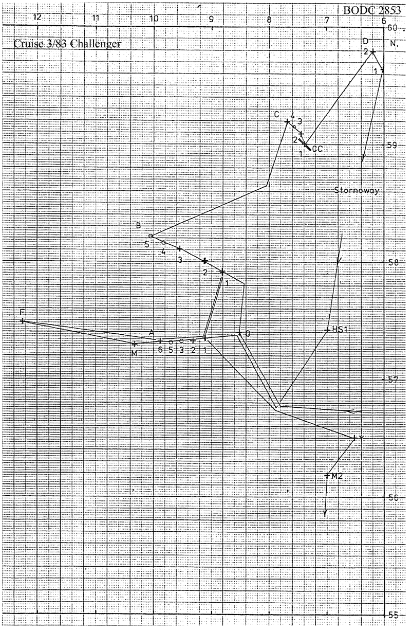
BODC Cruise Metadata Report for RRS Challenger (74CH) cruise CH3/83
Introduction
This report collates information from the BODC cruise inventory and oceanographic databases. It presents
- Cruise Inventory Information
- A summary of BODC data holdings for the cruise from the
- References - including cruise tracks and cruise reports
Cruise Inventory Information
| Long name | RRS Challenger (74CH) cruise CH3/83 |
|---|---|
| Short name | CH3/83 |
| Objectives and Narrative |
The objectives of this cruise were:
(1) To re-lay the SMBA mooring at site M (57 deg 18 min N, 10 deg 23 min W) and service mooring F (57.5N, 12.25W). Accomplished. (2) To recover the CONSLEX moorings from four sections across the Hebridean Slope. Accomplished. (3) To work the four CONSLEX CTD sections. One of the four sections worked. (4) To make Agassiz trawl hauls plus other benthos sampling in the vicinity of mooring M. Not possible. (5) To deploy a UCNW mooring at 56 deg 11 min N, 7W and service the mooring at 57 deg 26 min N, 6 deg 58 min W. Mooring deployed, but no time for service. (6) To grapple for missing moorings at station R (57N, 9W) and Y (56 deg 37 min N, 6 deg 25 min W) and re-lay Y if possible. Y partially recovered. (7) To collect large-volume samples for radiocaesium analysis with CTD profiles on stations across the Scottish shelf from the Sound of Mull. Water samples collected, but only one CTD profile possible. |
| Ship | RRS Challenger |
| Departure Port | Dunstaffnage, United Kingdom |
| Departure Date | 1983-02-08 |
| Arrival Port | Falmouth, United Kingdom |
| Arrival Date | 1983-02-22 |
| Principal Scientist(s) | Anton Edwards (Scottish Marine Biological Association) |
| Responsible Organisation | Scottish Marine Biological Association |
| Associated Project(s) | CONSLEX (Continental Slope Experiment) |
| IHB Sea Areas Visited | North East Atlantic Ocean (limit 40W) |
| Marsden Squares Visited | 181;372/181;4/182;370/182;371 |
| Work Area Description | N. & W. of Hebrides |
| Unable to lookup cruise bounds at this time | |
| Work Area Bounding Polygon | |
| Southern Limit | unknown |
| Northern Limit | unknown |
| Western Limit | unknown |
| Eastern Limit | unknown |
Cruise Inventory Datasets
| Physical oceanography | |
|---|---|
| CTD stations |
Quantity:
number of stations =
4
Description: noisy salinity |
| Current meters |
Quantity:
number of recoveries =
33
Description: no. of c.ms recovered;4-6 months |
| Sea level (inc. bot. press., inverted echosounder) |
Quantity:
number of recoveries =
5
Description: pressure gauge |
| Subsurface temperature measurements | Description: |
| Water bottle stations |
Quantity:
number of samples =
27
Description: S surface only |
| Chemical oceanography | |
| Radioactivity |
Quantity:
number of samples =
10
Description: water samples collected for radio-caesium determination |
Cruise Inventory Mooring/Buoy Operations
No information on datasets is currently available
Summary of BODC Data Holdings for the Cruise
National Oceanographic Database
Summary
| # Series | Instrument Description | Parameters |
|---|---|---|
| 4 | CTD/STD cast |
Salinity of the water column Temperature of the water column Vertical spatial coordinates |
Note: Parameter terms are taken from the BODC Parameter Discovery Vocabulary XML (SKOS)
Full List
| BODC Reference | Instrument Description | Date/Time | Location | |
|---|---|---|---|---|
| 187378 | CTD/STD cast | 1983-02-09 18:40Z | 56° 40' N, 6° 16' W | Click for more |
| 187391 | CTD/STD cast | 1983-02-12 20:00Z | 58° 57' N, 7° 20' W | Click for more |
| 187409 | CTD/STD cast | 1983-02-12 21:19Z | 59° 0' N, 7° 25' W | Click for more |
| 187410 | CTD/STD cast | 1983-02-12 22:42Z | 59° 4' N, 7° 31' W | Click for more |
Project Database
No data currently held for this cruise in the BODC Project Database
