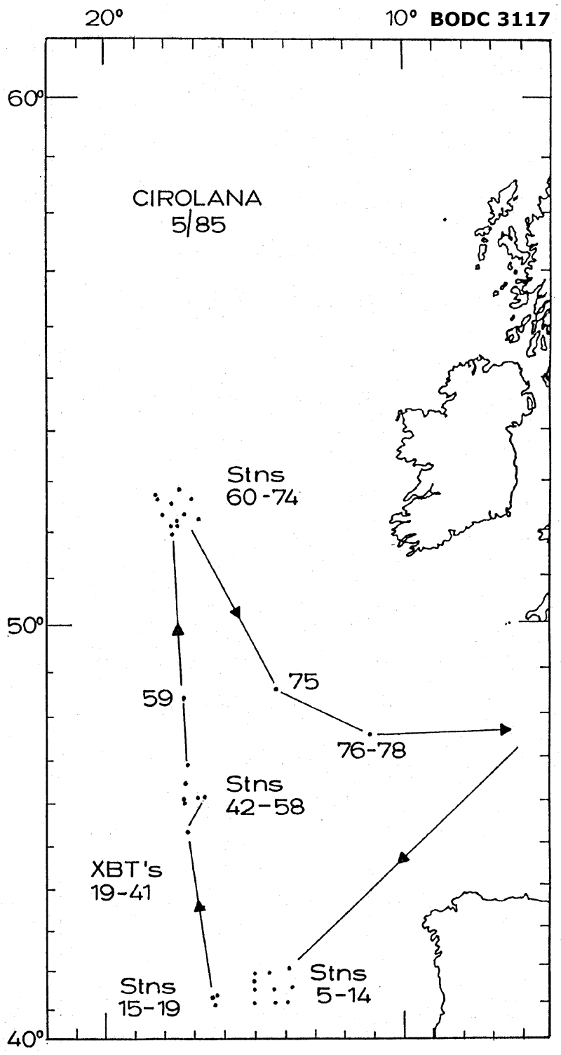
BODC Cruise Metadata Report for RV Cirolana (74CZ) cruise CIR5/85
Introduction
This report collates information from the BODC cruise inventory and oceanographic databases. It presents
- Cruise Inventory Information
- A summary of BODC data holdings for the cruise from the
- References - including cruise tracks and cruise reports
Cruise Inventory Information
| Long name | RV Cirolana (74CZ) cruise CIR5/85 |
|---|---|
| Short name | CIR5/85 |
| Objectives and Narrative |
1. To recover the nine-mooring current meter array at the SCFAR float launch site in the Iberia Abyssal Plain.
2. To recover NEADS-6 (8th deployment) and to lay a coherent nine-mooring c/m array (upper-bottom type) around the NEADS-6 site on the continental rise at the mouth of the Rockall Channel. 3. To work tandem Gerard barrel sampling and 30-1 rosette (+CTD) sampling for Cs and Pu in water at a few sites within the NEA dumpsite and 'upstream' (southwards) with emphasis on the near-bottom layer. 4. To take Reinek box cores at the same sampling locations to assess Pu ratios in surficial sediments, plus a bulk bear-bottom water sample for the in situ Pu Kd estimation. 5. To deploy fish traps at the same sampling locations to assess Cs and Pu levels in fish. 6. To recover and redeploy the dumpsite dummy drum mooring. 7. XBT's on passage (selected legs). 8. Surface Cs samples for Mr Jefferies where specified. |
| Ship | RV Cirolana |
| Departure Port | |
| Departure Date | 1985-05-20 |
| Arrival Port | Lowestoft, United Kingdom |
| Arrival Date | 1985-06-13 |
| Principal Scientist(s) | Robert R Dickson (Ministry of Agriculture, Fisheries and Food Lowestoft Fisheries Laboratory) |
| Responsible Organisation | Ministry of Agriculture, Fisheries and Food Lowestoft Fisheries Laboratory |
| Associated Project(s) | |
| IHB Sea Areas Visited | Bay of Biscay, North East Atlantic Ocean (limit 40W) |
| Marsden Squares Visited | 145;3/146;1/146;2/146;3/146;4/182;2 |
| Work Area Description | Iberian Abyssal Plain and the Rockall Channel |
| Unable to lookup cruise bounds at this time | |
| Work Area Bounding Polygon | |
| Southern Limit | unknown |
| Northern Limit | unknown |
| Western Limit | unknown |
| Eastern Limit | unknown |
Cruise Inventory Datasets
| Physical oceanography | |
|---|---|
| Bathythermograph |
Quantity:
number of profiles =
23
Description: |
| CTD stations |
Quantity:
number of stations =
11
Description: |
| Current meters | Description: 17 current meterss deployed;19 recovered;350 days of data. |
| Chemical oceanography | |
| Radioactivity |
Quantity:
number of samples =
18
Description: Caesium and Plutonium analysis |
| Biology and fisheries | |
| Other biological/fisheries measurement |
Quantity:
number of samples =
3
Description: abyssal fish for radioactive analysis |
| Geology and geophysics | |
| Core - soft bottom |
Quantity:
number of cores =
3
Description: |
Cruise Inventory Mooring/Buoy Operations
No information on datasets is currently available
Summary of BODC Data Holdings for the Cruise
National Oceanographic Database
Summary
| # Series | Instrument Description | Parameters |
|---|---|---|
| 8 | CTD/STD cast |
Salinity of the water column Temperature of the water column Vertical spatial coordinates |
Note: Parameter terms are taken from the BODC Parameter Discovery Vocabulary XML (SKOS)
Full List
| BODC Reference | Instrument Description | Date/Time | Location | |
|---|---|---|---|---|
| 58453 | CTD/STD cast | 1985-05-27 13:03Z | 41° 9' N, 16° 7' W | Click for more |
| 58465 | CTD/STD cast | 1985-05-30 12:49Z | 45° 58' N, 17° 10' W | Click for more |
| 58477 | CTD/STD cast | 1985-05-31 08:36Z | 46° 14' N, 17° 15' W | Click for more |
| 58489 | CTD/STD cast | 1985-06-03 17:43Z | 46° 45' N, 17° 13' W | Click for more |
| 58490 | CTD/STD cast | 1985-06-04 08:31Z | 48° 15' N, 17° 22' W | Click for more |
| 58508 | CTD/STD cast | 1985-06-08 11:00Z | 52° 4' N, 17° 28' W | Click for more |
| 58521 | CTD/STD cast | 1985-06-09 18:07Z | 48° 27' N, 14° 19' W | Click for more |
| 58533 | CTD/STD cast | 1985-06-10 09:00Z | 47° 26' N, 10° 59' W | Click for more |
Project Database
No data currently held for this cruise in the BODC Project Database
