BODC Cruise Metadata Report for RRS Challenger (74CH) cruise CH62A
Introduction
This report collates information from the BODC cruise inventory and oceanographic databases. It presents
- Cruise Inventory Information
- A summary of BODC data holdings for the cruise from the
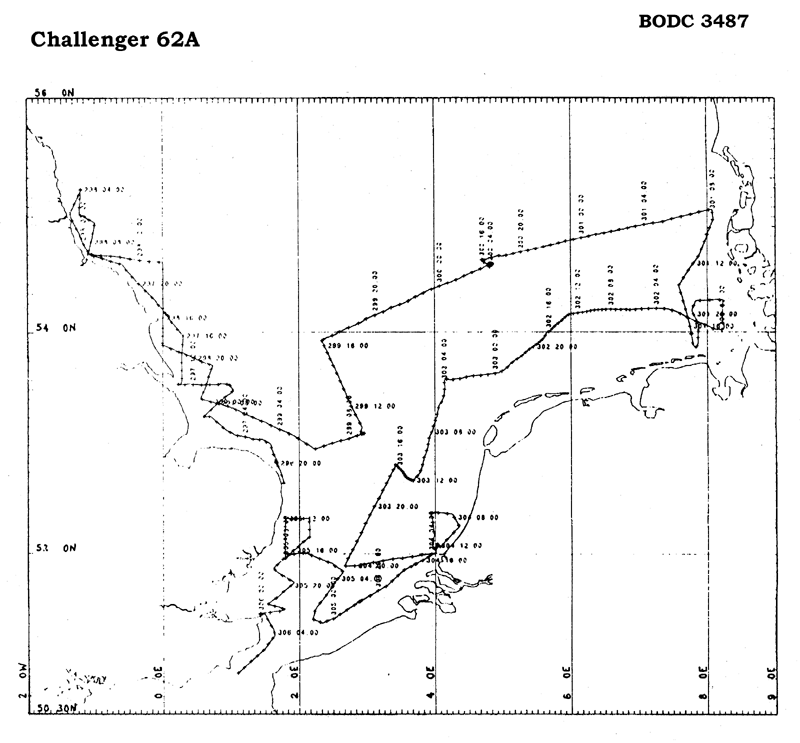
- References - including cruise tracks and cruise reports
Cruise Inventory Information
| Long name | RRS Challenger (74CH) cruise CH62A |
|---|---|
| Short name | CH62A |
| Objectives and Narrative |
1. To measure the concentrations and investigate the spatial distribution of the major nutrients: Nitrate, Nitrite, Ammonia, Silicate, Urea and Phosphate. Particular emphasis is being placed on these distributions in the sea area influenced by major European estuaries flowing into the North Sea.
2. To establish the relationships, and contribution of, these nutrient species to the formation of phytoplankton blooms. Specific attention will be paid to the contributions made by ammonia, phosphate and urea. 3. To carry out on-board mixing experiments using estuarine and offshore water samples. 4. To carry out deep gravity coring in order to study the historical record of Eutrophication using 15N, 13C and 14C compounds and other isotope dating techniques. 5. To investigate the distributions of chlorophyll and particulate organic carbon and nitrogen within the study area. 6. To study the primary production and assimilation rates of the phytoplankton using 32P. 14C and 15N tracers. 7. To investigate bacterial production using 3H-thymidine and methane oxidising bacteria using 14CH4/ 8. To investigate the influence of benthic macrofauna on re-suspension of particulate matter of two contrasting sites of the North Sea. |
| Ship | RRS Challenger |
| Departure Port | Great Yarmouth, United Kingdom |
| Departure Date | 1989-10-23 |
| Arrival Port | Cardiff, United Kingdom |
| Arrival Date | 1989-11-03 |
| Principal Scientist(s) | Nicholas J P Owens (Plymouth Marine Laboratory) |
| Responsible Organisation | Plymouth Marine Laboratory |
| Associated Project(s) | NERC North Sea Blooms |
| IHB Sea Areas Visited | North Sea |
| Marsden Squares Visited | 181;1/216;1/216;2 |
| Work Area Description | North Sea |
| Unable to lookup cruise bounds at this time | |
| Work Area Bounding Polygon | |
| Southern Limit | unknown |
| Northern Limit | unknown |
| Western Limit | unknown |
| Eastern Limit | unknown |
Cruise Inventory Datasets
| Physical oceanography | |
|---|---|
| CTD stations |
Quantity:
number of stations =
13
Description: |
| Optics (eg underwater light levels) |
Quantity:
number of stations =
13
Description: |
| Subsurface temperature and salinity measurements |
Quantity:
track kilometres =
2592
Description: |
| Surface measurements underway (T,S) |
Quantity:
track kilometres =
2592
Description: |
| Transparency (eg transmissometer) |
Quantity:
track kilometres =
2592
Description: |
| Water bottle stations |
Quantity:
number of stations =
13
Description: |
| Chemical oceanography | |
| Ammonia |
Quantity:
track kilometres =
2592
Description: dissolved, measuring concentrations and spatial distribution. |
| Nitrate |
Quantity:
track kilometres =
2592
Description: measuring concentrations and spatial distribution. |
| Nitrite |
Quantity:
track kilometres =
2592
Description: measuring concentrations and spatial distribution. |
| Oxygen |
Quantity:
track kilometres =
2592
Description: |
| Phosphate |
Quantity:
track kilometres =
2592
Description: measuring concentrations and spatial distribution. |
| Silicate |
Quantity:
track kilometres =
2592
Description: measuring concentrations and spatial distribution. |
| Contamination | |
| Other dissolved substances |
Quantity:
number of stations =
56
Description: organic P |
| Suspended matter |
Quantity:
number of stations =
56
Description: |
| Biology and fisheries | |
| Particulate organic matter (inc POC, PON) |
Quantity:
number of samples =
112
Description: |
| Pelagic bacteria/micro-organisms |
Quantity:
number of stations =
30
Description: distribution,biomass determination,energy transfers |
| Phytoplankton pigs (eg chlorophyll, fluorescence) |
Quantity:
number of stations =
56
Description: 1400 nautical miles |
| Primary productivity |
Quantity:
number of stations =
56
Description: |
| Seston |
Quantity:
number of stations =
56
Description: |
| Meteorology | |
| Incident radiation |
Quantity:
track kilometres =
2963
Description: |
| Occasional standard measurements |
Quantity:
number of measurements =
40
Description: |
| Geology and geophysics | |
| Core - soft bottom |
Quantity:
number of cores =
11
Description: deep gravity coring to study historical record of eutrophication. |
Cruise Inventory Mooring/Buoy Operations
No information on datasets is currently available
Summary of BODC Data Holdings for the Cruise
National Oceanographic Database
Summary
| # Series | Instrument Description | Parameters |
|---|---|---|
| 9 | Bottle station |
Chlorophyll pigment concentrations in water bodies Quality control flags Reference numbers Vertical spatial coordinates |
| 10 | CTD/STD cast |
Chlorophyll pigment concentrations in water bodies Concentration of suspended particulate material in the water column Density of the water column Salinity of the water column Temperature of the water column Transmittance and attenuance of the water column Vertical spatial coordinates Visible waveband radiance and irradiance measurements in the water column |
| 3 | CTD/STD cast |
Chlorophyll pigment concentrations in water bodies Density of the water column Salinity of the water column Temperature of the water column Transmittance and attenuance of the water column Vertical spatial coordinates Visible waveband radiance and irradiance measurements in the water column |
| 1 | Meteorological data logger |
Date and time Horizontal spatial co-ordinates Visible waveband radiance and irradiance measurements in the atmosphere |
| 1 | Ship's non-toxic supply |
Ammonium and ammonia concentration parameters in water bodies Chlorophyll pigment concentrations in water bodies Concentration of suspended particulate material in the water column Date and time Horizontal spatial co-ordinates Nitrate concentration parameters in the water column Nitrite concentration parameters in the water column Phosphate concentration parameters in the water column Salinity of the water column Silicate concentration parameters in the water column Temperature of the water column Transmittance and attenuance of the water column |
| 1 | Single-beam echosounder |
Bathymetry and Elevation Date and time Horizontal spatial co-ordinates |
Note: Parameter terms are taken from the BODC Parameter Discovery Vocabulary XML (SKOS)
Full List
| BODC Reference | Instrument Description | Date/Time | Location | |
|---|---|---|---|---|
| 822471 | CTD/STD cast | 1989-10-24 09:34Z | 53° 32' N, 0° 59' E | Click for more |
| 822483 | CTD/STD cast | 1989-10-24 17:35Z | 54° 9' N, 0° 4' E | Click for more |
| 822495 | CTD/STD cast | 1989-10-25 08:51Z | 54° 40' N, 1° 6' W | Click for more |
| 822502 | CTD/STD cast | 1989-10-25 17:35Z | 53° 54' N, 0° 0' W | Click for more |
| 822514 | CTD/STD cast | 1989-10-26 09:05Z | 53° 6' N, 2° 57' E | Click for more |
| 822526 | CTD/STD cast | 1989-10-26 16:34Z | 53° 55' N, 2° 21' E | Click for more |
| 822538 | CTD/STD cast | 1989-10-27 05:05Z | 54° 34' N, 4° 50' E | Click for more |
| 822551 | CTD/STD cast | 1989-10-27 12:05Z | 54° 34' N, 4° 48' E | Click for more |
| 822563 | CTD/STD cast | 1989-10-28 09:47Z | 54° 51' N, 8° 0' E | Click for more |
| 822575 | CTD/STD cast | 1989-10-28 16:30Z | 53° 59' N, 7° 46' E | Click for more |
| 822587 | CTD/STD cast | 1989-11-01 09:57Z | 52° 8' N, 1° 47' E | Click for more |
| 822599 | CTD/STD cast | 1989-11-01 17:05Z | 51° 57' N, 1° 46' E | Click for more |
| 822606 | CTD/STD cast | 1989-11-02 00:13Z | 51° 25' N, 1° 25' E | Click for more |
| 953274 | Single-beam echosounder | 1989-10-23 18:30Z to 1989-11-02 07:30Z | 50° 52' N to 55° 14' N; 1° 22' W to 8° 15' E | Click for more |
| 953286 | Meteorological data logger | 1989-10-23 18:30Z to 1989-11-02 07:30Z | 50° 52' N to 55° 14' N; 1° 22' W to 8° 15' E | Click for more |
| 953298 | Ship's non-toxic supply | 1989-10-23 18:30Z to 1989-11-02 07:30Z | 50° 52' N to 55° 14' N; 1° 22' W to 8° 15' E | Click for more |
| 1691067 | Bottle station | 1989-10-24 17:41Z | 54° 9' N, 0° 4' E | Click for more |
| 1691079 | Bottle station | 1989-10-25 08:57Z | 54° 40' N, 1° 6' W | Click for more |
| 1691080 | Bottle station | 1989-10-25 17:41Z | 53° 54' N, 0° 0' W | Click for more |
| 1691092 | Bottle station | 1989-10-26 09:12Z | 53° 6' N, 2° 57' E | Click for more |
| 1691111 | Bottle station | 1989-10-26 16:38Z | 53° 55' N, 2° 21' E | Click for more |
| 1691123 | Bottle station | 1989-10-28 16:36Z | 53° 59' N, 7° 46' E | Click for more |
| 1691135 | Bottle station | 1989-11-01 10:03Z | 52° 8' N, 1° 47' E | Click for more |
| 1691147 | Bottle station | 1989-11-01 17:10Z | 51° 57' N, 1° 46' E | Click for more |
| 1691159 | Bottle station | 1989-11-02 00:18Z | 51° 25' N, 1° 25' E | Click for more |
Project Database
| # Events | Gear Type | Parameters Held |
|---|---|---|
| 48 | Sample taken from ship's non-toxic supply | Concentration of suspended particulate material in the water column |
| 13 | CTD frame plus rosette sampler |
Transmittance and attenuance of the water column
Salinity of the water column Temperature of the water column Concentration of suspended particulate material in the water column Visible waveband radiance and irradiance measurements in the water column Density of the water column Chlorophyll pigment concentrations in water bodies |
Note: Parameter terms are taken from the BODC Parameter Discovery Vocabulary XML (SKOS)
