BODC Cruise Metadata Report for RV Corystes (74RY) cruise COR2A/93
Introduction
This report collates information from the BODC cruise inventory and oceanographic databases. It presents
- Cruise Inventory Information
- A summary of BODC data holdings for the cruise from the
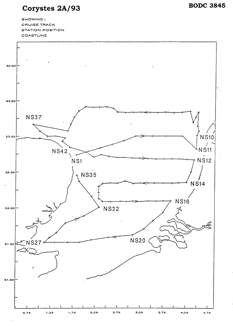
- References - including cruise tracks and cruise reports
Cruise Inventory Information
| Long name | RV Corystes (74RY) cruise COR2A/93 |
|---|---|
| Short name | COR2A/93 |
| Objectives and Narrative |
Following the failure of CIROLANA 1/93 to complete the North Sea JONUS and Phosphate stations because of bad weather, the priorities of this cruise were revised as follows:
1. To examine the nutrient distribution from river inputs to the North Sea. 2. To take samples over a grid in a Southern North Sea to improve knowledge of the seasonal signal in nutrients particuarly phosphate. 3. To identify and quantify the fate of river borne nutrients entering the Wash and Humber estuary. Due to the completion of aims 1 and 2, there was insufficient time to attempt aim 3. |
| Ship | RV Corystes |
| Departure Port | Lowestoft, United Kingdom |
| Departure Date | 1993-02-03 |
| Arrival Port | Lowestoft, United Kingdom |
| Arrival Date | 1993-02-07 |
| Principal Scientist(s) | J Alan Durance (Ministry of Agriculture, Fisheries and Food Lowestoft Fisheries Laboratory) |
| Responsible Organisation | Ministry of Agriculture, Fisheries and Food Lowestoft Fisheries Laboratory |
| Associated Project(s) | |
| IHB Sea Areas Visited | North Sea |
| Marsden Squares Visited | 216;1 |
| Work Area Description | Southern North Sea, Humber. |
| Unable to lookup cruise bounds at this time | |
| Work Area Bounding Polygon | |
| Southern Limit | unknown |
| Northern Limit | unknown |
| Western Limit | unknown |
| Eastern Limit | unknown |
Cruise Inventory Datasets
| Physical oceanography | |
|---|---|
| CTD stations |
Quantity:
number of stations =
26
Description: also 72 surface T S received but rejected |
| Surface measurements underway (T,S) |
Quantity:
number of stations =
101
Description: Surface T & S |
| Chemical oceanography | |
| Ammonia |
Quantity:
number of stations =
127
Description: 72 surface only |
| Nitrate |
Quantity:
number of stations =
101
Description: 75 surface only |
| Nitrite |
Quantity:
number of stations =
127
Description: 75 surface only |
| Phosphate |
Quantity:
number of stations =
127
Description: 75 surface only |
| Silicate |
Quantity:
number of stations =
127
Description: 75 surface only |
| Total - N |
Quantity:
number of stations =
127
Description: 75 surface only |
| Contamination | |
| Suspended matter |
Quantity:
number of stations =
127
Description: |
| Biology and fisheries | |
| Phytoplankton pigs (eg chlorophyll, fluorescence) |
Quantity:
number of stations =
127
Description: |
Cruise Inventory Mooring/Buoy Operations
No information on datasets is currently available
Summary of BODC Data Holdings for the Cruise
National Oceanographic Database
Summary
| # Series | Instrument Description | Parameters |
|---|---|---|
| 26 | CTD/STD cast |
Salinity of the water column Temperature of the water column Vertical spatial coordinates |
Note: Parameter terms are taken from the BODC Parameter Discovery Vocabulary XML (SKOS)
Full List
| BODC Reference | Instrument Description | Date/Time | Location | |
|---|---|---|---|---|
| 545988 | CTD/STD cast | 1993-02-03 09:30Z | 52° 44' N, 1° 49' E | Click for more |
| 546003 | CTD/STD cast | 1993-02-03 10:56Z | 52° 47' N, 2° 4' E | Click for more |
| 546015 | CTD/STD cast | 1993-02-03 13:30Z | 52° 52' N, 2° 37' E | Click for more |
| 546027 | CTD/STD cast | 1993-02-03 15:37Z | 53° 0' N, 3° 7' E | Click for more |
| 546039 | CTD/STD cast | 1993-02-03 18:14Z | 53° 0' N, 3° 48' E | Click for more |
| 546040 | CTD/STD cast | 1993-02-03 22:57Z | 53° 0' N, 4° 29' E | Click for more |
| 546052 | CTD/STD cast | 1993-02-04 18:34Z | 53° 10' N, 0° 51' E | Click for more |
| 546064 | CTD/STD cast | 1993-02-04 19:36Z | 53° 4' N, 1° 0' E | Click for more |
| 546076 | CTD/STD cast | 1993-02-04 20:42Z | 53° 0' N, 1° 10' E | Click for more |
| 546088 | CTD/STD cast | 1993-02-04 21:45Z | 53° 0' N, 1° 21' E | Click for more |
| 546107 | CTD/STD cast | 1993-02-04 23:22Z | 52° 55' N, 1° 30' E | Click for more |
| 546119 | CTD/STD cast | 1993-02-05 00:44Z | 52° 50' N, 1° 39' E | Click for more |
| 546120 | CTD/STD cast | 1993-02-05 11:17Z | 52° 40' N, 4° 25' E | Click for more |
| 546132 | CTD/STD cast | 1993-02-05 14:05Z | 52° 21' N, 4° 16' E | Click for more |
| 546144 | CTD/STD cast | 1993-02-06 03:41Z | 52° 6' N, 3° 55' E | Click for more |
| 546156 | CTD/STD cast | 1993-02-06 06:55Z | 51° 49' N, 3° 31' E | Click for more |
| 546168 | CTD/STD cast | 1993-02-06 09:05Z | 51° 37' N, 3° 4' E | Click for more |
| 546181 | CTD/STD cast | 1993-02-06 11:27Z | 51° 34' N, 2° 33' E | Click for more |
| 546193 | CTD/STD cast | 1993-02-06 15:05Z | 51° 31' N, 1° 54' E | Click for more |
| 546200 | CTD/STD cast | 1993-02-06 17:37Z | 51° 31' N, 1° 21' E | Click for more |
| 546212 | CTD/STD cast | 1993-02-06 18:53Z | 51° 31' N, 1° 6' E | Click for more |
| 546224 | CTD/STD cast | 1993-02-06 19:56Z | 51° 34' N, 1° 13' E | Click for more |
| 546236 | CTD/STD cast | 1993-02-06 22:00Z | 51° 46' N, 1° 34' E | Click for more |
| 546248 | CTD/STD cast | 1993-02-07 01:15Z | 52° 0' N, 2° 20' E | Click for more |
| 546261 | CTD/STD cast | 1993-02-07 03:44Z | 52° 22' N, 1° 52' E | Click for more |
| 546273 | CTD/STD cast | 1993-02-07 05:09Z | 52° 27' N, 1° 49' E | Click for more |
Project Database
No data currently held for this cruise in the BODC Project Database
