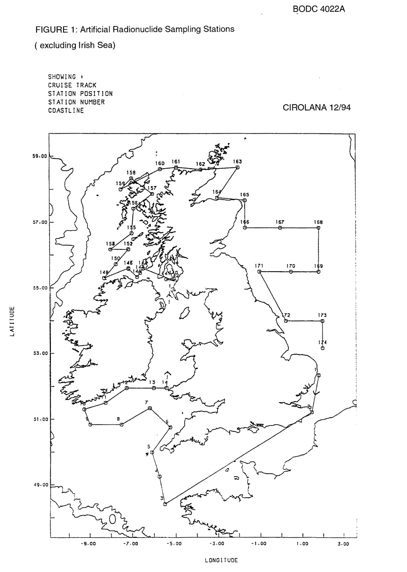
BODC Cruise Metadata Report for RV Cirolana (74CZ) cruise CIR12/94
Introduction
This report collates information from the BODC cruise inventory and oceanographic databases. It presents
- Cruise Inventory Information
- A summary of BODC data holdings for the cruise from the
- References - including cruise tracks and cruise reports
Cruise Inventory Information
| Long name | RV Cirolana (74CZ) cruise CIR12/94 |
|---|---|
| Short name | CIR12/94 |
| Objectives and Narrative |
1. To collect and process surface and bottom water from UK coastal waters for the analysis of Tc, Cs, Sb and transuranic radionuclides as part of the post Enhanced Actinide Removal plant (EARP) survey (AE0114A, Nuclear Fission Safety Programme).
2. To conduct further studies to determine the temporal distribution and stability if actinide colloids in both surface and bottom waters using a variety of ultrafiltration techniques (AE0114A, Nuclear Fission Safety Programme). 3. To study the surface sediment and water concentrations of U, Th, Ra, Po and Pb radionuclides and nutrients in the immediate vicinity of the Marchon outfall and further offshore in the eastern Irish Sea. Part of this work is to be done in conjunction with a small charter vessel (AE0115A). 4. To collect, on behalf of IAEA, the remainder of a bulk fish sample required for worldwide distribution as an intercalibration reference sample (carried over from CIR 6/94). |
| Ship | RV Cirolana |
| Departure Port | Lowestoft, United Kingdom |
| Departure Date | 1994-12-01 |
| Arrival Port | Lowestoft, United Kingdom |
| Arrival Date | 1994-12-19 |
| Principal Scientist(s) | Kinson S Leonard (Ministry of Agriculture, Fisheries and Food Lowestoft Fisheries Laboratory) |
| Responsible Organisation | Ministry of Agriculture, Fisheries and Food Lowestoft Fisheries Laboratory |
| Associated Project(s) | |
| IHB Sea Areas Visited | North Sea, Irish Sea and St. George's Channel |
| Marsden Squares Visited | 145;3/145;4/181;1/181;2/181;3/181;4/216;1/216;3 |
| Work Area Description | Celtic Sea, Irish Sea, Malin, Western Isles, North Sea |
| Unable to lookup cruise bounds at this time | |
| Work Area Bounding Polygon | |
| Southern Limit | unknown |
| Northern Limit | unknown |
| Western Limit | unknown |
| Eastern Limit | unknown |
Cruise Inventory Datasets
| Physical oceanography | |
|---|---|
| CTD stations |
Quantity:
number of stations =
5
Description: |
| Water bottle stations |
Quantity:
number of stations =
85
Description: surface S only |
| Chemical oceanography | |
| Radioactivity |
Quantity:
number of samples =
60
Description: natural radionuclides |
| Radioactivity |
Quantity:
number of samples =
86
Description: Caesium, Antimony, Americium, Cobalt studies |
| Radioactivity |
Quantity:
number of samples =
4
Description: radiocolloids |
| Biology and fisheries | |
| Demersal fish |
Quantity:
number of hauls =
4
Description: mixed fish samples for radiation contamination studies |
| Geology and geophysics | |
| Core - soft bottom |
Quantity:
number of cores =
2
Description: Caesium, Antimony, Americium, Cobalt studies |
Cruise Inventory Mooring/Buoy Operations
No information on datasets is currently available
Summary of BODC Data Holdings for the Cruise
National Oceanographic Database
Summary
| # Series | Instrument Description | Parameters |
|---|---|---|
| 5 | CTD/STD cast |
Salinity of the water column Temperature of the water column Vertical spatial coordinates |
Note: Parameter terms are taken from the BODC Parameter Discovery Vocabulary XML (SKOS)
Full List
| BODC Reference | Instrument Description | Date/Time | Location | |
|---|---|---|---|---|
| 545872 | CTD/STD cast | 1994-12-12 09:15Z | 54° 24' N, 3° 34' W | Click for more |
| 545884 | CTD/STD cast | 1994-12-13 16:13Z | 55° 36' N, 7° 9' W | Click for more |
| 545896 | CTD/STD cast | 1994-12-13 20:20Z | 55° 18' N, 8° 18' W | Click for more |
| 545903 | CTD/STD cast | 1994-12-14 08:50Z | 56° 10' N, 7° 9' W | Click for more |
| 545915 | CTD/STD cast | 1994-12-14 11:31Z | 56° 10' N, 7° 59' W | Click for more |
Project Database
No data currently held for this cruise in the BODC Project Database
