BODC Cruise Metadata Report for RRS Discovery (74E3) cruise D207
Introduction
This report collates information from the BODC cruise inventory and oceanographic databases. It presents
- Cruise Inventory Information
- A summary of BODC data holdings for the cruise from the
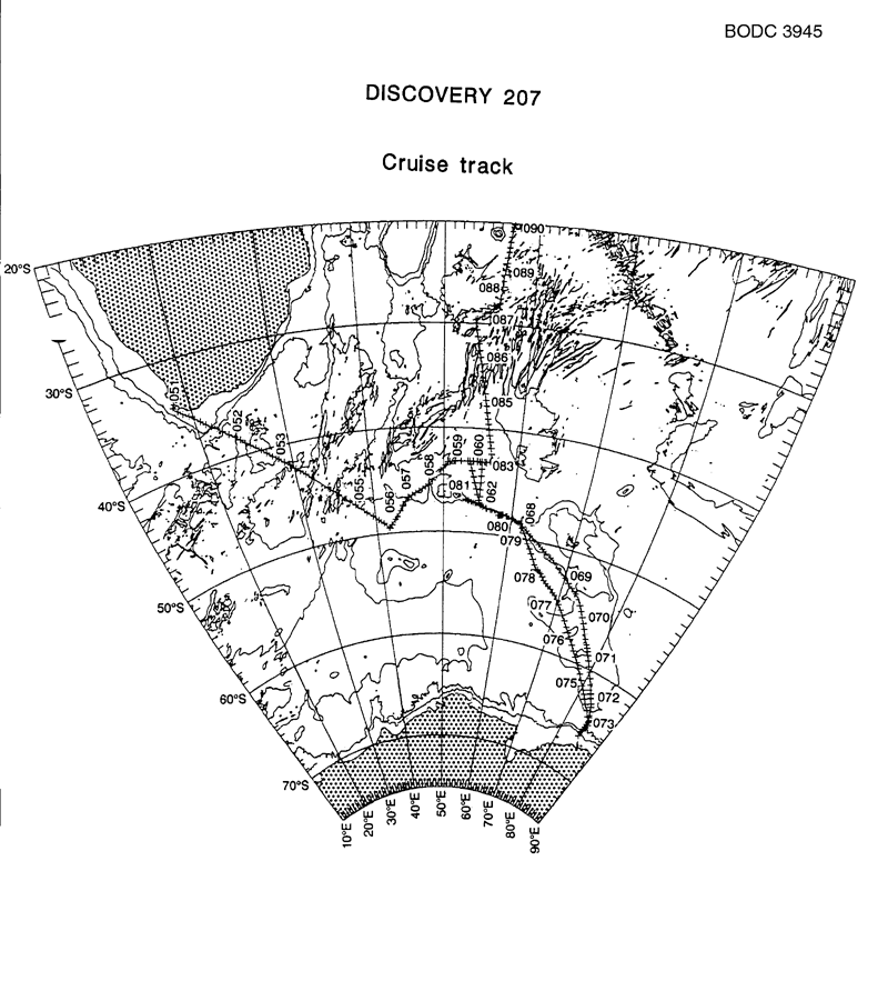
- References - including cruise tracks and cruise reports
Cruise Inventory Information
| Long name | RRS Discovery (74E3) cruise D207 |
|---|---|
| Short name | D207 |
| Objectives and Narrative |
1. To make measurements of the flow of deep and bottom waters passing eastward from the Weddell-Enderby Abyssal Plain to the Southern Indian Ocean via deep topographic gaps to the northeast and southeast of the Kerguelen Plateau. Specifically, to recover the two main current meter arrays deployed during Discovery 200 - an array of 10 moorings (42 current meters) and 2 bottom pressure gauges in the main gap between Crozet and Kerguelen, supplemented with a mooring in the deep cleft immediately west of Crozet Island, and a further 5 moorings (13 current meters) set in the Princess Elizabeth Trough between the Kerguelen Plateau and Antarctica.
2. To use a range of tracers, including the CFCs 10, 11, 12, 113, inorganic nutrients, dissolved oxygen and both oxygen and hydrogen isotopes (including meltwater content) to assist in partitioning the deep throughflow into its constituent watermasses, and to track the onward incursion of the AABW plume into the Indian Ocean. 3. To make discrete measurements of CO2 partial pressure in seawater, total seawater CO2 content and appropriate measures of biological activity throughout the cruise track as a BFOS/PRIME component of the BAS Antarctic Special Topic, and as a necessary determinant of WOCE. 4. To monitor a suite of discontinuous and continuous environmental variables throughout the cruise, including bathymetry from PES, XBT and ADCP, multimet, wave recorder, and thermosalinograph, and where possible to locate the major ocean frontal zones in this sector of the Southern Ocean. 5. To use a range of satellite-derived ice and weather intelligence where possible and appropriate. 6. To obtain water samples for heavy-metal analysis by Dr Frew. |
| Ship | RRS Discovery |
| Departure Port | Cape Town, South Africa |
| Departure Date | 1994-02-19 |
| Arrival Port | Port Louis, Mauritius |
| Arrival Date | 1994-03-31 |
| Principal Scientist(s) | Robert R Dickson (Ministry of Agriculture, Fisheries and Food Lowestoft Fisheries Laboratory) |
| Responsible Organisation | Ministry of Agriculture, Fisheries and Food Lowestoft Fisheries Laboratory |
| Associated Project(s) | WOCE |
| IHB Sea Areas Visited | Indian Ocean |
| Marsden Squares Visited | 402/438/441/442/473/474/475/476/477/508/509/543/544 |
| Work Area Description | Southern Indian Ocean, Crozet-Kerguelen, Princess Eliz.Trough, Madagascar Basin |
| Unable to lookup cruise bounds at this time | |
| Work Area Bounding Polygon | |
| Southern Limit | unknown |
| Northern Limit | unknown |
| Western Limit | unknown |
| Eastern Limit | unknown |
Cruise Inventory Datasets
| Physical oceanography | |
|---|---|
| Bathythermograph |
Quantity:
number of profiles =
160
Description: XBTs |
| CTD stations |
Quantity:
number of stations =
33
Description: |
| Current meters |
Quantity:
number of stations =
14
Description: 46 cms recovered |
| Current profiler (eg ADCP) |
Quantity:
activity duration in days =
40
Description: cont. shipborne ADCP records |
| Geochemical tracers (eg freons) |
Quantity:
number of stations =
33
Description: CFC12, CFC11, CFC113, CFC10, CCl4 |
| Instrumented wave measurements |
Quantity:
activity duration in days =
40
Description: cont. wave recordings |
| Surface measurements underway (T,S) |
Quantity:
activity duration in days =
40
Description: cont. |
| Chemical oceanography | |
| Carbon dioxide |
Quantity:
activity duration in days =
40
Description: cont. pCO2 and TCO2 |
| Isotopes |
Quantity:
number of stations =
33
Description: |
| Nitrate |
Quantity:
number of stations =
33
Description: |
| Nitrite |
Quantity:
number of stations =
33
Description: |
| Oxygen |
Quantity:
number of stations =
33
Description: |
| Phosphate |
Quantity:
number of stations =
33
Description: |
| Silicate |
Quantity:
number of stations =
33
Description: |
| Contamination | |
| Trace metals |
Quantity:
number of stations =
33
Description: |
| Meteorology | |
| Other meteorological measurements |
Quantity:
activity duration in days =
40
Description: cont. logging of wind,pressure,air temp,radiation,irradiance,waves |
| Routine standard measurements |
Quantity:
activity duration in days =
40
Description: synoptic observations by ship's officals |
Cruise Inventory Mooring/Buoy Operations
| Latitude | Longitude | Data type | Description |
|---|---|---|---|
| 64° 49' S | 85° 7' E | Current meters | recover 2 meters, 276 days data |
| 46° 25' S | 48° 0' E | Current meters | recover 2 meters, 352 days data |
| 48° 34' S | 61° 31' E | Current meters | recover 2 meters, 629 days data |
| 63° 3' S | 83° 34' E | Current meters | recover 2 meters, 764 days data |
| 48° 0' S | 58° 37' E | Current meters | recover 3 meters, 1095 days data |
| 63° 30' S | 83° 57' E | Current meters | recover 3 meters, 1125 days data |
| 46° 49' S | 53° 19' E | Current meters | recover 3 meters, 717 days data |
| 63° 55' S | 84° 19' E | Current meters | recover 3 meters, 764 days data |
| 64° 22' S | 84° 42' E | Current meters | recover 3 meters, 786 days data |
| 47° 37' S | 56° 48' E | Current meters | recover 4 meters, 1139 days data |
| 47° 25' S | 55° 36' E | Current meters | recover 4 meters, 1243 days data |
| 47° 1' S | 53° 4' E | Current meters | recover 4 meters, 1432 days data |
| 48° 12' S | 59° 37' E | Current meters | recover 4 meters, 891 days data |
| 47° 45' S | 58° 3' E | Current meters | recover 7 meters, 2512 days data |
| 46° 52' S | 53° 28' E | Sea level (inc. bot. press., inverted echosounder) | recover 1 bottom pressure recorder, 365 days data |
Summary of BODC Data Holdings for the Cruise
National Oceanographic Database
Summary
| # Series | Instrument Description | Parameters |
|---|---|---|
| 24 | Bottle station |
Nitrate concentration parameters in the water column Phosphate concentration parameters in the water column Quality control flags Reference numbers Silicate concentration parameters in the water column Vertical spatial coordinates |
| 32 | CTD/STD cast |
Density of the water column Dissolved oxygen parameters in the water column Salinity of the water column Temperature of the water column Vertical spatial coordinates |
| 1 | Single-beam echosounder |
Bathymetry and Elevation Date and time Horizontal spatial co-ordinates |
Note: Parameter terms are taken from the BODC Parameter Discovery Vocabulary XML (SKOS)
Full List
| BODC Reference | Instrument Description | Date/Time | Location | |
|---|---|---|---|---|
| 582182 | Single-beam echosounder | 1994-02-21 06:32Z to 1994-03-31 03:14Z | 66° 3' S to 20° 7' S; 24° 57' E to 85° 9' E | Click for more |
| 1006029 | CTD/STD cast | 1994-02-24 17:57Z | 49° 30' S, 41° 56' E | Click for more |
| 1006030 | CTD/STD cast | 1994-02-25 04:43Z | 48° 28' S, 43° 6' E | Click for more |
| 1006042 | CTD/STD cast | 1994-02-25 14:41Z | 47° 27' S, 44° 7' E | Click for more |
| 1006054 | CTD/STD cast | 1994-02-26 03:05Z | 46° 38' S, 44° 59' E | Click for more |
| 1006066 | CTD/STD cast | 1994-02-27 17:30Z | 43° 16' S, 50° 37' E | Click for more |
| 1006078 | CTD/STD cast | 1994-02-28 00:17Z | 43° 12' S, 51° 33' E | Click for more |
| 1006091 | CTD/STD cast | 1994-02-28 09:04Z | 43° 9' S, 53° 12' E | Click for more |
| 1006109 | CTD/STD cast | 1994-02-28 15:00Z | 43° 9' S, 53° 59' E | Click for more |
| 1006110 | CTD/STD cast | 1994-02-28 23:52Z | 43° 9' S, 54° 34' E | Click for more |
| 1006122 | CTD/STD cast | 1994-03-01 05:59Z | 43° 11' S, 54° 28' E | Click for more |
| 1006134 | CTD/STD cast | 1994-03-01 11:41Z | 43° 10' S, 55° 9' E | Click for more |
| 1006146 | CTD/STD cast | 1994-03-02 17:41Z | 47° 7' S, 54° 32' E | Click for more |
| 1006158 | CTD/STD cast | 1994-03-03 14:51Z | 46° 55' S, 53° 36' E | Click for more |
| 1006171 | CTD/STD cast | 1994-03-03 21:41Z | 46° 45' S, 53° 6' E | Click for more |
| 1006183 | CTD/STD cast | 1994-03-04 17:24Z | 47° 18' S, 55° 16' E | Click for more |
| 1006195 | CTD/STD cast | 1994-03-05 14:12Z | 47° 40' S, 57° 35' E | Click for more |
| 1006202 | CTD/STD cast | 1994-03-07 07:38Z | 48° 5' S, 59° 8' E | Click for more |
| 1006214 | CTD/STD cast | 1994-03-07 17:17Z | 48° 16' S, 60° 0' E | Click for more |
| 1006226 | CTD/STD cast | 1994-03-14 09:13Z | 66° 2' S, 84° 33' E | Click for more |
| 1006238 | CTD/STD cast | 1994-03-14 12:56Z | 65° 31' S, 84° 37' E | Click for more |
| 1006251 | CTD/STD cast | 1994-03-20 09:11Z | 48° 34' S, 61° 27' E | Click for more |
| 1006263 | CTD/STD cast | 1994-03-22 04:03Z | 47° 31' S, 56° 12' E | Click for more |
| 1006275 | CTD/STD cast | 1994-03-23 10:54Z | 43° 9' S, 53° 33' E | Click for more |
| 1006287 | CTD/STD cast | 1994-03-23 21:51Z | 43° 10' S, 54° 54' E | Click for more |
| 1006299 | CTD/STD cast | 1994-03-24 04:42Z | 43° 10' S, 55° 41' E | Click for more |
| 1006306 | CTD/STD cast | 1994-03-24 12:37Z | 43° 10' S, 56° 33' E | Click for more |
| 1006318 | CTD/STD cast | 1994-03-27 16:40Z | 29° 39' S, 53° 28' E | Click for more |
| 1006331 | CTD/STD cast | 1994-03-28 00:10Z | 29° 19' S, 54° 10' E | Click for more |
| 1006343 | CTD/STD cast | 1994-03-28 07:06Z | 28° 54' S, 54° 45' E | Click for more |
| 1006355 | CTD/STD cast | 1994-03-28 15:21Z | 28° 31' S, 55° 29' E | Click for more |
| 1006367 | CTD/STD cast | 1994-03-28 23:07Z | 28° 4' S, 56° 5' E | Click for more |
| 1006379 | CTD/STD cast | 1994-03-29 05:32Z | 27° 30' S, 56° 9' E | Click for more |
| 1299446 | Bottle station | 1994-02-24 19:41Z | 49° 30' S, 41° 56' E | Click for more |
| 1299458 | Bottle station | 1994-02-25 06:24Z | 48° 28' S, 43° 6' E | Click for more |
| 1299471 | Bottle station | 1994-02-25 16:09Z | 47° 26' S, 44° 7' E | Click for more |
| 1299483 | Bottle station | 1994-02-26 04:27Z | 46° 38' S, 44° 59' E | Click for more |
| 1299495 | Bottle station | 1994-02-27 18:48Z | 43° 16' S, 50° 37' E | Click for more |
| 1299502 | Bottle station | 1994-02-28 01:45Z | 43° 12' S, 51° 33' E | Click for more |
| 1299514 | Bottle station | 1994-02-28 10:24Z | 43° 9' S, 53° 12' E | Click for more |
| 1299526 | Bottle station | 1994-02-28 16:34Z | 43° 9' S, 53° 59' E | Click for more |
| 1299538 | Bottle station | 1994-03-01 01:23Z | 43° 9' S, 54° 34' E | Click for more |
| 1299551 | Bottle station | 1994-03-01 07:32Z | 43° 11' S, 54° 28' E | Click for more |
| 1299563 | Bottle station | 1994-03-01 13:15Z | 43° 10' S, 55° 9' E | Click for more |
| 1299575 | Bottle station | 1994-03-02 19:13Z | 47° 7' S, 54° 32' E | Click for more |
| 1299587 | Bottle station | 1994-03-03 16:20Z | 46° 55' S, 53° 36' E | Click for more |
| 1299599 | Bottle station | 1994-03-03 22:54Z | 46° 45' S, 53° 6' E | Click for more |
| 1299606 | Bottle station | 1994-03-04 19:10Z | 47° 18' S, 55° 16' E | Click for more |
| 1299618 | Bottle station | 1994-03-05 16:02Z | 47° 40' S, 57° 35' E | Click for more |
| 1299631 | Bottle station | 1994-03-07 09:38Z | 48° 5' S, 59° 8' E | Click for more |
| 1299643 | Bottle station | 1994-03-07 18:59Z | 48° 16' S, 60° 0' E | Click for more |
| 1299655 | Bottle station | 1994-03-27 18:21Z | 29° 39' S, 53° 28' E | Click for more |
| 1299667 | Bottle station | 1994-03-28 01:57Z | 29° 19' S, 54° 10' E | Click for more |
| 1299679 | Bottle station | 1994-03-28 08:52Z | 28° 54' S, 54° 45' E | Click for more |
| 1299680 | Bottle station | 1994-03-28 17:04Z | 28° 31' S, 55° 29' E | Click for more |
| 1299692 | Bottle station | 1994-03-29 00:48Z | 28° 4' S, 56° 5' E | Click for more |
| 1299711 | Bottle station | 1994-03-29 07:23Z | 27° 30' S, 56° 9' E | Click for more |
Project Database
| # Events | Gear Type | Parameters Held |
|---|---|---|
| 32 | CTD frame plus rosette sampler |
Phosphate concentration parameters in the water column
Dissolved oxygen parameters in the water column Temperature of the water column Salinity of the water column Stable isotopes in water bodies Silicate concentration parameters in the water column Other halocarbon concentrations in water bodies Density of the water column Nitrate concentration parameters in the water column Chlorofluorocarbon concentrations in the water column |
| 141 | Expendable Bathythermograph | Temperature of the water column |
| 661 | Sample taken from ship's non-toxic supply | Salinity of the water column |
| 7309 | Shipborne Acoustic Doppler Current Profile |
Note: Parameter terms are taken from the BODC Parameter Discovery Vocabulary XML (SKOS)
