BODC Cruise Metadata Report for RRS Discovery (74E3) cruise D214
Introduction
This report collates information from the BODC cruise inventory and oceanographic databases. It presents
- Cruise Inventory Information
- A summary of BODC data holdings for the cruise from the
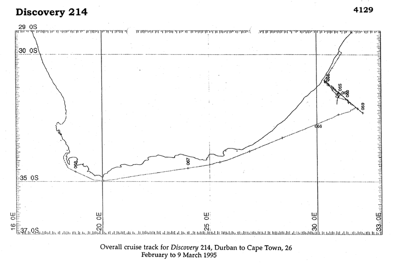
- References - including cruise tracks and cruise reports
Cruise Inventory Information
| Long name | RRS Discovery (74E3) cruise D214 |
|---|---|
| Short name | D214 |
| Objectives and Narrative |
The primary objective of the cruise was to deploy an array of moored current meters.
The second objective of the cruise was to make a hydrographic section of the Agulhas Current in order to determine the geostrophic transport of the Current. In addition, for this cruise, two developmental acoustic profiling techniques were prepared to help define the velocity structure of the Agulhas Current. |
| Ship | RRS Discovery |
| Departure Port | Durban, South Africa |
| Departure Date | 1995-02-26 |
| Arrival Port | Cape Town, South Africa |
| Arrival Date | 1995-03-09 |
| Principal Scientist(s) | Harry L Bryden (James Rennell Centre for Ocean Circulation) |
| Responsible Organisation | James Rennell Centre for Ocean Circulation |
| Associated Project(s) | WOCE |
| IHB Sea Areas Visited | Indian Ocean |
| Marsden Squares Visited | 440;1/441;1/441;2/442;2 |
| Work Area Description | Agulhas Current region, Southern Indian Ocean (30-33degS, 29-34degE) |
| Unable to lookup cruise bounds at this time | |
| Work Area Bounding Polygon | |
| Southern Limit | unknown |
| Northern Limit | unknown |
| Western Limit | unknown |
| Eastern Limit | unknown |
Cruise Inventory Datasets
| Physical oceanography | |
|---|---|
| CTD stations |
Quantity:
number of stations =
15
Description: NBIS with oxygen sensor |
| Current meters |
Quantity:
number of stations =
6
Description: 24 cms deployed |
| Current profiler (eg ADCP) |
Quantity:
activity duration in days =
11
Description: shipborne ADCP & Acou. Corr. Current Profiler (experimental) |
| Current profiler (eg ADCP) |
Quantity:
number of stations =
15
Description: Lowered ADCP, attached to CTD/Rosette frame |
| Surface measurements underway (T,S) |
Quantity:
activity duration in days =
11
Description: thermosalinograph |
| Water bottle stations |
Quantity:
number of samples =
115
Description: 15 t & S for CTD calibration & 100 surface salinity samples |
| Chemical oceanography | |
| Oxygen |
Quantity:
number of stations =
15
Description: samples for oxygen |
| Meteorology | |
| Other meteorological measurements |
Quantity:
activity duration in days =
11
Description: Shipborne Met. system |
| Geology and geophysics | |
| Single-beam echosounding |
Quantity:
activity duration in days =
11
Description: PES fish transducer and SIMRAD EA500 echosounder |
Cruise Inventory Mooring/Buoy Operations
| Latitude | Longitude | Data type | Description |
|---|---|---|---|
| 31° 4' S | 30° 22' E | Current meters | Mooring ACE A,4 cms,849m, depl. 5 Mar 1995 |
| 31° 5' S | 30° 25' E | Current meters | Mooring ACE B,4 cms,1 ADCP (D71), 1480m, depl. 4 Mar 1995 |
| 31° 10' S | 30° 32' E | Current meters | Mooring ACE C,4 cms,1 ADCP (D71), 2498m, depl. 3 Mar 1995 |
| 31° 20' S | 30° 46' E | Current meters | Mooring ACE D,4 cms,2900m,depl. 2 Mar 1995 |
| 31° 34' S | 31° 6' E | Current meters | Mooring ACE E,4 cms,2900m,depl. 1 Mar 1995 |
| 31° 54' S | 31° 28' E | Current meters | Mooring ACE F,4 cms,3446m,depl. 28 Feb 1995 |
Summary of BODC Data Holdings for the Cruise
National Oceanographic Database
Summary
| # Series | Instrument Description | Parameters |
|---|---|---|
| 15 | CTD/STD cast |
Density of the water column Dissolved oxygen parameters in the water column Salinity of the water column Temperature of the water column Vertical spatial coordinates |
Note: Parameter terms are taken from the BODC Parameter Discovery Vocabulary XML (SKOS)
Full List
| BODC Reference | Instrument Description | Date/Time | Location | |
|---|---|---|---|---|
| 1007764 | CTD/STD cast | 1995-02-27 21:51Z | 32° 19' S, 32° 9' E | Click for more |
| 1007776 | CTD/STD cast | 1995-02-28 00:03Z | 32° 18' S, 32° 8' E | Click for more |
| 1007788 | CTD/STD cast | 1995-02-28 19:59Z | 31° 55' S, 31° 35' E | Click for more |
| 1007807 | CTD/STD cast | 1995-03-01 00:33Z | 31° 48' S, 31° 25' E | Click for more |
| 1007819 | CTD/STD cast | 1995-03-02 19:23Z | 31° 37' S, 31° 10' E | Click for more |
| 1007820 | CTD/STD cast | 1995-03-02 23:33Z | 31° 31' S, 31° 0' E | Click for more |
| 1007832 | CTD/STD cast | 1995-03-03 23:44Z | 31° 25' S, 30° 51' E | Click for more |
| 1007844 | CTD/STD cast | 1995-03-04 04:49Z | 31° 18' S, 30° 40' E | Click for more |
| 1007856 | CTD/STD cast | 1995-03-04 20:29Z | 31° 15' S, 30° 35' E | Click for more |
| 1007868 | CTD/STD cast | 1995-03-05 02:59Z | 31° 7' S, 30° 25' E | Click for more |
| 1007881 | CTD/STD cast | 1995-03-05 11:52Z | 31° 7' S, 30° 22' E | Click for more |
| 1007893 | CTD/STD cast | 1995-03-05 16:26Z | 31° 2' S, 30° 20' E | Click for more |
| 1007900 | CTD/STD cast | 1995-03-05 17:41Z | 31° 1' S, 30° 19' E | Click for more |
| 1007912 | CTD/STD cast | 1995-03-06 02:43Z | 31° 43' S, 31° 18' E | Click for more |
| 1007924 | CTD/STD cast | 1995-03-06 09:42Z | 32° 6' S, 31° 51' E | Click for more |
Project Database
| # Events | Gear Type | Parameters Held |
|---|---|---|
| 15 | CTD frame plus rosette sampler |
Dissolved oxygen parameters in the water column
Temperature of the water column Salinity of the water column Density of the water column |
| 12 | Lowered Acoustic Doppler Current Profiler | |
| 68 | Sample taken from ship's non-toxic supply | Salinity of the water column |
| 728 | Shipborne Acoustic Doppler Current Profile |
Note: Parameter terms are taken from the BODC Parameter Discovery Vocabulary XML (SKOS)
