BODC Cruise Metadata Report for FRV Scotia (748S) cruise 0199S
Introduction
This report collates information from the BODC cruise inventory and oceanographic databases. It presents
- Cruise Inventory Information
- A summary of BODC data holdings for the cruise from the
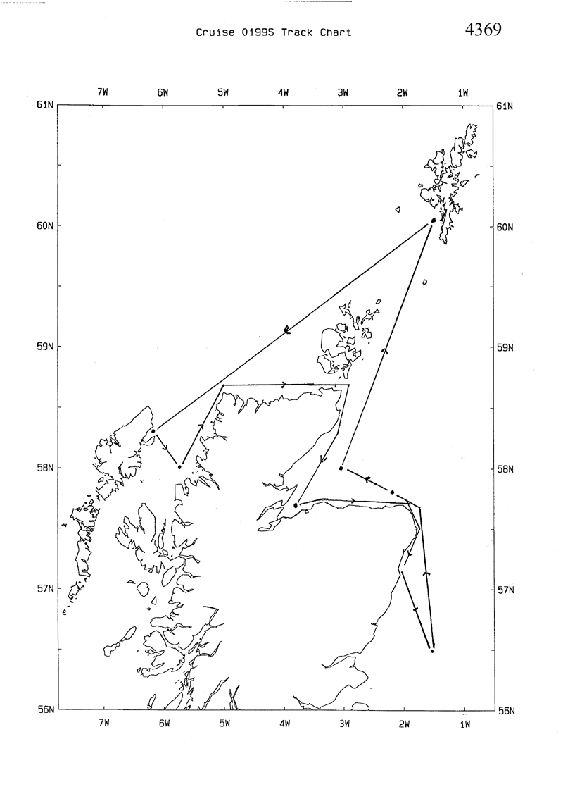
- References - including cruise tracks and cruise reports
Cruise Inventory Information
| Long name | FRV Scotia (748S) cruise 0199S |
|---|---|
| Short name | 0199S |
| Objectives and Narrative |
1. To undertake water, sediment and biological sampling for the National Marine Monitoring Plan (NMMP).
2. To undertake sampling of Nephrops at Halibut Bank and Burra Haaf. |
| Ship | FRV Scotia |
| Departure Port | Aberdeen, United Kingdom |
| Departure Date | 1999-01-16 |
| Arrival Port | Aberdeen, United Kingdom |
| Arrival Date | 1999-01-22 |
| Principal Scientist(s) | J M Pirie (Fisheries Research Services Aberdeen Marine Laboratory) |
| Responsible Organisation | Fisheries Research Services Aberdeen Marine Laboratory |
| Associated Project(s) | UK National Marine Monitoring Programme |
| IHB Sea Areas Visited | North Sea, Inner Seas off the West Coast of Scotland, North East Atlantic Ocean (limit 40W) |
| Marsden Squares Visited | 181;3/181;4/217;1 |
| Work Area Description | Shetland, North Minch, Moray Firth, North Sea |
| Unable to lookup cruise bounds at this time | |
| Work Area Bounding Polygon | |
| Southern Limit | unknown |
| Northern Limit | unknown |
| Western Limit | unknown |
| Eastern Limit | unknown |
Cruise Inventory Datasets
| Physical oceanography | |
|---|---|
| CTD stations |
Quantity:
number of stations =
4
Description: Stations |
| Water bottle stations |
Quantity:
number of stations =
4
Description: Stations - Determine Contaminant Levels in Water Column |
| Chemical oceanography | |
| Nitrate |
Quantity:
number of stations =
4
Description: Stations - Determine Contaminant Levels in Water Column |
| Contamination | |
| Chlorinated hydrocarbons |
Quantity:
number of stations =
4
Description: Stations - Determine Contaminant Levels in Sediment |
| Contaminants in organisms |
Quantity:
number of stations =
4
Description: Stations - Determine Contaminant Levels in Sediment |
| Trace metals |
Quantity:
number of stations =
4
Description: Stations - Determine Contaminant Levels in Sediment |
| Biology and fisheries | |
| Demersal fish |
Quantity:
number of hauls =
4
Description: Stations - Determine Contaminant Levels in Biota |
| Zoobenthos |
Quantity:
number of hauls =
4
Description: Stations - Determine Contaminant Levels in Biota |
Cruise Inventory Mooring/Buoy Operations
No information on datasets is currently available
Summary of BODC Data Holdings for the Cruise
National Oceanographic Database
Summary
| # Series | Instrument Description | Parameters |
|---|---|---|
| 4 | CTD/STD cast |
Electrical conductivity of the water column Reference numbers Salinity of the water column Temperature of the water column Vertical spatial coordinates |
Note: Parameter terms are taken from the BODC Parameter Discovery Vocabulary XML (SKOS)
Full List
| BODC Reference | Instrument Description | Date/Time | Location | |
|---|---|---|---|---|
| 532081 | CTD/STD cast | 1999-01-18 07:45Z | 56° 30' N, 1° 30' W | Click for more |
| 532093 | CTD/STD cast | 1999-01-18 21:48Z | 58° 0' N, 3° 0' W | Click for more |
| 532100 | CTD/STD cast | 1999-01-20 21:46Z | 58° 0' N, 5° 39' W | Click for more |
| 532112 | CTD/STD cast | 1999-01-21 15:10Z | 57° 40' N, 3° 48' W | Click for more |
Project Database
No data currently held for this cruise in the BODC Project Database
