BODC Cruise Metadata Report for Magnus Heinason cruise MH48/00
Introduction
This report collates information from the BODC cruise inventory and oceanographic databases. It presents
- Cruise Inventory Information
- A summary of BODC data holdings for the cruise from the
- References - including cruise tracks and cruise reports
Cruise Inventory Information
| Long name | Magnus Heinason cruise MH48/00 |
|---|---|
| Short name | MH48/00 |
| Objectives and Narrative | Hydrographic investigations, standard sections |
| Ship | Magnus Heinason |
| Departure Port | Tórshavn, Faroe Islands |
| Departure Date | 2000-07-06 |
| Arrival Port | Tórshavn, Faroe Islands |
| Arrival Date | 2000-07-12 |
| Principal Scientist(s) | Bogi Hansen (Faroese Fisheries Laboratory) |
| Responsible Organisation | Faroese Fisheries Laboratory |
| Associated Project(s) | |
| IHB Sea Areas Visited | North East Atlantic Ocean (limit 40W) |
| Marsden Squares Visited | 217;1/217;2/218;1 |
| Work Area Description | Faroese & UK waters |
| Unable to lookup cruise bounds at this time | |
| Work Area Bounding Polygon | |
| Southern Limit | unknown |
| Northern Limit | unknown |
| Western Limit | unknown |
| Eastern Limit | unknown |
Cruise Inventory Datasets
| Physical oceanography | |
|---|---|
| CTD stations |
Quantity:
number of stations =
14
Description: |
| Current meters |
Quantity:
number of deployments =
8
Description: |
| Current profiler (eg ADCP) |
Quantity:
number of deployments =
8
Description: 8 one-year moorings w. ADCP deployed |
| Sea level (inc. bot. press., inverted echosounder) |
Quantity:
number of deployments =
1
Description: |
| Water bottle stations |
Quantity:
number of stations =
14
Description: |
Cruise Inventory Mooring/Buoy Operations
No information on datasets is currently available
Summary of BODC Data Holdings for the Cruise
National Oceanographic Database
Summary
| # Series | Instrument Description | Parameters |
|---|---|---|
| 14 | CTD/STD cast |
Salinity of the water column Temperature of the water column Vertical spatial coordinates |
Note: Parameter terms are taken from the BODC Parameter Discovery Vocabulary XML (SKOS)
Full List
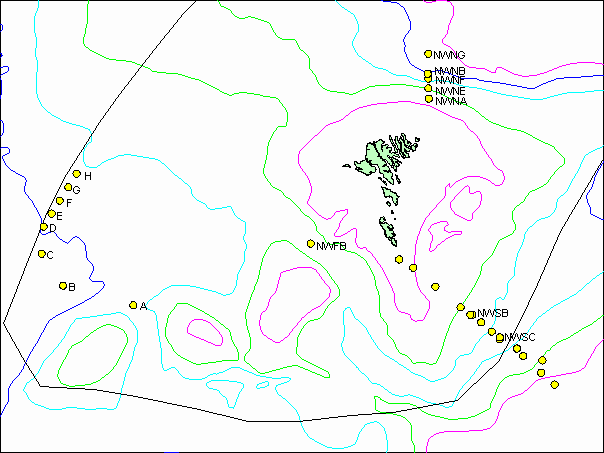
| BODC Reference | Instrument Description | Date/Time | Location | |
|---|---|---|---|---|
| 583216 | CTD/STD cast | 2000-07-08 10:30Z | 60° 10' N, 3° 43' W | Click for more |
| 583228 | CTD/STD cast | 2000-07-08 11:35Z | 60° 16' N, 3° 58' W | Click for more |
| 583241 | CTD/STD cast | 2000-07-08 12:23Z | 60° 22' N, 3° 57' W | Click for more |
| 583253 | CTD/STD cast | 2000-07-08 13:45Z | 60° 25' N, 4° 19' W | Click for more |
| 583265 | CTD/STD cast | 2000-07-08 14:40Z | 60° 28' N, 4° 25' W | Click for more |
| 583277 | CTD/STD cast | 2000-07-08 16:39Z | 60° 34' N, 4° 45' W | Click for more |
| 583289 | CTD/STD cast | 2000-07-08 17:35Z | 60° 37' N, 4° 54' W | Click for more |
| 583290 | CTD/STD cast | 2000-07-08 18:52Z | 60° 43' N, 5° 6' W | Click for more |
| 583308 | CTD/STD cast | 2000-07-08 19:58Z | 60° 46' N, 5° 16' W | Click for more |
| 583321 | CTD/STD cast | 2000-07-08 21:15Z | 60° 51' N, 5° 28' W | Click for more |
| 583333 | CTD/STD cast | 2000-07-08 23:10Z | 61° 1' N, 5° 57' W | Click for more |
| 583345 | CTD/STD cast | 2000-07-09 00:54Z | 61° 12' N, 6° 22' W | Click for more |
| 583357 | CTD/STD cast | 2000-07-09 01:57Z | 61° 16' N, 6° 37' W | Click for more |
| 583369 | CTD/STD cast | 2000-07-11 03:19Z | 62° 55' N, 6° 4' W | Click for more |
Project Database
No data currently held for this cruise in the BODC Project Database
