BODC Cruise Metadata Report for RRS Discovery (74E3) cruise D94_3
Introduction
This report collates information from the BODC cruise inventory and oceanographic databases. It presents
- Cruise Inventory Information
- A summary of BODC data holdings for the cruise from the
- References - including cruise tracks and cruise reports
Cruise Inventory Information
| Long name | RRS Discovery (74E3) cruise D94_3 |
|---|---|
| Short name | D94_3 |
| Objectives and Narrative |
1. To launch and track a drifing Spar carrying current meters from 14 to 50m depth.
2. To track near surface floats measuring Lagrangian shear, dispersion and vertical velocities. 3. To conduct batfish surveys in the depth range 0 to 80m. 4. To make directional wave measurements in conjunction with SEASAT passes and aircraft overflights. All these tasks were accomplished with a substantial degree of success. |
| Ship | RRS Discovery |
| Departure Port | Glasgow, United Kingdom |
| Departure Date | 1978-08-20 |
| Arrival Port | South Shields, United Kingdom |
| Arrival Date | 1978-09-17 |
| Principal Scientist(s) | Raymond T Pollard (Institute of Oceanographic Sciences Wormley Laboratory) |
| Responsible Organisation | Institute of Oceanographic Sciences Wormley Laboratory |
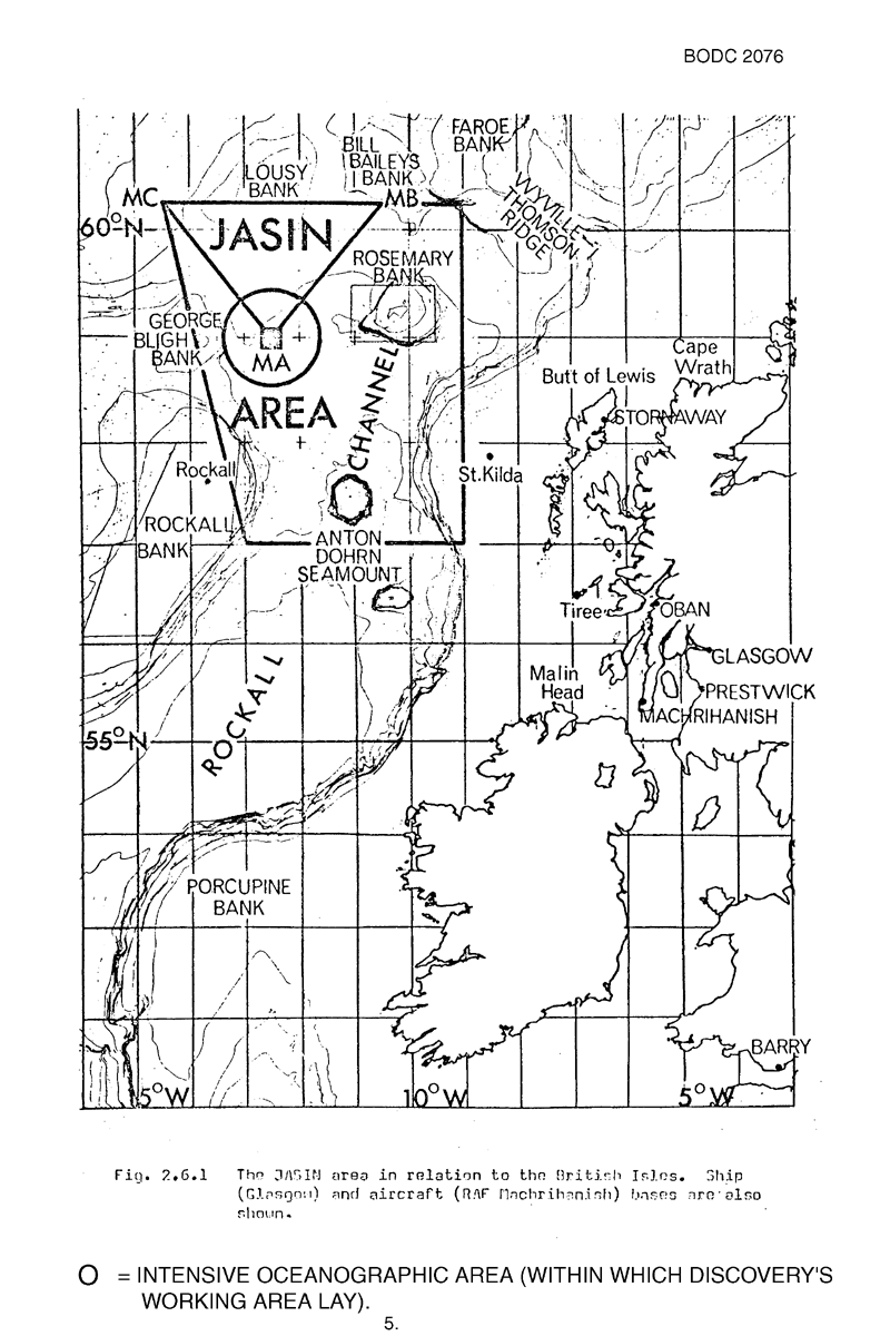
| Associated Project(s) | JASIN |
| IHB Sea Areas Visited | North East Atlantic Ocean (limit 40W) |
| Marsden Squares Visited | 182;392/182;393 |
| Work Area Description | |
| Unable to lookup cruise bounds at this time | |
| Work Area Bounding Polygon | |
| Southern Limit | unknown |
| Northern Limit | unknown |
| Western Limit | unknown |
| Eastern Limit | unknown |
Cruise Inventory Datasets
| Physical oceanography | |
|---|---|
| Bathythermograph |
Quantity:
number of profiles =
60
Description: |
| CTD stations |
Quantity:
number of stations =
16
Description: |
| Current meters |
Quantity:
8
Description: 5 days |
| Neutrally buoyant floats |
Quantity:
75
Description: |
| Subsurface temperature and salinity measurements |
Quantity:
activity duration in hours =
420
Description: |
| Surface measurements underway (T,S) |
Quantity:
activity duration in hours =
420
Description: T only |
| Water bottle stations | Description: 2 min. samples T surface only |
| Meteorology | |
| Incident radiation |
Quantity:
activity duration in days =
28
Description: 2 min. samples |
| Other meteorological measurements |
Quantity:
activity duration in days =
28
Description: Sea and swell; 6 hourly |
| Routine standard measurements |
Quantity:
activity duration in days =
28
Description: 2 min. samples |
| Geology and geophysics | |
| Single-beam echosounding |
Quantity:
track kilometres =
1482
Description: |
Cruise Inventory Mooring/Buoy Operations
No information on datasets is currently available
Summary of BODC Data Holdings for the Cruise
National Oceanographic Database
Summary
| # Series | Instrument Description | Parameters |
|---|---|---|
| 1 | Unspecified Instrumentation |
Air pressure Air temperature Atmospheric humidity Date and time Horizontal platform movement Horizontal spatial co-ordinates Temperature of the water column Wind strength and direction |
Note: Parameter terms are taken from the BODC Parameter Discovery Vocabulary XML (SKOS)
Full List
| BODC Reference | Instrument Description | Date/Time | Location | |
|---|---|---|---|---|
| 45682 | Unspecified Instrumentation | 1978-08-22 04:54Z to 1978-09-15 11:54Z | 58° 1' N to 59° 46' N; 13° 10' W to 7° 12' W | Click for more |
Project Database
No data currently held for this cruise in the BODC Project Database
