BODC Cruise Metadata Report for RRS Challenger (74CH) cruise CH117A0
Introduction
This report collates information from the BODC cruise inventory and oceanographic databases. It presents
- Cruise Inventory Information
- A summary of BODC data holdings for the cruise from the
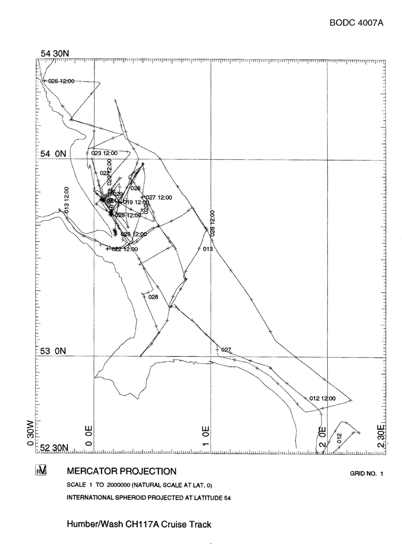
- References - including cruise tracks and cruise reports
Cruise Inventory Information
| Long name | RRS Challenger (74CH) cruise CH117A0 |
|---|---|
| Short name | CH117A0 |
| Objectives and Narrative | Studying fluxes of materials into and out of the coastal zone of the east coast of the UK. The cruise was severly affected by mechanical problems. The ship limped from Barry to Dover for temporary repairs, did a small amount of scientific work in the Humber-Wash area before entering dry dock in Hull. The continuation of this cruise leg is designated CH117A. |
| Ship | RRS Challenger |
| Departure Port | Barry, United Kingdom |
| Departure Date | 1995-01-07 |
| Arrival Port | Hull, United Kingdom |
| Arrival Date | 1995-01-13 |
| Principal Scientist(s) | Sarah Jones (University of Wales, Bangor School of Ocean Sciences) |
| Responsible Organisation | Plymouth Marine Laboratory |
| Associated Project(s) | LOIS - RACS |
| IHB Sea Areas Visited | English Channel, North Sea |
| Marsden Squares Visited | 145;3/181;1/216;1 |
| Work Area Description | English Channel transect. Coastal waters between the Humber and the Wash. |
| Unable to lookup cruise bounds at this time | |
| Work Area Bounding Polygon | |
| Southern Limit | unknown |
| Northern Limit | unknown |
| Western Limit | unknown |
| Eastern Limit | unknown |
Cruise Inventory Datasets
| Physical oceanography | |
|---|---|
| CTD stations |
Quantity:
number of profiles =
4
Description: Neil Brown Mk IIIB CTDO with 25cm SeaTech transmissometer, upwelling and downwelling 2-pi PAR and fluorometer |
| Current profiler (eg ADCP) |
Quantity:
track kilometres =
1325
Description: Underway surface incident PAR and solar radiation, thermosalinograph, transmissometer, fluorometer and ADCP. |
| Optics (eg underwater light levels) |
Quantity:
number of profiles =
4
Description: Neil Brown Mk IIIB CTDO with 25cm SeaTech transmissometer, upwelling and downwelling 2-pi PAR and fluorometer |
| Surface measurements underway (T,S) |
Quantity:
track kilometres =
1325
Description: Underway surface incident PAR and solar radiation, thermosalinograph, transmissometer, fluorometer and ADCP. |
| Transparency (eg transmissometer) |
Quantity:
number of profiles =
4
Description: Neil Brown Mk IIIB CTDO with 25cm SeaTech transmissometer, upwelling and downwelling 2-pi PAR and fluorometer |
| Transparency (eg transmissometer) |
Quantity:
track kilometres =
1325
Description: Underway surface incident PAR and solar radiation, thermosalinograph, transmissometer, fluorometer and ADCP. |
| Chemical oceanography | |
| Oxygen |
Quantity:
number of profiles =
4
Description: Neil Brown Mk IIIB CTDO with 25cm SeaTech transmissometer, upwelling and downwelling 2-pi PAR and fluorometer |
| Contamination | |
| Suspended matter |
Quantity:
number of samples =
4
Description: Chlorophyll and SPM determinations on CTD rosette samples |
| Suspended matter |
Quantity:
number of profiles =
4
Description: Lasentech in-situ particle sizer profiles |
| Suspended matter |
Quantity:
number of samples =
6
Description: Setting velocity tube samples |
| Biology and fisheries | |
| Phytoplankton pigs (eg chlorophyll, fluorescence) |
Quantity:
number of samples =
4
Description: Chlorophyll and SPM determinations on CTD rosette samples |
| Phytoplankton pigs (eg chlorophyll, fluorescence) |
Quantity:
track kilometres =
1325
Description: Underway surface incident PAR and solar radiation, thermosalinograph, transmissometer, fluorometer and ADCP. |
| Phytoplankton pigs (eg chlorophyll, fluorescence) |
Quantity:
number of profiles =
4
Description: Neil Brown Mk IIIB CTDO with 25cm SeaTech transmissometer, upwelling and downwelling 2-pi PAR and fluorometer |
| Meteorology | |
| Incident radiation |
Quantity:
track kilometres =
1325
Description: Underway surface incident PAR and solar radiation, thermosalinograph, transmissometer, fluorometer and ADCP. |
Cruise Inventory Mooring/Buoy Operations
| Latitude | Longitude | Data type | Description |
|---|---|---|---|
| 53° 34' N | 0° 3' E | Current meters | Station S4, recovered 13 Jan 95 |
| 53° 34' N | 0° 3' E | Current profiler (eg ADCP) | Station S4, recovered 13 Jan 95 |
| 53° 34' N | 0° 3' E | Sea level (inc. bot. press., inverted echosounder) | Station S4, recovered 13 Jan 95 |
| 53° 34' N | 0° 3' E | Transparency (eg transmissometer) | Station S4, recovered 13 Jan 95 |
Summary of BODC Data Holdings for the Cruise
National Oceanographic Database
Summary
| # Series | Instrument Description | Parameters |
|---|---|---|
| 4 | Bottle station |
Chlorophyll pigment concentrations in water bodies Phaeopigment concentrations in the water column Quality control flags Reference numbers Vertical spatial coordinates |
| 4 | Bottle station |
Chlorophyll pigment concentrations in water bodies Quality control flags Reference numbers Vertical spatial coordinates |
| 4 | Bottle station |
Quality control flags Reference numbers Salinity of the water column Temperature of the water column Vertical spatial coordinates |
| 4 | CTD/STD cast |
Chlorophyll pigment concentrations in water bodies Concentration of suspended particulate material in the water column Density of the water column Salinity of the water column Temperature of the water column Transmittance and attenuance of the water column Vertical spatial coordinates Visible waveband radiance and irradiance measurements in the water column |
| 1 | Meteorological data logger |
Date and time Horizontal spatial co-ordinates Solar Radiation Visible waveband radiance and irradiance measurements in the atmosphere |
| 1 | Ship's non-toxic supply |
Chlorophyll pigment concentrations in water bodies Concentration of suspended particulate material in the water column Date and time Horizontal spatial co-ordinates Nitrate concentration parameters in the water column Nitrite concentration parameters in the water column Phosphate concentration parameters in the water column Salinity of the water column Silicate concentration parameters in the water column Temperature of the water column Transmittance and attenuance of the water column |
| 1 | Single-beam echosounder |
Bathymetry and Elevation Date and time Horizontal spatial co-ordinates |
Note: Parameter terms are taken from the BODC Parameter Discovery Vocabulary XML (SKOS)
Full List
| BODC Reference | Instrument Description | Date/Time | Location | |
|---|---|---|---|---|
| 838043 | CTD/STD cast | 1995-01-12 19:45Z | 53° 15' N, 0° 39' E | Click for more |
| 838055 | CTD/STD cast | 1995-01-12 22:03Z | 53° 24' N, 0° 46' E | Click for more |
| 838067 | CTD/STD cast | 1995-01-13 01:05Z | 53° 39' N, 0° 58' E | Click for more |
| 838079 | CTD/STD cast | 1995-01-13 03:18Z | 53° 46' N, 0° 49' E | Click for more |
| 952258 | Single-beam echosounder | 1995-01-08 09:00Z to 1995-01-13 09:00Z | 49° 49' N to 53° 46' N; 3° 37' W to 2° 16' E | Click for more |
| 952271 | Meteorological data logger | 1995-01-08 09:00Z to 1995-01-13 09:00Z | 49° 49' N to 53° 46' N; 3° 37' W to 2° 16' E | Click for more |
| 952283 | Ship's non-toxic supply | 1995-01-08 09:00Z to 1995-01-13 09:00Z | 49° 49' N to 53° 46' N; 3° 37' W to 2° 16' E | Click for more |
| 1682826 | Bottle station | 1995-01-12 19:48Z | 53° 15' N, 0° 39' E | Click for more |
| 1682838 | Bottle station | 1995-01-12 22:05Z | 53° 24' N, 0° 46' E | Click for more |
| 1682851 | Bottle station | 1995-01-13 01:06Z | 53° 39' N, 0° 58' E | Click for more |
| 1682863 | Bottle station | 1995-01-13 03:19Z | 53° 46' N, 0° 49' E | Click for more |
| 2258611 | Bottle station | 1995-01-12 19:47Z | 53° 15' N, 0° 39' E | Click for more |
| 2258623 | Bottle station | 1995-01-12 22:05Z | 53° 24' N, 0° 46' E | Click for more |
| 2258635 | Bottle station | 1995-01-13 01:05Z | 53° 39' N, 0° 58' E | Click for more |
| 2258647 | Bottle station | 1995-01-13 03:19Z | 53° 46' N, 0° 49' E | Click for more |
| 2260639 | Bottle station | 1995-01-12 19:47Z | 53° 15' N, 0° 39' E | Click for more |
| 2260640 | Bottle station | 1995-01-12 22:05Z | 53° 24' N, 0° 46' E | Click for more |
| 2260652 | Bottle station | 1995-01-13 01:05Z | 53° 39' N, 0° 58' E | Click for more |
| 2260664 | Bottle station | 1995-01-13 03:19Z | 53° 46' N, 0° 49' E | Click for more |
Project Database
| # Events | Gear Type | Parameters Held |
|---|---|---|
| 4 | LASENTECH Particle Sizing Profiler |
Metadata parameters
Suspended particulate material grain size parameters Sediment grain size parameters |
| 4 | CTD frame plus rosette sampler |
Transmittance and attenuance of the water column
Salinity of the water column Temperature of the water column Carbon concentrations in suspended particulate material Concentration of suspended particulate material in the water column Nitrogen concentrations in suspended particulate material Visible waveband radiance and irradiance measurements in the water column Density of the water column Phaeopigment concentrations in the water column Chlorophyll pigment concentrations in water bodies |
| 5 | Sample taken from ship's non-toxic supply | Salinity of the water column |
| 6 | Settling velocity tube |
Note: Parameter terms are taken from the BODC Parameter Discovery Vocabulary XML (SKOS)
