Metadata Report for BODC Series Reference Number 1621672
Metadata Summary
Problem Reports
Data Access Policy
Narrative Documents
Project Information
Data Activity or Cruise Information
Fixed Station Information
BODC Quality Flags
SeaDataNet Quality Flags
Metadata Summary
Data Description |
|||||||||||||||||||||||||||||||||||||||||
|
|||||||||||||||||||||||||||||||||||||||||
Data Identifiers |
|||||||||||||||||||||||||||||||||||||||||
|
|||||||||||||||||||||||||||||||||||||||||
Time Co-ordinates(UT) |
|||||||||||||||||||||||||||||||||||||||||
|
|||||||||||||||||||||||||||||||||||||||||
Spatial Co-ordinates | |||||||||||||||||||||||||||||||||||||||||
|
|||||||||||||||||||||||||||||||||||||||||
Parameters |
|||||||||||||||||||||||||||||||||||||||||
|
|||||||||||||||||||||||||||||||||||||||||
Definition of BOTTFLAG | |||||||||||||||||||||||||||||||||||||||||
| BOTTFLAG | Definition |
|---|---|
| 0 | The sampling event occurred without any incident being reported to BODC. |
| 1 | The filter in an in-situ sampling pump physically ruptured during sample resulting in an unquantifiable loss of sampled material. |
| 2 | Analytical evidence (e.g. surface water salinity measured on a sample collected at depth) indicates that the water sample has been contaminated by water from depths other than the depths of sampling. |
| 3 | The feedback indicator on the deck unit reported that the bottle closure command had failed. General Oceanics deck units used on NERC vessels in the 80s and 90s were renowned for reporting misfires when the bottle had been closed. This flag is also suitable for when a trigger command is mistakenly sent to a bottle that has previously been fired. |
| 4 | During the sampling deployment the bottle was fired in an order other than incrementing rosette position. Indicative of the potential for errors in the assignment of bottle firing depth, especially with General Oceanics rosettes. |
| 5 | Water was reported to be escaping from the bottle as the rosette was being recovered. |
| 6 | The bottle seals were observed to be incorrectly seated and the bottle was only part full of water on recovery. |
| 7 | Either the bottle was found to contain no sample on recovery or there was no bottle fitted to the rosette position fired (but SBE35 record may exist). |
| 8 | There is reason to doubt the accuracy of the sampling depth associated with the sample. |
| 9 | The bottle air vent had not been closed prior to deployment giving rise to a risk of sample contamination through leakage. |
Definition of Rank |
|
|
Problem Reports
No Problem Report Found in the Database
Data Access Policy
Open Data
These data have no specific confidentiality restrictions for users. However, users must acknowledge data sources as it is not ethical to publish data without proper attribution. Any publication or other output resulting from usage of the data should include an acknowledgment.
If the Information Provider does not provide a specific attribution statement, or if you are using Information from several Information Providers and multiple attributions are not practical in your product or application, you may consider using the following:
"Contains public sector information licensed under the Open Government Licence v1.0."
Narrative Documents
RRS Discovery Cruise D357 (UK GEOTRACES) dissolved Nutrient CTD bottle data
Responsible investigator
Malcolm Woodward
email: EMSW@pml.ac.uk
Plymouth Marine Laboratory (PML)
Prospect Place
The Hoe
Plymouth
PL1 3DH
United Kingdom
Data contributor
-
Laboratory of analysis
Shipboard - Plymouth Marine Laboratory (PML)
Objectives
To investigate the spatial and temporal variations of the micromolar nutrient species; Nitrate, Nitrite, Silicate, Ammonium and Phosphate during the research cruise across the 40 degree south transect.
Sampling and analysis was carried out according to Go-Ship protocols wherever possible, a certified International Nutrient reference materials provided by KANSO, Japan was used during this cruise, as part of the global programme to improve nutrient analysis data quality world-wide.
Originator's Data Processing
Sampling Strategy
Water samples were taken from either a 24 x 20 litre stainless steel CTD/Rosette system (SeaBird), or an automatically fired (Sea-Ram system, (SeaBird)) CTD 24 bottle system on a trace metal free titanium rosette system. These samples were processed within the trace metal free sampling laboratory container .The CTD bottles were sub sampled into acid clean, 'aged', 60 mls HDPE (nalgene) sample bottles and analysis for the nutrient samples was in most cases complete within 2-3 hours of sampling.
Clean handling techniques were employed to avoid any contamination of the samples, particularly for the ammonium samples. Gloves used were Dura-Touch, and all people sampling prior to the nutrients from the CTD wore these gloves. Samples were not decanted and kept tightly closed until just before analysis for the ammonium, this to avoid any contamination from external sources.
Sample preparation
No filtering or any storage. In the rare cases where there was an instrument delays or problems samples were stored in the dark at 5 degrees. Samples were always run at lab temperature.
Sample Analysis
All samples were analysed on a 5 channel (nitrate, nitrite, phosphate, silicate and ammonium) Bran and Luebbe AAIII segmented flow, colorimetric, autoanalyser.
The ammonium channel was dropped once the ship left the waters of the continental shelf as the sensitivity of the colorimetric system was insufficient for the water column concentrations found.
The instrument was calibrated with home produced nutrient standards and then compared against Certified Nutrient Reference Materials, from KANSO Technos, Japan. A deep water reference sample was taken from about 1000m at the first station and was used to act as a daily tracking standard.
The analytical chemical methodologies used were according to Brewer and Riley (1965) for nitrate, Grasshoff (1976) for nitrite, Kirkwood (1989) for phosphate and silicate, and Mantoura and Woodward (1983) for ammonium.
References Cited
Jia-Zhong Zhang and Jie Chi, 2002.Automated Analysis of Nanomolar Concentrations of Phosphate in Natural Waters with Liquid Waveguide. Environ. Sci. Technol., 36 (5), pp 1048-1053
Brewer P.G. and Riley J.P., 1965. The automatic determination of nitrate in seawater. Deep Sea Research, 12, 765-72.
Grasshoff K., 1976. Methods of seawater analysis. Verlag Chemie, Weinheim and New York, 317pp.
Kirkwood D., 1989. Simultaneous determination of selected nutrients in seawater. ICES CM 1989/C:29.
Mantoura R.F.C. and Woodward, E.M.S., 1983. Optimisation of indophenol blue method for the automated determination of ammonia in estuarine waters. Estuarine Coastal and Shelf Science, 17, 219-24.
BODC data processing
The data were supplied to BODC as an Excel spreadsheet. The variables supplied by the Data Originator were mapped to BODC parameter vocabularies as follows:
| Originator's Parameter | Units | Description | BODC Parameter Code | Units | Comments |
|---|---|---|---|---|---|
| Nitrate+nitrite | µmol l-1 | Concentration of nitrate+nitrite {NO3+NO2} per unit volume of the water body [dissolved plus reactive particulate phase] by colorimetric autoanalysis | NTRZAATX | µmol l-1 | n/a |
| Nitrite | µmol l-1 | Concentration of nitrite {NO2} per unit volume of the water body [dissolved plus reactive particulate phase] by colorimetric autoanalysis | NTRIAATX | µmol l-1 | n/a |
| Phosphate | µmol l-1 | Concentration of phosphate {PO4} per unit volume of the water body [dissolved plus reactive particulate phase] by colorimetric autoanalysis | PHOSAATX | µmol l-1 | n/a |
| Silicate | µmol l-1 | Concentration of silicate {SiO4} per unit volume of the water body [dissolved plus reactive particulate phase] by colorimetric autoanalysis | SLCAAATX | µmol l-1 | n/a |
| Ammonium | µmol l-1 | Concentration of ammonium {NH4} per unit volume of the water body [dissolved plus reactive particulate phase] by colorimetric autoanalysis | AMONAATX | µmol l-1 | n/a |
Data Quality
Numerous data had been flagged at being below the limit of detection by the originator. These data have been assigned the BODC flag '<'.
CTD009_S bottle 13,14,15,16,17, CTD019_S bottle 6, CTD042_S bottle 14 and CTD046_S bottle 5 have been marked as suspect by the data originator. All data from these bottles have been assigned BODC flag 'L'.
Problem report
None
Project Information
GEOTRACES
Introduction
GEOTRACES is an international programme sponsored by SCOR which aims to improve our understanding of biogeochemical cycles and large-scale distribution of trace elements and their isotopes (TEIs) in the marine environment. The global field programme started in 2009 and will run for at least a decade. Before the official launch of GEOTRACES, fieldwork was carried out as part of the International Polar Year (IPY)(2007-2009) where 14 cruises were connected to GEOTRACES.
GEOTRACES is expected to become the largest programme to focus on the chemistry of the oceans and will improve our understanding of past, present and future distributions of TEIs and their relationships to important global processes.
This initiative was prompted by the increasing recognition that TEIs are playing a crucial role as regulators and recorders of important biogeochemical and physical processes that control the structure and productivity of marine ecosystems, the dispersion of contaminants in the marine environment, the level of greenhouse gases in the atmosphere, and global climate.
Scientific Objectives
GEOTRACES mission is: To identify processes and quantify fluxes that control the distribution of key trace elements and isotopes in the ocean, and to establish the sensitivity of these distributions to changing environmental conditions.
Three overriding goals support the GEOTRACES mission
- Determine ocean distributions of selected TEIs at all major ocean basins
- Evaluate the sources, sinks, and internal cycling of these TEIs and thereby characterize more completely their global biogeochemical cycles
- Provide a baseline distribution in the Polar Regions as reference for assessing past and future changes.
These goals will be pursued through complementary research strategies, including observations, experiments and modelling.
Fieldwork
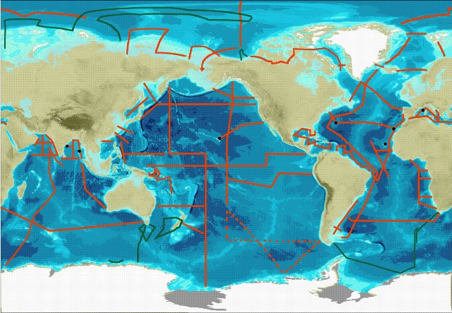
The central component of GEOTRACES fieldwork will be a series of cruises spanning all Ocean basins see map below.
Three types of cruise are required to meet the goals set out by GEOTRACES. These are
- Section cruises - These will measure all the key parameters (see below) over the full depth of the water column. The sections were discussed and approved by the International GEOTRACES Scientific Steering Committee at the basin workshops.
- Process Studies - These will investigate a particular process relevant to the cycling of trace metal and isotopes. They must follow the "Criteria for Establishing GEOTRACES Process Studies" and be approved by the International GEOTRACES Scientific Steering Committee.
- Cruises collecting GEOTRACES compliant data - These will collect some trace element or isotope data. They must follow the GEOTRACES Intercalibration and Data Management protocols
IPY-GEOTRACES
The IPY-GEOTRACES programme comprised of 14 research cruises on ships from 7 nations; Australia, Canada, France, Germany, New Zealand, Japan and Russia. The cruises will not be classified in the same way as the full GEOTRACES programme since the intercalibration protocols and data management protocols had not been established before the start of the IPY. But IPY-GEOTRACES data will still be quality controlled by GDAC and in the majority of cases verified versus Intercalibration standards or protocols.
Key parameters
The key parameters as set out by the GEOTRACES science plan are as follows: Fe, Al, Zn, Mn, Cd, Cu; 15N, 13C; 230Th, 231Pa; Pb isotopes, Nd isotopes; stored sample, particles, aerosols.
Weblink:
http://www.bodc.ac.uk/geotraces/
http://www.geotraces.org/
Data Activity or Cruise Information
Data Activity
| Start Date (yyyy-mm-dd) | 2010-10-26 |
| End Date (yyyy-mm-dd) | 2010-10-26 |
| Organization Undertaking Activity | University of Oxford Department of Earth Sciences |
| Country of Organization | United Kingdom |
| Originator's Data Activity Identifier | D357_UCCTD_CTD017_T |
| Platform Category | lowered unmanned submersible |
BODC Sample Metadata Report for D357_UCCTD_CTD017_T
| Sample reference number | Nominal collection volume(l) | Bottle rosette position | Bottle firing sequence number | Minimum pressure sampled (dbar) | Maximum pressure sampled (dbar) | Depth of sampling point (m) | Bottle type | Sample quality flag | Bottle reference | Comments |
|---|---|---|---|---|---|---|---|---|---|---|
| 238434 | 1 | 1 | 5135.40 | 5136.40 | 5036.40 | unknown | No problem reported | 235 | ||
| 238435 | 2 | 2 | 4579.20 | 4584.00 | 4498.30 | unknown | No problem reported | 236 | ||
| 238436 | 3 | 3 | 4065.30 | 4070.30 | 3998.20 | unknown | No problem reported | 237 | ||
| 238437 | 4 | 4 | 3552.80 | 3556.80 | 3498.20 | unknown | No problem reported | 238 | ||
| 238438 | 5 | 5 | 3040.40 | 3045.70 | 2998.20 | unknown | No problem reported | 239 | ||
| 238439 | 6 | 6 | 2530.20 | 2535.20 | 2498.60 | unknown | No problem reported | 240 | ||
| 238440 | 7 | 7 | 2021.60 | 2026.40 | 1998.80 | unknown | No problem reported | 241 | ||
| 238441 | 8 | 8 | 1512.90 | 1518.50 | 1498.50 | unknown | No problem reported | 242 | ||
| 238442 | 9 | 9 | 1260.50 | 1264.90 | 1249.00 | unknown | No problem reported | 243 | ||
| 238443 | 10 | 10 | 1006.50 | 1011.60 | 998.60 | unknown | No problem reported | 244 | ||
| 238444 | 11 | 11 | 755.60 | 757.20 | 749.40 | unknown | No problem reported | 245 | ||
| 238445 | 12 | 12 | 503.80 | 505.40 | 499.70 | unknown | No problem reported | 246 | ||
| 238446 | 13 | 13 | 403.50 | 405.30 | 400.60 | unknown | No problem reported | 247 | ||
| 238447 | 14 | 14 | 302.40 | 304.20 | 300.40 | unknown | No problem reported | 248 | ||
| 238448 | 15 | 15 | 252.30 | 253.80 | 250.70 | unknown | No problem reported | 249 | ||
| 238449 | 16 | 16 | 200.70 | 202.10 | 200.00 | unknown | No problem reported | 250 | ||
| 238450 | 17 | 17 | 150.30 | 151.10 | 149.50 | unknown | No problem reported | 251 | ||
| 238451 | 18 | 18 | 130.00 | 131.10 | 129.60 | unknown | No problem reported | 252 | ||
| 238452 | 19 | 19 | 99.30 | 101.30 | 99.60 | unknown | No problem reported | 253 | ||
| 238453 | 20 | 20 | 69.80 | 71.60 | 69.90 | unknown | No problem reported | 254 | ||
| 238454 | 21 | 21 | 49.30 | 50.00 | 49.40 | unknown | No problem reported | 255 | ||
| 238455 | 22 | 22 | 31.40 | 32.50 | 31.50 | unknown | No problem reported | 256 | ||
| 238456 | 23 | 23 | 28.70 | 29.30 | 28.70 | unknown | No problem reported | 257 | ||
| 238457 | 24 | 24 | 19.30 | 20.30 | 19.60 | unknown | No problem reported | 258 |
Please note:the supplied parameters may not have been sampled from all the bottle firings described in the table above. Cross-match the Sample Reference Number above against the SAMPRFNM value in the data file to identify the relevant metadata.
Cruise
| Cruise Name | D357 (GA10) |
| Departure Date | 2010-10-18 |
| Arrival Date | 2010-11-22 |
| Principal Scientist(s) | Gideon Henderson (University of Oxford Department of Earth Sciences) |
| Ship | RRS Discovery |
Complete Cruise Metadata Report is available here
Fixed Station Information
No Fixed Station Information held for the Series
BODC Quality Control Flags
The following single character qualifying flags may be associated with one or more individual parameters with a data cycle:
| Flag | Description |
|---|---|
| Blank | Unqualified |
| < | Below detection limit |
| > | In excess of quoted value |
| A | Taxonomic flag for affinis (aff.) |
| B | Beginning of CTD Down/Up Cast |
| C | Taxonomic flag for confer (cf.) |
| D | Thermometric depth |
| E | End of CTD Down/Up Cast |
| G | Non-taxonomic biological characteristic uncertainty |
| H | Extrapolated value |
| I | Taxonomic flag for single species (sp.) |
| K | Improbable value - unknown quality control source |
| L | Improbable value - originator's quality control |
| M | Improbable value - BODC quality control |
| N | Null value |
| O | Improbable value - user quality control |
| P | Trace/calm |
| Q | Indeterminate |
| R | Replacement value |
| S | Estimated value |
| T | Interpolated value |
| U | Uncalibrated |
| W | Control value |
| X | Excessive difference |
SeaDataNet Quality Control Flags
The following single character qualifying flags may be associated with one or more individual parameters with a data cycle:
| Flag | Description |
|---|---|
| 0 | no quality control |
| 1 | good value |
| 2 | probably good value |
| 3 | probably bad value |
| 4 | bad value |
| 5 | changed value |
| 6 | value below detection |
| 7 | value in excess |
| 8 | interpolated value |
| 9 | missing value |
| A | value phenomenon uncertain |
| B | nominal value |
| Q | value below limit of quantification |
