Metadata Report for BODC Series Reference Number 1929143
Metadata Summary
Problem Reports
Data Access Policy
Narrative Documents
Project Information
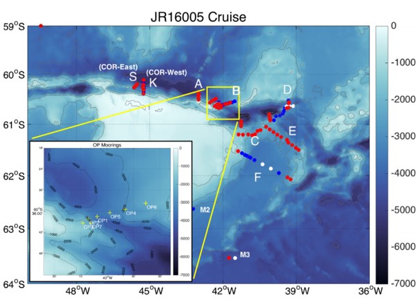
Data Activity or Cruise Information
Fixed Station Information
BODC Quality Flags
SeaDataNet Quality Flags
Metadata Summary
Data Description |
|||||||||||||||||||||||||
|
|||||||||||||||||||||||||
Data Identifiers |
|||||||||||||||||||||||||
|
|||||||||||||||||||||||||
Time Co-ordinates(UT) |
|||||||||||||||||||||||||
|
|||||||||||||||||||||||||
Spatial Co-ordinates | |||||||||||||||||||||||||
|
|||||||||||||||||||||||||
Parameters |
|||||||||||||||||||||||||
|
|||||||||||||||||||||||||
|
|||||||||||||||||||||||||
Problem Reports
No Problem Report Found in the Database
Data Access Policy
Open Data
These data have no specific confidentiality restrictions for users. However, users must acknowledge data sources as it is not ethical to publish data without proper attribution. Any publication or other output resulting from usage of the data should include an acknowledgment.
If the Information Provider does not provide a specific attribution statement, or if you are using Information from several Information Providers and multiple attributions are not practical in your product or application, you may consider using the following:
"Contains public sector information licensed under the Open Government Licence v1.0."
Narrative Documents
RBR Solo T - Temperature logger
Single channel compact temperature logger developed for application in moorings, bore holes, profiling or towed arrays. It has a depth rating down to 1700m and a clock accuracy of ± 60 seconds per year.
| Measurement range | -5°C to 35°C |
|---|---|
| Accuracy | ± 0.002°C |
| Resolution | < 0.00005°C |
| Time constant | ~1s (standard) ~0.15 (optional |
| Typical stability | 0.002°C per year |
| Sample capacity | ~ 25million readings |
| Sample capacity (4, 8 or 16 Hz) | ~ 66 million readings |
BODC Data Processing
Data Processing
The data arrived at BODC as individual .mat files containing data collected on moorings OP1, OP2, OP5 and OP7. They were submitted as part of an accession including several different instruments - ADCP, Aquadopp, RCM11, SBE37 and SBE39.
Reformatting
Due to the file size it was decided that the data would be sub-sampled to a one minute interval. The original files (with 10s sampling interval) are available upon request.
Parameters in the originator's files were reformatted into an internal file format using BODC standard procedures.
Some variables included in the RBR files have not been reformatted into the internal format files, as they will be stored as metadata. These include - botdepth (meters), date, lat (degrees north), lon (degrees east), mooringname, nomdepth (meters), serial_no and type.
The following table lists all the parameters included in the internal format files, showing how the originator's variables as named in the matlab files were mapped to appropriate BODC parameter codes.
| Originator's Variable | Originator's Units | BODC Parameter Code | BODC Units | Comments |
|---|---|---|---|---|
| temp | deg. C | TEMPPR01 | degrees C |
|
| press_inferred | dbar | PREXSINT | dbar | Pressure inferred from neighbouring instruments |
Screening
Quality control flags were automatically added to data outside the expected parameter specific range during the reformatting process. All parameters were then visualised and screened using in house software, and any improbable or missing data point was assigned a quality control flag.
DyNOPO RBR 2015-2017 Originator's Data Processing
Sampling Strategy
Sampling was carried out as a part of the 'Dynamics of the Orkney Passage Outflow (DynOPO)' project. The project involved the deployment of several instruments in the Orkney Passage in the Southern Ocean's Weddell Sea.
The instruments were deployed during cruise JR20150309 (JR272D, JR310) between 09 March 2015 — 14 April 2015. Moorings M2, M3a, OP1, OP2, OP3, OP4, OP5, OP6 and OP7 were recovered as part of cruise JR16005 between 17 March 2017 — 08 May 2017. In total, 45 RBR instruments were deployed on moorings OP1, OP2, OP5 and OP7.
The pressure data included in the originator's files was inferred from other nearby instruments with pressure sensors.
Project Information
Dynamics of Orkney Passage Outflow (DynOPO)
DynOPO is a five year research project that aims to understand how Antarctic Bottom Water is exported and modified through the Orkney Passage, the overflow's controlling dynamics, and its downstream impact on the Atlantic Ocean abyss.
Introduction
Mooring data collected for the DynOPO project are a component of a long term time series, in association with the Ocean Regulation of Climate by Heat and Carbon Sequestration and Transports (ORCHESTRA) project, led by Emily Shuckburgh (British Antarctic Survey) since 2016. The time series originally started out as part of the British Antarctic Survey's Long-Term Monitoring and Survey (LTMS) programme. Moorings were deployed on RRS James Clark Ross cruise JR20150309 (JR310 and JR272D) which ran from 09 March to 14 April 2015. RRS James Clark Ross cruise JR16005 ran from 17 March to 08 May 2017 and was the primary fieldwork element of the DynOPO project. The cruise had two main goals: (1) to conduct measurements of the hydrographic properties, velocity and turbulent processes of the Antarctic Bottom Water outflow along its pathway through the Orkney Passage region; and (2) to turn around a set of long-term moorings deployed in the area by British Antarctic Survey (BAS) and Lamont-Doherty Earth Observatory (LDEO) scientists, including recovery of additional instruments on some of the moorings deployed by JR20150309.
Project Collaborators
The project was led by the University of Southampton, and is an international collaboration with;
- UK: British Antarctic Survey (BAS), UK Meteorological Office, University of East Anglia and Newcastle University;
- Europe: University of Gothenburg (Sweden), University of Paris 6 (France);
- Australia: University of Tasmania;
- US: Lamont Doherty Earth Observatory, Woods Hole Oceanographic Institute, NOAA, University of California, Washington State University and Princeton University
Funding
The project was funded by the Natural Environment Research Council and ran from March 2015 to November 2018.
Data Activity or Cruise Information
Data Activity
| Start Date (yyyy-mm-dd) | 2015-04-05 |
| End Date (yyyy-mm-dd) | 2017-04-15 |
| Organization Undertaking Activity | British Antarctic Survey |
| Country of Organization | United Kingdom |
| Originator's Data Activity Identifier | OP1 |
| Platform Category | subsurface mooring |
Orkney Passage Mooring 1 (OP1)
The mooring was deployed at the following positions:
| Organisation Undertaking Activity | British Antarctic Survey, Cambridge |
|---|---|
| Country of Organisation | United Kingdom |
| Originator's Data Activity Identifier | OP1 |
| Platform Category | Subsurface mooring |
| Latitude (+ve N) | -60.62537 |
| Longitude (+ve E) | -42.09601 |
| Water Depth (m) | 3644 |
The mooring was deployed on the Orkney Passage on cruise JR20150309 (JR272D, JR310) on 05 April 2015 and recovery was done on cruise JR16005 on 15 April 2017.
The table below lists the instruments deployed on this mooring:
| Instrument type | Serial Number | Data start (UT) | Data end (UT) | Instrument depth (m) | Comments |
|---|---|---|---|---|---|
| RBRsoloT | 72248 | 05 April 2015 20:50 | 15 April 2017 10:01 | 3637 | Bent sensor and shield |
| SBE37 SMP | 7316 | 05 April 2015 21:00 | 15 April 2017 10:00 | 3625 | - |
| Aquadopp | 8111 | 05 April 2015 20:50 | 15 April 2017 10:00 | 3524 | - |
| SBE37 SMP | 7297 | 05 April 2015 21:00 | 15 April 2017 10:00 | 3545 | - |
| Aquadopp | 6260 | 05 April 2015 20:50 | 15 April 2017 10:00 | 3544 | - |
| RBRsoloT | 72273 | 05 April 2015 20:50 | 15 April 2017 10:01 | 3494 | - |
| SBE37 SMP | 7314 | 05 April 2015 21:00 | 15 April 2017 10:00 | 3445 | - |
| Aquadopp | 11979 | 05 April 2015 20:50 | 15 April 2017 10:00 | 3444 | - |
| RBRsoloT | 72234 | 05 April 2015 20:50 | 15 April 2017 10:01 | 3394 | - |
| SBE37 SMP | 7299 | 05 April 2015 21:00 | 15 April 2017 10:00 | 345 | - |
| Aquadopp | 6203 | 05 April 2015 20:50 | 15 April 2017 10:00 | 3344 | - |
| RBRsoloT | 72233 | 05 April 2015 20:50 | 15 April 2017 10:01 | 3294 | - |
| SBE37 SMP | 7294 | 05 April 2015 21:00 | 15 April 2017 10:00 | 3245 | - |
| Aquadopp | 6244 | 05 April 2015 20:50 | 15 April 2017 10:00 | 3244 | - |
| RBRsoloT | 72235 | 05 April 2015 20:50 | 15 April 2017 10:01 | 3194 | - |
| SBE37 SMP | 7311 | 05 April 2015 21:00 | 15 April 2017 10:00 | 3145 | - |
| Aquadopp | 11997 | 05 April 2015 20:50 | 15 April 2017 10:00 | 3144 | - |
| RBRsoloT | 72231 | 05 April 2015 20:50 | 15 April 2017 10:01 | 3094 | - |
| SBE37 SMP | 8076 | 05 April 2015 21:00 | 15 April 2017 10:00 | 3045 | - |
| Aquadopp | 6275 | 05 April 2015 20:50 | 15 April 2017 10:00 | 3044 | - |
| RBRsoloT | 72270 | 05 April 2015 20:50 | 15 April 2017 10:02 | 2994 | - |
| SBE37 SMP | 7310 | 05 April 2015 21:00 | 15 April 2017 10:00 | 2945 | - |
| Aquadopp | 8352 | 05 April 2015 20:50 | 15 April 2017 10:00 | 2944 | - |
| RBRsoloT | 72269 | 05 April 2015 20:50 | 15 April 2017 10:02 | 2894 | - |
| SBE37 SMP | 7302 | 05 April 2015 21:00 | 15 April 2017 10:00 | 2845 | - |
| Aquadopp | 8088 | 05 April 2015 20:50 | 15 April 2017 10:00 | 2844 | - |
| RBRsoloT | 72268 | 05 April 2015 20:50 | 15 April 2017 10:02 | 2794 | - |
| RBRsoloT | 72267 | 05 April 2015 20:50 | 15 April 2017 10:01 | 2745 | - |
| Aquadopp | 5883 | 05 April 2015 20:50 | 15 April 2017 10:00 | 2744 | Large compass offset |
| RBRsoloT | 72266 | 05 April 2015 20:50 | 15 April 2017 10:02 | 2694 | - |
| SBE37 SMP | 9379 | 05 April 2015 20:50 | 15 April 2017 10:00 | 2645 | - |
| Aquadopp | 6178 | 05 April 2015 20:50 | 15 April 2017 10:00 | 2644 | - |
| RBRsoloT | 72265 | 05 April 2015 20:50 | 15 April 2017 10:01 | 2594 | - |
| SBE37 SMP | 7307 | 05 April 2015 21:00 | 15 April 2017 10:00 | 2544 | - |
| RDI Longranger ADCP | 22182 | 05 April 2015 21:00 | 15 April 2017 09:00 | 2528 | - |
| RBRsoloT | 72274 | 05 April 2015 20:50 | 15 April 2017 10:01 | 2494 | - |
| RBRsoloT | 72252 | 05 April 2015 20:50 | 15 April 2017 10:02 | 2445 | - |
| Aquadopp | 8355 | 05 April 2015 20:50 | 15 April 2017 10:00 | 2444 | - |
| RBRsoloT | 72253 | 05 April 2015 20:50 | 15 April 2017 10:02 | 2369 | - |
| SBE37 SMP | 7313 | 05 April 2015 20:50 | 15 April 2017 10:00 | 2295 | - |
| Aquadopp | 6182 | 05 April 2015 20:50 | 15 April 2017 10:00 | 2294 | - |
| RBRsoloT | 72251 | 05 April 2015 20:50 | 15 April 2017 10:02 | 2219 | - |
| SBE37 SMP | 9394 | 05 April 2015 20:50 | 15 April 2017 10:00 | 2145 | - |
| Aquadopp | 12020 | 05 April 2015 20:50 | 15 April 2017 10:00 | 2144 | - |
| SBE39 | 4413 | 05 April 2015 20:50 | 15 April 2017 10:00 | 2069 | - |
| SBE37 SMP | 7309 | 05 April 2015 21:00 | 15 April 2017 10:00 | 1995 | - |
| Aquadopp | 8351 | 05 April 2015 20:50 | 15 April 2017 10:00 | 1994 | - |
| SBE39 | 4716 | 05 April 2015 20:50 | 15 April 2017 10:00 | 1919 | - |
| SBE37 SMP | 7308 | 05 April 2015 21:00 | 15 April 2017 10:00 | 1845 | - |
| Aquadopp | 6273 | 05 April 2015 20:50 | 15 April 2017 10:00 | 1844 | - |
Related Data Activity activities are detailed in Appendix 1
Cruise
| Cruise Name | JR20150309 (JR272D, JR310) |
| Departure Date | 2015-03-09 |
| Arrival Date | 2015-04-14 |
| Principal Scientist(s) | Povl Abrahamsen (British Antarctic Survey) |
| Ship | RRS James Clark Ross |
Complete Cruise Metadata Report is available here
Fixed Station Information
Fixed Station Information
| Station Name | Orkney Passage OP1 |
| Category | Offshore location |
| Latitude | 60° 39.16' S |
| Longitude | 42° 4.78' W |
| Water depth below MSL | 3700.0 m |
Orkney Passage OP1 site
Site OP1 is part of the Orkney Passage mooring array which is an activity covered by the Long Term Monitoring and Survey British Antarctic Survey's (BAS) programme.The data collection is the result of an ongoing collaboration between BAS and the Lamont-Doherty Earth Observatory (LDEO).
This site was previously occupied in 2007 by an LDEO mooring (M4) and from 2011 onwards it became BAS's responsibility and was assigned its current name. The recovery/deployment history, including position details is presented below:
| Deployed | Recovered | |||||
|---|---|---|---|---|---|---|
| Year | Cruise | Year | Cruise | Latitude (+ve N) | Longitude (+ve E) | Water Depth (m) |
| 2007 | ES20070116 (ES031, ES038, ES048) | 2009 | -60.6526 | -42.0796 | 3700 | |
| 2011 | JR20110319 (JR252, JR254C) | 2013 | JR20130317 (JR272B, JR273A, JR281, UKD-4) | -60.6526 | -42.0796 | 3700 |
| 2013 | JR20130317 (JR272B, JR273A, JR281, UKD-4) | 2015 | JR20150309 (JR272D, JR310) | -60.6285 | -42.0876 | 3664 |
| 2015 | JR20150309 (JR272D, JR310) | 2017 | JR16005 | -60.625 | -42.096 | 3644 |
Recovery of this mooring was not possible in 2009, during ES033a, cruise due to an unresponsive release. It was re-deployed again in 2011.
Related Fixed Station activities are detailed in Appendix 2
BODC Quality Control Flags
The following single character qualifying flags may be associated with one or more individual parameters with a data cycle:
| Flag | Description |
|---|---|
| Blank | Unqualified |
| < | Below detection limit |
| > | In excess of quoted value |
| A | Taxonomic flag for affinis (aff.) |
| B | Beginning of CTD Down/Up Cast |
| C | Taxonomic flag for confer (cf.) |
| D | Thermometric depth |
| E | End of CTD Down/Up Cast |
| G | Non-taxonomic biological characteristic uncertainty |
| H | Extrapolated value |
| I | Taxonomic flag for single species (sp.) |
| K | Improbable value - unknown quality control source |
| L | Improbable value - originator's quality control |
| M | Improbable value - BODC quality control |
| N | Null value |
| O | Improbable value - user quality control |
| P | Trace/calm |
| Q | Indeterminate |
| R | Replacement value |
| S | Estimated value |
| T | Interpolated value |
| U | Uncalibrated |
| W | Control value |
| X | Excessive difference |
SeaDataNet Quality Control Flags
The following single character qualifying flags may be associated with one or more individual parameters with a data cycle:
| Flag | Description |
|---|---|
| 0 | no quality control |
| 1 | good value |
| 2 | probably good value |
| 3 | probably bad value |
| 4 | bad value |
| 5 | changed value |
| 6 | value below detection |
| 7 | value in excess |
| 8 | interpolated value |
| 9 | missing value |
| A | value phenomenon uncertain |
| B | nominal value |
| Q | value below limit of quantification |
Appendix 1: OP1
Related series for this Data Activity are presented in the table below. Further information can be found by following the appropriate links.
If you are interested in these series, please be aware we offer a multiple file download service. Should your credentials be insufficient for automatic download, the service also offers a referral to our Enquiries Officer who may be able to negotiate access.
| Series Identifier | Data Category | Start date/time | Start position | Cruise |
|---|---|---|---|---|
| 1894344 | Currents -subsurface Eulerian | 2015-04-05 20:50:00 | 60.62537 S, 42.09602 W | RRS James Clark Ross JR20150309 (JR272D, JR310) |
| 1894356 | Currents -subsurface Eulerian | 2015-04-05 20:50:00 | 60.62537 S, 42.09602 W | RRS James Clark Ross JR20150309 (JR272D, JR310) |
| 1894368 | Currents -subsurface Eulerian | 2015-04-05 20:50:00 | 60.62537 S, 42.09602 W | RRS James Clark Ross JR20150309 (JR272D, JR310) |
| 1894381 | Currents -subsurface Eulerian | 2015-04-05 20:50:00 | 60.62537 S, 42.09602 W | RRS James Clark Ross JR20150309 (JR272D, JR310) |
| 1894393 | Currents -subsurface Eulerian | 2015-04-05 20:50:00 | 60.62537 S, 42.09602 W | RRS James Clark Ross JR20150309 (JR272D, JR310) |
| 1894400 | Currents -subsurface Eulerian | 2015-04-05 20:50:00 | 60.62537 S, 42.09602 W | RRS James Clark Ross JR20150309 (JR272D, JR310) |
| 1894412 | Currents -subsurface Eulerian | 2015-04-05 20:50:00 | 60.62537 S, 42.09602 W | RRS James Clark Ross JR20150309 (JR272D, JR310) |
| 1894424 | Currents -subsurface Eulerian | 2015-04-05 20:50:00 | 60.62537 S, 42.09602 W | RRS James Clark Ross JR20150309 (JR272D, JR310) |
| 1894436 | Currents -subsurface Eulerian | 2015-04-05 20:50:00 | 60.62537 S, 42.09602 W | RRS James Clark Ross JR20150309 (JR272D, JR310) |
| 1894448 | Currents -subsurface Eulerian | 2015-04-05 20:50:00 | 60.62537 S, 42.09602 W | RRS James Clark Ross JR20150309 (JR272D, JR310) |
| 1894461 | Currents -subsurface Eulerian | 2015-04-05 20:50:00 | 60.62537 S, 42.09602 W | RRS James Clark Ross JR20150309 (JR272D, JR310) |
| 1894473 | Currents -subsurface Eulerian | 2015-04-05 20:50:00 | 60.62537 S, 42.09602 W | RRS James Clark Ross JR20150309 (JR272D, JR310) |
| 1894485 | Currents -subsurface Eulerian | 2015-04-05 20:50:00 | 60.62537 S, 42.09602 W | RRS James Clark Ross JR20150309 (JR272D, JR310) |
| 1894497 | Currents -subsurface Eulerian | 2015-04-05 20:50:00 | 60.62537 S, 42.09602 W | RRS James Clark Ross JR20150309 (JR272D, JR310) |
| 1894504 | Currents -subsurface Eulerian | 2015-04-05 20:50:00 | 60.62537 S, 42.09602 W | RRS James Clark Ross JR20150309 (JR272D, JR310) |
| 1894516 | Currents -subsurface Eulerian | 2015-04-05 20:50:00 | 60.62537 S, 42.09602 W | RRS James Clark Ross JR20150309 (JR272D, JR310) |
| 1891555 | Hydrography time series at depth | 2015-04-05 20:50:00 | 60.62537 S, 42.09602 W | RRS James Clark Ross JR20150309 (JR272D, JR310) |
| 1891567 | Hydrography time series at depth | 2015-04-05 20:50:00 | 60.62537 S, 42.09602 W | RRS James Clark Ross JR20150309 (JR272D, JR310) |
| 1929106 | Hydrography time series at depth | 2015-04-05 20:50:00 | 60.62537 S, 42.09602 W | RRS James Clark Ross JR20150309 (JR272D, JR310) |
| 1929118 | Hydrography time series at depth | 2015-04-05 20:50:00 | 60.62537 S, 42.09602 W | RRS James Clark Ross JR20150309 (JR272D, JR310) |
| 1929131 | Hydrography time series at depth | 2015-04-05 20:50:00 | 60.62537 S, 42.09602 W | RRS James Clark Ross JR20150309 (JR272D, JR310) |
| 1929155 | Hydrography time series at depth | 2015-04-05 20:50:00 | 60.62537 S, 42.09602 W | RRS James Clark Ross JR20150309 (JR272D, JR310) |
| 1929167 | Hydrography time series at depth | 2015-04-05 20:50:00 | 60.62537 S, 42.09602 W | RRS James Clark Ross JR20150309 (JR272D, JR310) |
| 1929179 | Hydrography time series at depth | 2015-04-05 20:50:00 | 60.62537 S, 42.09602 W | RRS James Clark Ross JR20150309 (JR272D, JR310) |
| 1929180 | Hydrography time series at depth | 2015-04-05 20:50:00 | 60.62537 S, 42.09602 W | RRS James Clark Ross JR20150309 (JR272D, JR310) |
| 1929192 | Hydrography time series at depth | 2015-04-05 20:50:00 | 60.62537 S, 42.09602 W | RRS James Clark Ross JR20150309 (JR272D, JR310) |
| 1929211 | Hydrography time series at depth | 2015-04-05 20:50:00 | 60.62537 S, 42.09602 W | RRS James Clark Ross JR20150309 (JR272D, JR310) |
| 1929223 | Hydrography time series at depth | 2015-04-05 20:50:00 | 60.62537 S, 42.09602 W | RRS James Clark Ross JR20150309 (JR272D, JR310) |
| 1929235 | Hydrography time series at depth | 2015-04-05 20:50:00 | 60.62537 S, 42.09602 W | RRS James Clark Ross JR20150309 (JR272D, JR310) |
| 1929247 | Hydrography time series at depth | 2015-04-05 20:50:00 | 60.62537 S, 42.09602 W | RRS James Clark Ross JR20150309 (JR272D, JR310) |
| 1929259 | Hydrography time series at depth | 2015-04-05 20:50:00 | 60.62537 S, 42.09602 W | RRS James Clark Ross JR20150309 (JR272D, JR310) |
| 1929260 | Hydrography time series at depth | 2015-04-05 20:50:00 | 60.62537 S, 42.09602 W | RRS James Clark Ross JR20150309 (JR272D, JR310) |
| 1929272 | Hydrography time series at depth | 2015-04-05 20:50:00 | 60.62537 S, 42.09602 W | RRS James Clark Ross JR20150309 (JR272D, JR310) |
| 1880951 | Hydrography time series at depth | 2015-04-05 20:50:01 | 60.62537 S, 42.09602 W | RRS James Clark Ross JR20150309 (JR272D, JR310) |
| 1880987 | Hydrography time series at depth | 2015-04-05 20:50:01 | 60.62537 S, 42.09602 W | RRS James Clark Ross JR20150309 (JR272D, JR310) |
| 1880846 | Hydrography time series at depth | 2015-04-05 21:00:01 | 60.62537 S, 42.09602 W | RRS James Clark Ross JR20150309 (JR272D, JR310) |
| 1880858 | Hydrography time series at depth | 2015-04-05 21:00:01 | 60.62537 S, 42.09602 W | RRS James Clark Ross JR20150309 (JR272D, JR310) |
| 1880871 | Hydrography time series at depth | 2015-04-05 21:00:01 | 60.62537 S, 42.09602 W | RRS James Clark Ross JR20150309 (JR272D, JR310) |
| 1880883 | Hydrography time series at depth | 2015-04-05 21:00:01 | 60.62537 S, 42.09602 W | RRS James Clark Ross JR20150309 (JR272D, JR310) |
| 1880895 | Hydrography time series at depth | 2015-04-05 21:00:01 | 60.62537 S, 42.09602 W | RRS James Clark Ross JR20150309 (JR272D, JR310) |
| 1880902 | Hydrography time series at depth | 2015-04-05 21:00:01 | 60.62537 S, 42.09602 W | RRS James Clark Ross JR20150309 (JR272D, JR310) |
| 1880914 | Hydrography time series at depth | 2015-04-05 21:00:01 | 60.62537 S, 42.09602 W | RRS James Clark Ross JR20150309 (JR272D, JR310) |
| 1880926 | Hydrography time series at depth | 2015-04-05 21:00:01 | 60.62537 S, 42.09602 W | RRS James Clark Ross JR20150309 (JR272D, JR310) |
| 1880938 | Hydrography time series at depth | 2015-04-05 21:00:01 | 60.62537 S, 42.09602 W | RRS James Clark Ross JR20150309 (JR272D, JR310) |
| 1880963 | Hydrography time series at depth | 2015-04-05 21:00:01 | 60.62537 S, 42.09602 W | RRS James Clark Ross JR20150309 (JR272D, JR310) |
| 1880975 | Hydrography time series at depth | 2015-04-05 21:00:01 | 60.62537 S, 42.09602 W | RRS James Clark Ross JR20150309 (JR272D, JR310) |
| 1880999 | Hydrography time series at depth | 2015-04-05 21:00:01 | 60.62537 S, 42.09602 W | RRS James Clark Ross JR20150309 (JR272D, JR310) |
| 1881002 | Hydrography time series at depth | 2015-04-05 21:00:01 | 60.62537 S, 42.09602 W | RRS James Clark Ross JR20150309 (JR272D, JR310) |
Appendix 2: Orkney Passage OP1
Related series for this Fixed Station are presented in the table below. Further information can be found by following the appropriate links.
If you are interested in these series, please be aware we offer a multiple file download service. Should your credentials be insufficient for automatic download, the service also offers a referral to our Enquiries Officer who may be able to negotiate access.
| Series Identifier | Data Category | Start date/time | Start position | Cruise |
|---|---|---|---|---|
| 1362730 | Currents -subsurface Eulerian | 2011-03-26 14:45:00 | 60.62847 S, 42.08758 W | RRS James Clark Ross JR20110319 (JR252, JR254C) |
| 1362742 | Currents -subsurface Eulerian | 2011-03-26 14:45:00 | 60.62847 S, 42.08758 W | RRS James Clark Ross JR20110319 (JR252, JR254C) |
| 1362754 | Currents -subsurface Eulerian | 2011-03-26 14:45:00 | 60.62847 S, 42.08758 W | RRS James Clark Ross JR20110319 (JR252, JR254C) |
| 1362766 | Currents -subsurface Eulerian | 2011-03-26 14:45:00 | 60.62847 S, 42.08758 W | RRS James Clark Ross JR20110319 (JR252, JR254C) |
| 1223385 | Hydrography time series at depth | 2011-03-26 14:45:00 | 60.62847 S, 42.08758 W | RRS James Clark Ross JR20110319 (JR252, JR254C) |
| 1223404 | Hydrography time series at depth | 2011-03-26 14:45:00 | 60.62847 S, 42.08758 W | RRS James Clark Ross JR20110319 (JR252, JR254C) |
| 1223361 | Hydrography time series at depth | 2011-03-26 14:45:01 | 60.62847 S, 42.08758 W | RRS James Clark Ross JR20110319 (JR252, JR254C) |
| 1223373 | Hydrography time series at depth | 2011-03-26 14:45:01 | 60.62847 S, 42.08758 W | RRS James Clark Ross JR20110319 (JR252, JR254C) |
| 1223397 | Hydrography time series at depth | 2011-03-26 14:45:01 | 60.62847 S, 42.08758 W | RRS James Clark Ross JR20110319 (JR252, JR254C) |
| 1840832 | Currents -subsurface Eulerian | 2013-04-02 17:45:00 | 60.62387 S, 42.09798 W | RRS James Clark Ross JR20130317 (JR252B, JR272B, JR273A, JR281, UKD-4) |
| 1840844 | Currents -subsurface Eulerian | 2013-04-02 17:45:00 | 60.62387 S, 42.09798 W | RRS James Clark Ross JR20130317 (JR252B, JR272B, JR273A, JR281, UKD-4) |
| 1840856 | Currents -subsurface Eulerian | 2013-04-02 17:45:00 | 60.62387 S, 42.09798 W | RRS James Clark Ross JR20130317 (JR252B, JR272B, JR273A, JR281, UKD-4) |
| 1840868 | Currents -subsurface Eulerian | 2013-04-02 17:45:00 | 60.62387 S, 42.09798 W | RRS James Clark Ross JR20130317 (JR252B, JR272B, JR273A, JR281, UKD-4) |
| 1840217 | Hydrography time series at depth | 2013-04-02 17:45:00 | 60.62387 S, 42.09798 W | RRS James Clark Ross JR20130317 (JR252B, JR272B, JR273A, JR281, UKD-4) |
| 1840230 | Hydrography time series at depth | 2013-04-02 17:45:00 | 60.62387 S, 42.09798 W | RRS James Clark Ross JR20130317 (JR252B, JR272B, JR273A, JR281, UKD-4) |
| 1840198 | Hydrography time series at depth | 2013-04-02 17:45:01 | 60.62387 S, 42.09798 W | RRS James Clark Ross JR20130317 (JR252B, JR272B, JR273A, JR281, UKD-4) |
| 1840205 | Hydrography time series at depth | 2013-04-02 17:45:01 | 60.62387 S, 42.09798 W | RRS James Clark Ross JR20130317 (JR252B, JR272B, JR273A, JR281, UKD-4) |
| 1840229 | Hydrography time series at depth | 2013-04-02 17:45:01 | 60.62387 S, 42.09798 W | RRS James Clark Ross JR20130317 (JR252B, JR272B, JR273A, JR281, UKD-4) |
| 1814051 | CTD or STD cast | 2015-03-20 05:01:20 | 60.6348 S, 42.0846 W | RRS James Clark Ross JR20150309 (JR272D, JR310) |
| 1805717 | Currents -subsurface Eulerian | 2015-03-20 05:01:33 | 60.63475 S, 42.08455 W | RRS James Clark Ross JR20150309 (JR272D, JR310) |
| 1894344 | Currents -subsurface Eulerian | 2015-04-05 20:50:00 | 60.62537 S, 42.09602 W | RRS James Clark Ross JR20150309 (JR272D, JR310) |
| 1894356 | Currents -subsurface Eulerian | 2015-04-05 20:50:00 | 60.62537 S, 42.09602 W | RRS James Clark Ross JR20150309 (JR272D, JR310) |
| 1894368 | Currents -subsurface Eulerian | 2015-04-05 20:50:00 | 60.62537 S, 42.09602 W | RRS James Clark Ross JR20150309 (JR272D, JR310) |
| 1894381 | Currents -subsurface Eulerian | 2015-04-05 20:50:00 | 60.62537 S, 42.09602 W | RRS James Clark Ross JR20150309 (JR272D, JR310) |
| 1894393 | Currents -subsurface Eulerian | 2015-04-05 20:50:00 | 60.62537 S, 42.09602 W | RRS James Clark Ross JR20150309 (JR272D, JR310) |
| 1894400 | Currents -subsurface Eulerian | 2015-04-05 20:50:00 | 60.62537 S, 42.09602 W | RRS James Clark Ross JR20150309 (JR272D, JR310) |
| 1894412 | Currents -subsurface Eulerian | 2015-04-05 20:50:00 | 60.62537 S, 42.09602 W | RRS James Clark Ross JR20150309 (JR272D, JR310) |
| 1894424 | Currents -subsurface Eulerian | 2015-04-05 20:50:00 | 60.62537 S, 42.09602 W | RRS James Clark Ross JR20150309 (JR272D, JR310) |
| 1894436 | Currents -subsurface Eulerian | 2015-04-05 20:50:00 | 60.62537 S, 42.09602 W | RRS James Clark Ross JR20150309 (JR272D, JR310) |
| 1894448 | Currents -subsurface Eulerian | 2015-04-05 20:50:00 | 60.62537 S, 42.09602 W | RRS James Clark Ross JR20150309 (JR272D, JR310) |
| 1894461 | Currents -subsurface Eulerian | 2015-04-05 20:50:00 | 60.62537 S, 42.09602 W | RRS James Clark Ross JR20150309 (JR272D, JR310) |
| 1894473 | Currents -subsurface Eulerian | 2015-04-05 20:50:00 | 60.62537 S, 42.09602 W | RRS James Clark Ross JR20150309 (JR272D, JR310) |
| 1894485 | Currents -subsurface Eulerian | 2015-04-05 20:50:00 | 60.62537 S, 42.09602 W | RRS James Clark Ross JR20150309 (JR272D, JR310) |
| 1894497 | Currents -subsurface Eulerian | 2015-04-05 20:50:00 | 60.62537 S, 42.09602 W | RRS James Clark Ross JR20150309 (JR272D, JR310) |
| 1894504 | Currents -subsurface Eulerian | 2015-04-05 20:50:00 | 60.62537 S, 42.09602 W | RRS James Clark Ross JR20150309 (JR272D, JR310) |
| 1894516 | Currents -subsurface Eulerian | 2015-04-05 20:50:00 | 60.62537 S, 42.09602 W | RRS James Clark Ross JR20150309 (JR272D, JR310) |
| 1891555 | Hydrography time series at depth | 2015-04-05 20:50:00 | 60.62537 S, 42.09602 W | RRS James Clark Ross JR20150309 (JR272D, JR310) |
| 1891567 | Hydrography time series at depth | 2015-04-05 20:50:00 | 60.62537 S, 42.09602 W | RRS James Clark Ross JR20150309 (JR272D, JR310) |
| 1929106 | Hydrography time series at depth | 2015-04-05 20:50:00 | 60.62537 S, 42.09602 W | RRS James Clark Ross JR20150309 (JR272D, JR310) |
| 1929118 | Hydrography time series at depth | 2015-04-05 20:50:00 | 60.62537 S, 42.09602 W | RRS James Clark Ross JR20150309 (JR272D, JR310) |
| 1929131 | Hydrography time series at depth | 2015-04-05 20:50:00 | 60.62537 S, 42.09602 W | RRS James Clark Ross JR20150309 (JR272D, JR310) |
| 1929155 | Hydrography time series at depth | 2015-04-05 20:50:00 | 60.62537 S, 42.09602 W | RRS James Clark Ross JR20150309 (JR272D, JR310) |
| 1929167 | Hydrography time series at depth | 2015-04-05 20:50:00 | 60.62537 S, 42.09602 W | RRS James Clark Ross JR20150309 (JR272D, JR310) |
| 1929179 | Hydrography time series at depth | 2015-04-05 20:50:00 | 60.62537 S, 42.09602 W | RRS James Clark Ross JR20150309 (JR272D, JR310) |
| 1929180 | Hydrography time series at depth | 2015-04-05 20:50:00 | 60.62537 S, 42.09602 W | RRS James Clark Ross JR20150309 (JR272D, JR310) |
| 1929192 | Hydrography time series at depth | 2015-04-05 20:50:00 | 60.62537 S, 42.09602 W | RRS James Clark Ross JR20150309 (JR272D, JR310) |
| 1929211 | Hydrography time series at depth | 2015-04-05 20:50:00 | 60.62537 S, 42.09602 W | RRS James Clark Ross JR20150309 (JR272D, JR310) |
| 1929223 | Hydrography time series at depth | 2015-04-05 20:50:00 | 60.62537 S, 42.09602 W | RRS James Clark Ross JR20150309 (JR272D, JR310) |
| 1929235 | Hydrography time series at depth | 2015-04-05 20:50:00 | 60.62537 S, 42.09602 W | RRS James Clark Ross JR20150309 (JR272D, JR310) |
| 1929247 | Hydrography time series at depth | 2015-04-05 20:50:00 | 60.62537 S, 42.09602 W | RRS James Clark Ross JR20150309 (JR272D, JR310) |
| 1929259 | Hydrography time series at depth | 2015-04-05 20:50:00 | 60.62537 S, 42.09602 W | RRS James Clark Ross JR20150309 (JR272D, JR310) |
| 1929260 | Hydrography time series at depth | 2015-04-05 20:50:00 | 60.62537 S, 42.09602 W | RRS James Clark Ross JR20150309 (JR272D, JR310) |
| 1929272 | Hydrography time series at depth | 2015-04-05 20:50:00 | 60.62537 S, 42.09602 W | RRS James Clark Ross JR20150309 (JR272D, JR310) |
| 1880951 | Hydrography time series at depth | 2015-04-05 20:50:01 | 60.62537 S, 42.09602 W | RRS James Clark Ross JR20150309 (JR272D, JR310) |
| 1880987 | Hydrography time series at depth | 2015-04-05 20:50:01 | 60.62537 S, 42.09602 W | RRS James Clark Ross JR20150309 (JR272D, JR310) |
| 1880846 | Hydrography time series at depth | 2015-04-05 21:00:01 | 60.62537 S, 42.09602 W | RRS James Clark Ross JR20150309 (JR272D, JR310) |
| 1880858 | Hydrography time series at depth | 2015-04-05 21:00:01 | 60.62537 S, 42.09602 W | RRS James Clark Ross JR20150309 (JR272D, JR310) |
| 1880871 | Hydrography time series at depth | 2015-04-05 21:00:01 | 60.62537 S, 42.09602 W | RRS James Clark Ross JR20150309 (JR272D, JR310) |
| 1880883 | Hydrography time series at depth | 2015-04-05 21:00:01 | 60.62537 S, 42.09602 W | RRS James Clark Ross JR20150309 (JR272D, JR310) |
| 1880895 | Hydrography time series at depth | 2015-04-05 21:00:01 | 60.62537 S, 42.09602 W | RRS James Clark Ross JR20150309 (JR272D, JR310) |
| 1880902 | Hydrography time series at depth | 2015-04-05 21:00:01 | 60.62537 S, 42.09602 W | RRS James Clark Ross JR20150309 (JR272D, JR310) |
| 1880914 | Hydrography time series at depth | 2015-04-05 21:00:01 | 60.62537 S, 42.09602 W | RRS James Clark Ross JR20150309 (JR272D, JR310) |
| 1880926 | Hydrography time series at depth | 2015-04-05 21:00:01 | 60.62537 S, 42.09602 W | RRS James Clark Ross JR20150309 (JR272D, JR310) |
| 1880938 | Hydrography time series at depth | 2015-04-05 21:00:01 | 60.62537 S, 42.09602 W | RRS James Clark Ross JR20150309 (JR272D, JR310) |
| 1880963 | Hydrography time series at depth | 2015-04-05 21:00:01 | 60.62537 S, 42.09602 W | RRS James Clark Ross JR20150309 (JR272D, JR310) |
| 1880975 | Hydrography time series at depth | 2015-04-05 21:00:01 | 60.62537 S, 42.09602 W | RRS James Clark Ross JR20150309 (JR272D, JR310) |
| 1880999 | Hydrography time series at depth | 2015-04-05 21:00:01 | 60.62537 S, 42.09602 W | RRS James Clark Ross JR20150309 (JR272D, JR310) |
| 1881002 | Hydrography time series at depth | 2015-04-05 21:00:01 | 60.62537 S, 42.09602 W | RRS James Clark Ross JR20150309 (JR272D, JR310) |
| 1814604 | CTD or STD cast | 2015-04-06 05:23:27 | 60.6324 S, 42.0845 W | RRS James Clark Ross JR20150309 (JR272D, JR310) |
| 1806260 | Currents -subsurface Eulerian | 2015-04-06 05:23:39 | 60.63236 S, 42.08447 W | RRS James Clark Ross JR20150309 (JR272D, JR310) |
| 2022248 | Currents -subsurface Eulerian | 2017-04-18 16:00:00 | 60.63513 S, 42.08583 W | RRS James Clark Ross JR16005 |
| 2022261 | Currents -subsurface Eulerian | 2017-04-18 16:00:00 | 60.63513 S, 42.08583 W | RRS James Clark Ross JR16005 |
| 2022273 | Currents -subsurface Eulerian | 2017-04-18 16:00:00 | 60.63513 S, 42.08583 W | RRS James Clark Ross JR16005 |
| 2022285 | Currents -subsurface Eulerian | 2017-04-18 16:00:00 | 60.63513 S, 42.08583 W | RRS James Clark Ross JR16005 |
| 2022550 | Hydrography time series at depth | 2017-04-18 16:00:00 | 60.63513 S, 42.08583 W | RRS James Clark Ross JR16005 |
| 2022562 | Hydrography time series at depth | 2017-04-18 16:00:00 | 60.63513 S, 42.08583 W | RRS James Clark Ross JR16005 |
| 2022445 | Hydrography time series at depth | 2017-04-18 16:00:01 | 60.63513 S, 42.08583 W | RRS James Clark Ross JR16005 |
| 2022457 | Hydrography time series at depth | 2017-04-18 16:00:01 | 60.63513 S, 42.08583 W | RRS James Clark Ross JR16005 |
| 2022469 | Hydrography time series at depth | 2017-04-18 16:00:01 | 60.63513 S, 42.08583 W | RRS James Clark Ross JR16005 |
