BODC Cruise Metadata Report for RRS Discovery (74E3) cruise D64
Introduction
This report collates information from the BODC cruise inventory and oceanographic databases. It presents
- Cruise Inventory Information
- A summary of BODC data holdings for the cruise from the
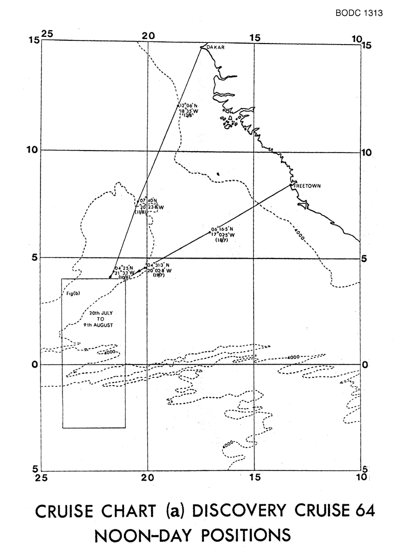
- References - including cruise tracks and cruise reports
Cruise Inventory Information
| Long name | RRS Discovery (74E3) cruise D64 |
|---|---|
| Short name | D64 |
| Objectives and Narrative | To extend our observations on the structure of the vertical ecosystem into equatorial regions and secondly to examine the influence of the equatorial undercurrent on the depth distribution of the migrant fauna, using mainly Rectangular Midwater Trawling nets of one and eight square meters carrying a current meter to determine the speed and distance through the water and a depth sensor to help control them. The neuston net was used to sample surface species. The majority of trawls were planned to be made by day, but it was hoped to make some near-surface night-time trawls to study the diurnal vertical migration, and STD profiles to 2000m depth to deterime the physical properties. |
| Ship | RRS Discovery |
| Departure Port | Freetown, Sierra Leone |
| Departure Date | 1974-07-17 |
| Arrival Port | Dakar, Senegal |
| Arrival Date | 1974-08-13 |
| Principal Scientist(s) | Stephen A Thorpe (Institute of Oceanographic Sciences Wormley Laboratory) |
| Responsible Organisation | Institute of Oceanographic Sciences Wormley Laboratory |
| Associated Project(s) | GATE |
| IHB Sea Areas Visited | South Atlantic Ocean |
| Marsden Squares Visited | 3/302 |
| Work Area Description | |
| Unable to lookup cruise bounds at this time | |
| Work Area Bounding Polygon | |
| Southern Limit | unknown |
| Northern Limit | unknown |
| Western Limit | unknown |
| Eastern Limit | unknown |
Cruise Inventory Datasets
| Physical oceanography | |
|---|---|
| CTD stations |
Quantity:
number of stations =
100
Description: |
| Current meters |
Quantity:
2
Description: no.of sts.;2 per station;2 positions:02-58.20N;22-34.48W(20days) & 00-21.18S;22-39.29W(16days) |
| Subsurface temperature and salinity measurements |
Quantity:
track kilometres =
926
Description: batfish(towed CTD) |
| Surface measurements underway (T,S) | Description: |
| Water bottle stations | Description: surface only |
| Biology and fisheries | |
| Nekton |
Quantity:
106
Description: |
| Neuston |
Quantity:
16
Description: |
| Other biological/fisheries measurement | Description: deep scattering layers |
| Other biological/fisheries measurement | Description: bioluminescence expts.on individual organisms |
| Phytoplankton pigs (eg chlorophyll, fluorescence) |
Quantity:
2
Description: also underway fluorescence msmnts.(milles) |
| Zooplankton |
Quantity:
53
Description: survey, taxonomy |
| Meteorology | |
| Incident radiation | Description: cont.logging solarimeter |
| Other meteorological measurements | Description: 2 min.values of dry and wet bulb temp.,hull temp.,wind and atm.pressure |
| Routine standard measurements | Description: 6 hrly. |
| Geology and geophysics | |
| Multi-beam echosounding |
Quantity:
track kilometres =
4630
Description: |
Cruise Inventory Mooring/Buoy Operations
No information on datasets is currently available
Summary of BODC Data Holdings for the Cruise
National Oceanographic Database
Summary
| # Series | Instrument Description | Parameters |
|---|---|---|
| 5 | CTD/STD cast |
Salinity of the water column Temperature of the water column Vertical spatial coordinates |
| 5 | CTD/STD cast |
Chlorophyll pigment concentrations in water bodies Salinity of the water column Temperature of the water column Vertical spatial coordinates |
| 2 | CTD/STD cast |
Chlorophyll pigment concentrations in water bodies Temperature of the water column Vertical spatial coordinates |
Note: Parameter terms are taken from the BODC Parameter Discovery Vocabulary XML (SKOS)
Full List
| BODC Reference | Instrument Description | Date/Time | Location | |
|---|---|---|---|---|
| 298015 | CTD/STD cast | 1974-07-23 21:44Z to 1974-07-23 23:26Z | 0° 18' N, 22° 25' W | Click for more |
| 298027 | CTD/STD cast | 1974-07-25 19:09Z to 1974-07-25 20:30Z | 0° 18' N, 22° 25' W | Click for more |
| 298039 | CTD/STD cast | 1974-07-28 05:59Z to 1974-07-28 07:28Z | 0° 13' N, 22° 27' W | Click for more |
| 298040 | CTD/STD cast | 1974-08-02 00:42Z to 1974-08-02 02:05Z | 2° 33' N, 23° 29' W | Click for more |
| 298052 | CTD/STD cast | 1974-08-07 18:18Z to 1974-08-07 18:43Z | 0° 26' N, 22° 22' W | Click for more |
| 298064 | CTD/STD cast | 1974-08-07 19:03Z to 1974-08-07 19:43Z | 0° 27' N, 22° 23' W | Click for more |
| 298076 | CTD/STD cast | 1974-08-07 20:17Z to 1974-08-07 21:00Z | 0° 27' N, 22° 24' W | Click for more |
| 298088 | CTD/STD cast | 1974-08-07 20:52Z to 1974-08-07 21:14Z | 0° 28' N, 22° 24' W | Click for more |
| 298107 | CTD/STD cast | 1974-08-09 19:08Z to 1974-08-09 19:53Z | 2° 58' N, 22° 36' W | Click for more |
| 298119 | CTD/STD cast | 1974-08-09 19:50Z to 1974-08-09 20:39Z | 2° 58' N, 22° 37' W | Click for more |
| 298120 | CTD/STD cast | 1974-08-09 20:35Z to 1974-08-09 21:22Z | 2° 58' N, 22° 38' W | Click for more |
| 298132 | CTD/STD cast | 1974-08-09 21:37Z to 1974-08-09 22:59Z | 2° 58' N, 22° 39' W | Click for more |
Project Database
No data currently held for this cruise in the BODC Project Database
