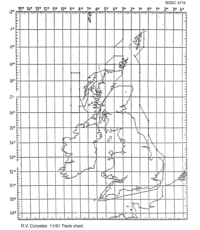
BODC Cruise Metadata Report for RV Corystes (74RY) cruise COR11/91
Introduction
This report collates information from the BODC cruise inventory and oceanographic databases. It presents
- Cruise Inventory Information
- A summary of BODC data holdings for the cruise from the
- References - including cruise tracks and cruise reports
Cruise Inventory Information
| Long name | RV Corystes (74RY) cruise COR11/91 |
|---|---|
| Short name | COR11/91 |
| Objectives and Narrative |
1. To continue examination of the distribution of caesium-134 and caesium-137 in coastal waters of the British Isles.
2. To determine concentrations of tritium in the Bristol Channel and other selected areas. 3. To lay the near bed velocity recorder and associated guard buoys near St Bees Head. |
| Ship | RV Corystes |
| Departure Port | Lowestoft, United Kingdom |
| Departure Date | 1991-11-07 |
| Arrival Port | Lowestoft, United Kingdom |
| Arrival Date | 1991-11-27 |
| Principal Scientist(s) | T C Doddington (Ministry of Agriculture, Fisheries and Food Lowestoft Fisheries Laboratory) |
| Responsible Organisation | Ministry of Agriculture, Fisheries and Food Lowestoft Fisheries Laboratory |
| Associated Project(s) | |
| IHB Sea Areas Visited | English Channel, North Sea, Irish Sea and St. George's Channel, North East Atlantic Ocean (limit 40W) |
| Marsden Squares Visited | 145;3/180;3/181;1/181;2/181;3/181;4/216;1/217;1 |
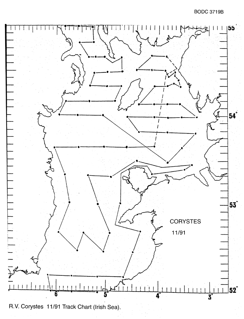
| Work Area Description | North Sea and Irish Seas |
| Unable to lookup cruise bounds at this time | |
| Work Area Bounding Polygon | |
| Southern Limit | unknown |
| Northern Limit | unknown |
| Western Limit | unknown |
| Eastern Limit | unknown |
Cruise Inventory Datasets
| Physical oceanography | |
|---|---|
| CTD stations |
Quantity:
number of stations =
5
Description: |
| Chemical oceanography | |
| Radioactivity |
Quantity:
number of samples =
47
Description: surface tritium |
| Radioactivity |
Quantity:
number of samples =
166
Description: surface & subsurface caesium |
Cruise Inventory Mooring/Buoy Operations
No information on datasets is currently available
Summary of BODC Data Holdings for the Cruise
National Oceanographic Database
Summary
| # Series | Instrument Description | Parameters |
|---|---|---|
| 5 | CTD/STD cast |
Salinity of the water column Temperature of the water column Vertical spatial coordinates |
Note: Parameter terms are taken from the BODC Parameter Discovery Vocabulary XML (SKOS)
Full List
| BODC Reference | Instrument Description | Date/Time | Location | |
|---|---|---|---|---|
| 334915 | CTD/STD cast | 1991-11-19 11:02Z | 58° 0' N, 8° 0' W | Click for more |
| 334927 | CTD/STD cast | 1991-11-19 23:55Z | 57° 30' N, 9° 0' W | Click for more |
| 334939 | CTD/STD cast | 1991-11-20 05:49Z | 56° 30' N, 9° 0' W | Click for more |
| 334940 | CTD/STD cast | 1991-11-20 11:48Z | 56° 0' N, 8° 0' W | Click for more |
| 334952 | CTD/STD cast | 1991-11-20 19:30Z | 57° 0' N, 7° 0' W | Click for more |
Project Database
No data currently held for this cruise in the BODC Project Database
