BODC Cruise Metadata Report for RV Corystes (74RY) cruise COR1B/94
Introduction
This report collates information from the BODC cruise inventory and oceanographic databases. It presents
- Cruise Inventory Information
- A summary of BODC data holdings for the cruise from the
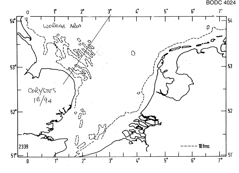
- References - including cruise tracks and cruise reports
Cruise Inventory Information
| Long name | RV Corystes (74RY) cruise COR1B/94 |
|---|---|
| Short name | COR1B/94 |
| Objectives and Narrative |
1. To test the new Minipod frame and logger system over 2 tides and to evaluate the results.
2. To compare the bed shear stresses, both tidally and wave generated on two sites (Race Bank typically 10-12 water depth) and another site to the East with water depth of 20 m). The ADCP (Acoustic Doppler current Profiler) and CTD will be used to supplement measurements from a Minipod. 3. To undertake a sediment survey around the proposed site of the long term deployment of a Minipod on Race Bank. 4. To conduct a sidescan survey around the proposed long term deployment site. 5. To deploy a Minipod and Guard Buoys on the long term site for recovery on CIRO 4/94. |
| Ship | RV Corystes |
| Departure Port | Lowestoft, United Kingdom |
| Departure Date | 1994-01-19 |
| Arrival Port | Lowestoft, United Kingdom |
| Arrival Date | 1994-01-26 |
| Principal Scientist(s) | Jonathon Mark Rees (Ministry of Agriculture, Fisheries and Food Lowestoft Fisheries Laboratory) |
| Responsible Organisation | Ministry of Agriculture, Fisheries and Food Lowestoft Fisheries Laboratory |
| Associated Project(s) | |
| IHB Sea Areas Visited | North Sea |
| Marsden Squares Visited | 216;1 |
| Work Area Description | Race Bank, Outer Wash |
| Unable to lookup cruise bounds at this time | |
| Work Area Bounding Polygon | |
| Southern Limit | unknown |
| Northern Limit | unknown |
| Western Limit | unknown |
| Eastern Limit | unknown |
Cruise Inventory Datasets
| Physical oceanography | |
|---|---|
| CTD stations |
Quantity:
number of stations =
6
Description: |
| Current meters |
Quantity:
number of deployments =
2
Description: 2 near bed cms |
| Current profiler (eg ADCP) | Description: ADCP |
| Geology and geophysics | |
| Grab |
Quantity:
number of samples =
2
Description: |
| Long/short range side scan sonar |
Quantity:
number of deployments =
6
Description: around proposed long term deployment site of minipod |
| Other geological/geophysical measurements |
Quantity:
number of deployments =
3
Description: underwater TV |
Cruise Inventory Mooring/Buoy Operations
| Latitude | Longitude | Data type | Description |
|---|---|---|---|
| 53° 1' N | 1° 36' E | Current meters | near bed current meter |
| 53° 15' N | 0° 46' E | Current meters | near bed current meter |
Summary of BODC Data Holdings for the Cruise
National Oceanographic Database
Summary
| # Series | Instrument Description | Parameters |
|---|---|---|
| 6 | CTD/STD cast |
Concentration of suspended particulate material in the water column Salinity of the water column Temperature of the water column Transmittance and attenuance of the water column Vertical spatial coordinates |
Note: Parameter terms are taken from the BODC Parameter Discovery Vocabulary XML (SKOS)
Full List
| BODC Reference | Instrument Description | Date/Time | Location | |
|---|---|---|---|---|
| 545927 | CTD/STD cast | 1994-01-21 18:05Z | 53° 15' N, 0° 46' E | Click for more |
| 545939 | CTD/STD cast | 1994-01-21 18:48Z | 53° 15' N, 0° 46' E | Click for more |
| 545940 | CTD/STD cast | 1994-01-22 09:24Z | 53° 15' N, 0° 46' E | Click for more |
| 545952 | CTD/STD cast | 1994-01-22 13:31Z | 53° 12' N, 0° 44' E | Click for more |
| 545964 | CTD/STD cast | 1994-01-23 11:06Z | 53° 12' N, 0° 45' E | Click for more |
| 545976 | CTD/STD cast | 1994-01-23 14:02Z | 53° 12' N, 0° 45' E | Click for more |
Project Database
No data currently held for this cruise in the BODC Project Database
