BODC Cruise Metadata Report for RV Corystes (74RY) cruise COR11B/95
Introduction
This report collates information from the BODC cruise inventory and oceanographic databases. It presents
- Cruise Inventory Information
- A summary of BODC data holdings for the cruise from the
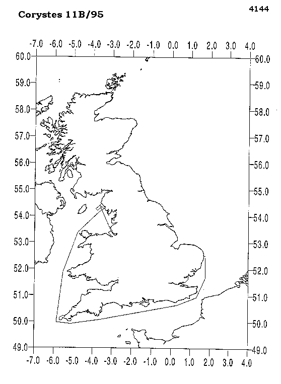
- References - including cruise tracks and cruise reports
Cruise Inventory Information
| Long name | RV Corystes (74RY) cruise COR11B/95 |
|---|---|
| Short name | COR11B/95 |
| Objectives and Narrative |
1. To deploy an array of six current meter moorings off the Cumbrian Coast for a four week deployment. The current meters will be serviced on CIROLANA 10/95 and recovered on CIROLANA 1/96. This works aims to help validate the Eastern Irish Sea Model (AE128D0).
2. To conduct short trial deployments of the Tetrapod and Quadrapod to test new sensors and new configurations of sensors (AE0135A0). 3. To deploy the Tetrapod, Quadrapod and four Minipods for a two month deployment being recovered on CIROLANA 1/96. One Minipod will be recovered in December on CIROLANA 10/95 so that water sampling syringes can be serviced (AE0135A0). 4. To conduct Sidescan and CTD surveys of the proposed trawling site (AE0135A0). Additional Aim: 5. To deploy on a Minipod the prototype light sensor for the Micro Tag (MF0129E0). |
| Ship | RV Corystes |
| Departure Port | Birkenhead, United Kingdom |
| Departure Date | 1995-11-08 |
| Arrival Port | Lowestoft, United Kingdom |
| Arrival Date | 1995-11-20 |
| Principal Scientist(s) | Jonathon Mark Rees (Ministry of Agriculture, Fisheries and Food Lowestoft Fisheries Laboratory) |
| Responsible Organisation | Ministry of Agriculture, Fisheries and Food Lowestoft Fisheries Laboratory |
| Associated Project(s) | |
| IHB Sea Areas Visited | Irish Sea and St. George's Channel |
| Marsden Squares Visited | 181;1 |
| Work Area Description | Eastern Irish Sea |
| Unable to lookup cruise bounds at this time | |
| Work Area Bounding Polygon | |
| Southern Limit | unknown |
| Northern Limit | unknown |
| Western Limit | unknown |
| Eastern Limit | unknown |
Cruise Inventory Datasets
| Physical oceanography | |
|---|---|
| CTD stations |
Quantity:
number of stations =
14
Description: |
| Current meters |
Quantity:
number of deployments =
9
Description: 6 moored current meters & 3 near bed velocity meters deployed |
| Geology and geophysics | |
| Long/short range side scan sonar |
Quantity:
number of stations =
2
Description: |
Cruise Inventory Mooring/Buoy Operations
| Latitude | Longitude | Data type | Description |
|---|---|---|---|
| 54° 18' N | 3° 40' W | Current meters | moored c/m deploy |
| 54° 21' N | 3° 52' W | Current meters | moored c/m deploy |
| 54° 16' N | 3° 46' W | Current meters | moored c/m deploy |
| 54° 24' N | 3° 45' W | Current meters | moored c/m deploy |
| 54° 19' N | 3° 33' W | Current meters | moored c/m deploy |
| 54° 25' N | 3° 39' W | Current meters | moored c/m deploy |
| 54° 19' N | 3° 49' W | Current meters | near bed velocity meter deploy |
| 54° 22' N | 3° 37' W | Current meters | near bed velocity meter deploy |
| 54° 21' N | 3° 42' W | Current meters | near bed velocity meter deploy |
Summary of BODC Data Holdings for the Cruise
National Oceanographic Database
Summary
| # Series | Instrument Description | Parameters |
|---|---|---|
| 14 | CTD/STD cast |
Reference numbers Salinity of the water column Temperature of the water column Transmittance and attenuance of the water column Vertical spatial coordinates |
Note: Parameter terms are taken from the BODC Parameter Discovery Vocabulary XML (SKOS)
Full List
| BODC Reference | Instrument Description | Date/Time | Location | |
|---|---|---|---|---|
| 489604 | CTD/STD cast | 1995-11-17 09:55Z | 54° 25' N, 3° 39' W | Click for more |
| 489616 | CTD/STD cast | 1995-11-17 10:41Z | 54° 24' N, 3° 45' W | Click for more |
| 489628 | CTD/STD cast | 1995-11-17 11:21Z | 54° 21' N, 3° 52' W | Click for more |
| 489641 | CTD/STD cast | 1995-11-17 11:50Z | 54° 19' N, 3° 49' W | Click for more |
| 489653 | CTD/STD cast | 1995-11-17 12:36Z | 54° 21' N, 3° 42' W | Click for more |
| 489665 | CTD/STD cast | 1995-11-17 13:16Z | 54° 23' N, 3° 36' W | Click for more |
| 489677 | CTD/STD cast | 1995-11-17 13:47Z | 54° 20' N, 3° 33' W | Click for more |
| 489689 | CTD/STD cast | 1995-11-17 14:07Z | 54° 19' N, 3° 36' W | Click for more |
| 489690 | CTD/STD cast | 1995-11-17 14:33Z | 54° 18' N, 3° 40' W | Click for more |
| 489708 | CTD/STD cast | 1995-11-17 14:57Z | 54° 16' N, 3° 43' W | Click for more |
| 489721 | CTD/STD cast | 1995-11-17 15:24Z | 54° 15' N, 3° 47' W | Click for more |
| 489733 | CTD/STD cast | 1995-11-17 15:48Z | 54° 14' N, 3° 51' W | Click for more |
| 489745 | CTD/STD cast | 1995-11-17 16:40Z | 54° 13' N, 3° 54' W | Click for more |
| 489757 | CTD/STD cast | 1995-11-17 17:35Z | 54° 12' N, 3° 58' W | Click for more |
Project Database
No data currently held for this cruise in the BODC Project Database
