BODC Cruise Metadata Report for FRV Scotia (749S) cruise 0195S
Introduction
This report collates information from the BODC cruise inventory and oceanographic databases. It presents
- Cruise Inventory Information
- A summary of BODC data holdings for the cruise from the
- References - including cruise tracks and cruise reports
Cruise Inventory Information
| Long name | FRV Scotia (749S) cruise 0195S |
|---|---|
| Short name | 0195S |
| Objectives and Narrative |
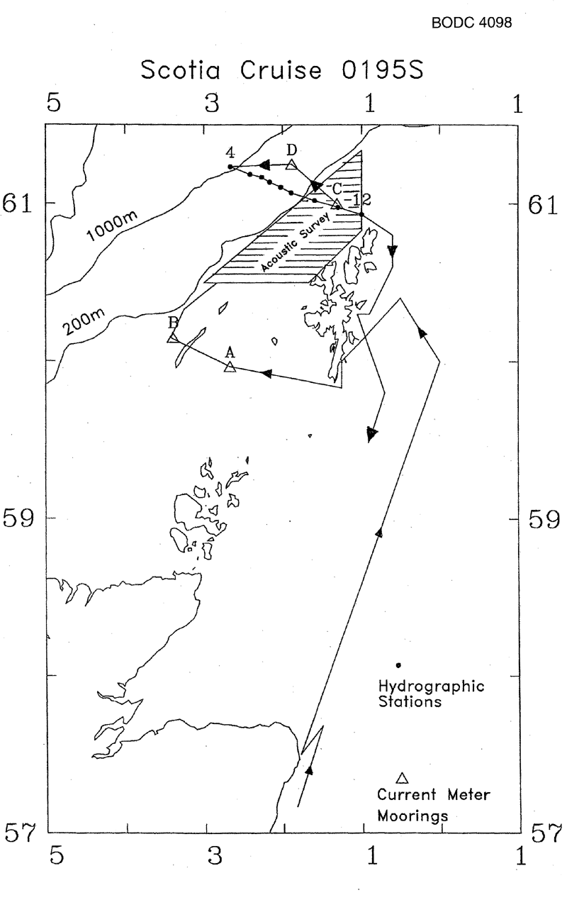
1. To perform hydrographic surveys along the shelf edge east, north and west of the Shetland Islands.
2. To perform repeat acoustic surveys of mackerel patches in the same area. 3. To perform exploratory trawls (maximum of one per day) of observed acoustic targets. 4. To recover four current meter moorings to the north and west of the Shetland Islands. |
| Ship | FRV Scotia |
| Departure Port | Aberdeen, United Kingdom |
| Departure Date | 1995-01-09 |
| Arrival Port | Aberdeen, United Kingdom |
| Arrival Date | 1995-01-18 |
| Principal Scientist(s) | Bill Turrell (Scottish Office Agriculture Environment and Fisheries Department Aberdeen Marine Laboratory) |
| Responsible Organisation | Scottish Office Agriculture Environment and Fisheries Department Aberdeen Marine Laboratory |
| Associated Project(s) | |
| IHB Sea Areas Visited | North East Atlantic Ocean (limit 40W) |
| Marsden Squares Visited | 181;3/217;1/252;1 |
| Work Area Description | Shelf edge east, north and west of the Shetland Islands |
| Unable to lookup cruise bounds at this time | |
| Work Area Bounding Polygon | |
| Southern Limit | unknown |
| Northern Limit | unknown |
| Western Limit | unknown |
| Eastern Limit | unknown |
Cruise Inventory Datasets
| Physical oceanography | |
|---|---|
| CTD stations |
Quantity:
number of stations =
12
Description: Seabird Sealogger |
| Current meters |
Quantity:
number of stations =
4
Description: 10 ACM recovered |
| Surface measurements underway (T,S) |
Quantity:
track kilometres =
1760
Description: |
| Water bottle stations |
Quantity:
number of stations =
8
Description: Seabird cals. |
| Biology and fisheries | |
| Acoustic reflection on marine organisms. |
Quantity:
activity duration in hours =
27
Description: Mackerel Survey |
Cruise Inventory Mooring/Buoy Operations
| Latitude | Longitude | Data type | Description |
|---|---|---|---|
| 59° 58' N | 2° 40' W | Current meters | Recovered 2 ACM, 12 Jan 1995 |
| 61° 0' N | 1° 18' W | Current meters | Recovered 2 ACM, 15 Jan 1995 |
| 60° 9' N | 3° 22' W | Current meters | Recovered 3 ACM, 12 Jan 1995 |
| 61° 15' N | 1° 52' W | Current meters | Recovered 3 ACM, 15 Jan 1995 |
Summary of BODC Data Holdings for the Cruise
National Oceanographic Database
Summary
| # Series | Instrument Description | Parameters |
|---|---|---|
| 12 | CTD/STD cast |
Electrical conductivity of the water column Salinity of the water column Temperature of the water column Vertical spatial coordinates |
Note: Parameter terms are taken from the BODC Parameter Discovery Vocabulary XML (SKOS)
Full List
| BODC Reference | Instrument Description | Date/Time | Location | |
|---|---|---|---|---|
| 461987 | CTD/STD cast | 1995-01-12 08:03Z | 59° 57' N, 2° 39' W | Click for more |
| 461999 | CTD/STD cast | 1995-01-12 15:16Z | 60° 10' N, 3° 19' W | Click for more |
| 462002 | CTD/STD cast | 1995-01-14 13:00Z | 61° 24' N, 0° 58' W | Click for more |
| 462014 | CTD/STD cast | 1995-01-16 05:05Z | 61° 13' N, 2° 39' W | Click for more |
| 462026 | CTD/STD cast | 1995-01-16 07:09Z | 61° 11' N, 2° 24' W | Click for more |
| 462038 | CTD/STD cast | 1995-01-16 09:33Z | 61° 10' N, 2° 15' W | Click for more |
| 462051 | CTD/STD cast | 1995-01-16 10:44Z | 61° 8' N, 2° 9' W | Click for more |
| 462063 | CTD/STD cast | 1995-01-16 11:54Z | 61° 6' N, 2° 1' W | Click for more |
| 462075 | CTD/STD cast | 1995-01-16 13:03Z | 61° 4' N, 1° 53' W | Click for more |
| 462087 | CTD/STD cast | 1995-01-16 14:43Z | 61° 1' N, 1° 35' W | Click for more |
| 462099 | CTD/STD cast | 1995-01-16 15:57Z | 60° 58' N, 1° 17' W | Click for more |
| 462106 | CTD/STD cast | 1995-01-16 17:04Z | 60° 55' N, 1° 0' W | Click for more |
Project Database
No data currently held for this cruise in the BODC Project Database
