Metadata Report for BODC Series Reference Number 1978148
Metadata Summary
Problem Reports
Data Access Policy
Narrative Documents
Project Information
Data Activity or Cruise Information
Fixed Station Information
BODC Quality Flags
SeaDataNet Quality Flags
Metadata Summary
Data Description |
|||||||||||||||||||||||||||||||||||||||||||||||||||||||||
|
|||||||||||||||||||||||||||||||||||||||||||||||||||||||||
Data Identifiers |
|||||||||||||||||||||||||||||||||||||||||||||||||||||||||
|
|||||||||||||||||||||||||||||||||||||||||||||||||||||||||
Time Co-ordinates(UT) |
|||||||||||||||||||||||||||||||||||||||||||||||||||||||||
|
|||||||||||||||||||||||||||||||||||||||||||||||||||||||||
Spatial Co-ordinates | |||||||||||||||||||||||||||||||||||||||||||||||||||||||||
|
|||||||||||||||||||||||||||||||||||||||||||||||||||||||||
Parameters |
|||||||||||||||||||||||||||||||||||||||||||||||||||||||||
|
|||||||||||||||||||||||||||||||||||||||||||||||||||||||||
|
|||||||||||||||||||||||||||||||||||||||||||||||||||||||||
Problem Reports
No Problem Report Found in the Database
Data Access Policy
Open Data
These data have no specific confidentiality restrictions for users. However, users must acknowledge data sources as it is not ethical to publish data without proper attribution. Any publication or other output resulting from usage of the data should include an acknowledgment.
If the Information Provider does not provide a specific attribution statement, or if you are using Information from several Information Providers and multiple attributions are not practical in your product or application, you may consider using the following:
"Contains public sector information licensed under the Open Government Licence v1.0."
Narrative Documents
Sea-Bird Dissolved Oxygen Sensor SBE 43 and SBE 43F
The SBE 43 is a dissolved oxygen sensor designed for marine applications. It incorporates a high-performance Clark polarographic membrane with a pump that continuously plumbs water through it, preventing algal growth and the development of anoxic conditions when the sensor is taking measurements.
Two configurations are available: SBE 43 produces a voltage output and can be incorporated with any Sea-Bird CTD that accepts input from a 0-5 volt auxiliary sensor, while the SBE 43F produces a frequency output and can be integrated with an SBE 52-MP (Moored Profiler CTD) or used for OEM applications. The specifications below are common to both.
Specifications
| Housing | Plastic or titanium |
| Membrane | 0.5 mil- fast response, typical for profile applications 1 mil- slower response, typical for moored applications |
| Depth rating | 600 m (plastic) or 7000 m (titanium) 10500 m titanium housing available on request |
| Measurement range | 120% of surface saturation |
| Initial accuracy | 2% of saturation |
| Typical stability | 0.5% per 1000 h |
Further details can be found in the manufacturer's specification sheet.
SOLSTICE-WIO AP06 Pemba Channel CTD Instrument Description
CTD Unit and Auxillary Sensors
A Sea-Bird 19plus CTD system used on cruise AP06. This was coupled to a stainless steel SBE55 rosette sampler, equipped with six 6-litre Niskin bottles. The CTD was fitted with the following scientific sensors:
| Sensor | Serial Number | Last calibration date | Comments |
|---|---|---|---|
| Sea-Bird SBE 19plus underwater temperature and conductivity unit | 4624 | 02 March 2019 | - |
| Sea-Bird SBE 43 dissolved oxygen sensor | 3745 | 28 February 2019 | - |
| Satlantic PAR sensor | 1163 | 10 April 2019 | - |
| WETLabs ECO-FLNTU(RT) combined fluorometer and turbidty sensor | FLNTURT-5075 | 19 March 2019 | - |
Sea-Bird SBE 19 and SBE 19plus SEACAT Profiler CTDs
The SBE 19 SEACAT Profiler is a self-contained, battery powered, pumped CTD system designed to measure conductivity, temperature, and pressure in marine or fresh water environments to depths of 10,500 meters. It was replaced by the SBE 19plus model in 2001. An updated version of this instrument is the SBE 19plus V2, which incorporates an electronics upgrade and additional features, with six differentially amplified A/D input channels, one RS-232 data input channel, and 64 MB FLASH memory.
The standard CTD unit comes with a plastic housing (rated to 600 m), although this can be replaced by titanium housing for depths up to 7000 m. It is typically used for CTD profiling although a conversion kit is available for mooring deployments. The CTD can also be attached to an SBE 36 CTD Deck Unit and Power/Data Interface Module (PDIM) for real-time operation on single-core armored cable up to 10,000 m.
Specifications
| Parameter | SBE 19 | SBE 19plus |
|---|---|---|
| Temperature | Range: -5 to +35 °C Accuracy: 0.01 °C Resolution: 0.001 °C Calibration: +1 to +32 °C* | Range: -5 to +35 °C Accuracy: 0.005 °C Resolution: 0.0001 °C Calibration: +1 to +32 °C* |
| Conductivity | Range: 0 to 7 S m-1 (0 to 70 mmho cm-1) Accuracy: 0.001 S m-1 Resolution: 0.0001 S m-1 Calibration: 0 to 7 S m-1. Physical calibration over the range 1.4 - 6 S m-1* | Range: 0 to 9 Sm-1 Accuracy: 0.0005 Resolution: 0.00005 (most oceanic waters, resolves 0.4 ppm in salinity); 0.00007 (high salinity waters, resolves 0.4 ppm in salinity); 0.00001 (fresh waters, resolves 0.1 ppm in salinity) Calibration: 0 to 9 S m-1. Physical calibration over the range 1.4 - 6 S m-1* |
| Strain gauge pressure sensor | Range: 0 to100, 150, 300, 500, 1000, 1500, 3000, 5000, 10000 or 15000 psia Accuracy: 0.25% of full scale range (100 - 1500 psia); 0.15% of full scale range (3000 - 15000 psia) Resolution: 0.015% of full scale Calibration: 0 to full scale in 20% steps | Range: 0 to 20, 100, 350, 1000, 2000, 3500 or 7000 m Accuracy: 0.1% of full scale range Resolution: 0.002% of full scale range Calibration: ambient pressure to full scale range in 5 steps |
*Measurements outside this range may be at slightly reduced accuracy due to extrapolation errors.
Options and accessories
Additional sensors can be attached to the CTD, including:
- high accuracy Paroscientific Digiquartz pressure sensor (depth range 0 to 20, 60, 130, 200, 270, 680, 1400, 2000, 4200, 7000 or 10500 m; accuracy 0.02% of full scale; resolution 0.0025% of full scale)
- Dissolved Oxygen (SBE 43 DO Sensor)
- pH* (SBE 18 pH Sensor or SBE 27 pH/ORP Sensor)
- fluorescence
- radiance (PAR)
- light transmission
- optical backscatter (turbidity)
The standard SBE 5M pump may be replaced by an SBE 5P (plastic housing) or 5T (titanium housing) pump for use with dissolved oxygen and/or other pumped sensors. Further details can be found in the manufacturer's SBE 19plus V2 instrument specification or theSBE 19 andSBE 19 plus user guides.
WETLabs ECO FLNTU fluorescence and turbidity sensor
The Environmental Characterization Optics (ECO) Fluorometer and Turbidity (FLNTU) sensor is a dual wavelength, single-angle instrument that simultaneously determines chlorophyll fluorescence and turbidity. It is easily integrated in CTD packages and provides a reliable turbidity measurement that is not affected by Colored Dissolved Organic Matter (CDOM) concentration.
The FLNTU can operate continuously or periodically and has two different types of connectors to output the data. There are 5 other models that operate the same way as this instrument but have slight differences, as stated below:
- FLNTU(RT) - has an analog an RS-232 serial output and operates continuously, when power is supplied
- FLNTU(RT)D - similar to the FLNTU(RT) but has a depth rating of 6000 m
- FLNTUB - has internal batteries for autonomous operation
- FLNTUS - has an integrated anti-fouling bio-wiper
- FLNTUSB - has the same characteristics as the FLNTUS but with internal batteries for autonomous operation
Specifications
| Temperature range | 0 to 30°C |
| Depth rating | 600 m (standard) 6000 m (deep) |
| Turbidity | |
| Wavelength | 700 nm |
| Sensitivity | 0.01 NTU |
| Typical range | 0.01 to 25 NTU |
| Fluorescence | |
| Wavelength | 470 nm (excitation), 695 nm (emission) |
| Sensitivity | 0.01 µg L-1 |
| Typical range | 0.01 to 50 µg L-1 |
| Linearity | 99% R2 |
Further details can be found in the manufacturer's specification sheet.
SOLSTICE-WIO AP06 Pemba Channel CTD Data Originator's Processing
Sampling strategy
A total of 43 CTD casts were performed during the cruise.
Data processing
The data were processed using the mexec software suite developed by NOC. Because the CTD system used during this cruise (SBE 19+) contained an auto fire module (AFM) some minor changes were made to constants and/or coefficients compared to the typical The following modules were run:
- Data Conversion: Converts raw frequency and voltage data by applying manufacturer's calibrations stored in the .XMLCON file, and outputs the data in an ASCII format (cast data as .cnv, bottle data as .ros). This was run with the hysteresis correction for oxygen and ensuring conductivity was in the units of mS cm-1
- Align CTD: Shifts selected sensors' data in time, relative to pressure. This is required for sensors with a slower response time and when extra time is required for the water parcel to reach the sensor (e.g. traveling through extra lengths of hose). A standard alignment of 5 seconds was applied to both oxygen and temperature relative to pressure.
- WildEdit: Pass 1 (2 d.s., 500 scans), Pass 2 (10 s.d., 500 scans).
- CellTM: This module removes conductivity cell thermal mass effects from the measured conductivity. Sea-bird recommended constants (?=0.04 and 1/?=8.0) were used.
- Translate: Converts from binary to ascii
Further details of the processing performed can be found on page 22 of the AP06 cruise report.
Calibration
CTD salinity and fluoroscence data were calibrated against bottle samples using the MEXEC software suite. Further details on the proceedures used for the CTD calibration can be found on page 25 of the AP06 cruise report.
SOLSTICE-WIO AP06 Pemba Channel CTD Data Processing by BODC
The CTD data were supplied to BODC as 43 MSTAR formatted NetCDF files and converted to the BODC internal format (NetCDF).
During transfer the originator's variables were mapped to unique BODC parameter codes. The following table shows the parameter mapping.:
| Originator's variable | Units | BODC Code | Units | Comments |
|---|---|---|---|---|
| absol_salin | g kg-1-t10 | - | - | Not Transferred |
| cond | mS cm-1 | - | - | Uncalibrated channel, not transferred |
| condcal | mS cm-1 | CNCLCCI1 | S m-1 | Divided by 10 to convert units |
| conserv_temp | degc90 | - | - | Not Transferred |
| depth | m | DEPHPR01 | m | - |
| fluor_cal | µg l-1 | CPHLPS01 | mg m-3 | Units equivalent, no conversion required |
| oxy_per_kg | µmol kg-1 | - | - | Not Transferred, oxygen in µmol l-1 is the preferred for tranfer. |
| oxy_per_l | µmol l-1 | DOXYSU01 | µmol l-1 | - |
| oxygen | ml l-1 | - | - | Not Transferred, oxygen in µmol l-1 is the preferred for tranfer. |
| oxysat | % | - | - | Not transferred, calculated by BODC during transfer |
| oxysat_ml | ml l-1 | - | - | Not transferred, calculated by BODC during transfer |
| PAR | µmol photons m-2 s-1 | IRRDUV01 | µE m-2 s-1 | µmol photons m-2 s-1 are equilivant to µE m-2 s-1 |
| pdens_t10 | kg m-3 | - | - | Not Transferred |
| pdensity | kg m-3 | - | Not transferred | |
| potemp | degc90 | - | - | Not transferred, calculated by BODC during transfer |
| press | dbar | PRESPR01 | dbar | - |
| pressure_temp | degc90 | - | - | Not transferred |
| raw_fluor | µg l-1 | - | mg m-3 | Uncalibrated channel, not transferred |
| salin | pss-78 | PSALCC01 | Dimensionless | - |
| temp | degc90 | TEMPST01 | µC | - |
| turbidity | m-1 sr-1 | BB117NIR | m-1 nm-1 sr-1 | - |
| - | - | OXYSZZ01 | % | Derived by BODC using DOXYSC01, TEMPST01 and PSALCC01 |
| - | - | POTMCV01 | °C | Derived by BODC using TEMPST01, PSALCC01 and PRESPR01 |
| - | - | SIGTPR01 | kg m-3 | Derived by BODC using POTMCV01, PSALCC01 and PRESPR01 |
Variables not transferred can be provided on request.
Following transfer the data were screened using BODC in-house visualisation software. Suspect data values were assigned the appropriate BODC data quality flag. Missing data values, where present, were changed to the missing data value and assigned a BODC data quality flag.
Satlantic PAR sensor
Basic introduction
PAR (400 - 700 nm) sensor that measures quantum irradiance with near flat spectral response and cosine spatial response. Cosine collectors for in air and in water measurements for 2 depth ratings, 1000 m and 7000 m. Digital and analog output options. Compatible with SeaBird CTD platforms. Tilt and internal temperature measurements carried out for data quality analysis. Max sample rate of 100 Hz, PAR range 0 - 5000 µmol photons m-2 s-1. Cosine error 0-60° <3% and 60-85° <10%
Specifications
| Spectrum | 400 - 700 nm |
|---|---|
| PAR Range | 0 - 5000 µmol photons m-2 s-1 |
| Spatial | Cosine Response |
| Cosine Error | 0° - 60° <3% |
| 60° - 85° <10% | |
| Collector Area | 86 mm2 |
| Detector | 17 mm2 silicon photodiode |
| Input Voltage | 6 - 28 VDC |
| Current Draw | 17 mA at 12 VDC |
| Sample Rate | 100 Hz Maximum |
| Digital Output | RS-232 ASCII, up to 100 Hz |
| Analog Signal Output | 0.125 - 4.0 V |
| Analog Signal Scaling | linear or logarithmic |
| Weight (in air) | 88 g (plastic) or 182 g (titanium) |
| Weight (in water) | 39 g (plastic) or 133 g (titanium) |
| Depth Rating | 1000 m (plastic) or 7000 m (titanium) |
| Length | 139 mm (with connector) 89 mm (housing) |
| Diameter | 25 mm |
More information may be found in the Satlantic PAR brochure
Project Information
SOLSTICE-WIO: Sustainable Oceans, Livelihoods and food Security Through Increased Capacity in Ecosystem research in the Western Indian Ocean
Introduction
SOLSTICE-WIO is a four-year collaborative project funded by the UK Global Challenges Research Fund (GCRF). Launched in October 2017, it brings together recent advances in marine technologies, local knowledge and research expertise to address challenges facing the Western Indian Ocean region in a cost-effective way via state-of-the-art technology transfer, collaborative environmental and socio-economic research and hands-on training.
Over 100 million people in the Western Indian Ocean (WIO) region live within 100km of the coast, with over 1 million working in the fisheries sector. The WIO is highly dependent on the ocean for economic stability, food security, and social cohesion. In recent years, the region has seen dramatic and often poorly understood reductions in key fisheries, due to the combined effects of climate change, natural ecosystem variability, overfishing and degradation of key marine habitats. Until the mechanisms behind the collapse are understood, there is little potential for aiding recovery or guiding adaptation. The key to stability of living marine resources lies in an ecosystem approach to fisheries (EAF), which sees human-natural systems as a whole, integrated entity rather than separately considering individual target species. Understanding and managing WIO fisheries and the impacts of recent and future changes requires a mature capacity to implement an ecosystem approach to fisheries management (EAF) that is built on sound environmental and socio-economic information.
The core strength of SOLSTICE-WIO lies in its integral approach to food security, drawing on UK expertise in physical oceanography, marine ecology, autonomous observations, environmental economics and the human dimension,and WIO expertise in fisheries, the marine economy and regional policy development. SOLSTICE will provide the region with the state-of-the-art technology to deliver cost-effective marine research and provide the information needed to achieve maximum potential from the region's living marine resources. In the UK marine robotics, ocean models and novel data products from satellite observations have developed rapidly in the last decade, and now underpin Blue Economies and Ocean Governance in Europe. These technologies are highly agile and ready to be applied in the developing world as cost-effective ways to maximise understanding and sustainable exploitation of living marine resources. Such "technology leapfrogging" can overcome the severe lack of research ships in the WIO and save decades of effort in developing predictive modelling systems from scratch.
Scientific Objectives
SOLSTICE-WIO main objectives are to:
- Grow marine environmental research capability to address challenges facing the WIO region in a cost-effective way via state-of-the-art technology transfer, collaborative environmental and socio-economic research, and hands-on training.
- Strengthen the capacity of UK marine scientists to apply leading-edge technologies in developing countries, and work with regional and local experts to ensure that their research addresses local and regional needs.
- Strengthen the ability of WIO scientists to effectively deliver evidence-based environmental and socio-economic information to support policy development and implementation at national and regional levels.
- Ensure future sustainability of marine research capability in the region by training and mentoring early career scientists and post-graduate students from the WIO and by developing on-line resources for use in distance learning and hands-on training of marine scientists outside the partner organisations and beyond the duration of the project.
- Ensure on-going support for an Ecosystem Approach to Fisheries in the WIO by building lasting strategic research partnerships between UK marine science and regional centres of excellence, between these centres and other WIO research organisations, and between marine scientist and government agencies and NGOs mandated to deliver sustainable development and exploitation of marine living resources in the WIO.
Fieldwork
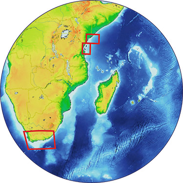
SOLSTICE-WIO will demonstrate its approach to strengthening research capacity through three case studies in Kenya, Tanzania and South Africa. These have been selected by SOLSTICE-WIO partners in each of the three countries.
-
Tanzania Case Study: Pemba Channel small pelagic fishery under climate threat.
The small pelagic fishery is important for local communities in Zanzibar and mainland Tanzania as a source of food security, nutrition and livelihood support. This diverse group includes mackerel, sardines and anchovies â?? found in schools over the continental shelf, in bays and deep lagoons with nutrient rich waters. They are more abundant during the southeast monsoon, when stronger winds drive upwelling that brings nutrient rich water to the surface.
Despite its importance for coastal economies, there is a lack of data and information about the fishery, which hampers effective management. Using robotics, modelling, remote sensing, field observations and socio-economic studies, SOLSTICE will identify key environmental and anthropogenic drivers of the main species and address climatic pressures on this fishery.
-
Kenya Case Study: Emerging fishery of the North Kenya Bank, an opportunity for coastal populations.
The North Kenya Bank fishery is expected to spur economic growth for local communities. If well managed, it could help achieve national development goals, including poverty alleviation and wealth creation. Sustainability requires informed management interventions, but there is only scant information on the ecological status and drivers of the fishery.
Using modelling, remote sensing, field observations and socio-economic studies, SOLSTICE will explore processes related to productivity and resilience of the ecosystems supporting the fishery, identify the main drivers of variability and change, and advise the fishery and government on how to optimise use of this important resource.
-
South Africa Case Study: Environmental drivers and socio-economic consequences of the South African Chokka squid fishery collapsing.
The collapse of the Chokka squid fishery in 2013 had a devastating effect on the Eastern Cape, one of the poorest provinces in South Africa. The reasons for the collapse are unknown, although local fishermen believe it happened as a result of environmental change.
SOLSTICE will address key environmental and anthropogenic factors controlling the ecosystem dynamics of the Agulhas Bank. The results will help explain why the fishery collapsed, and inform the fishery and government as to whether the current recovery is stable, or whether similar collapses are likely in the future.
Project Collaborators
The science delivered as part of SOLSTICE-WIO is greatly enhanced by the collaboration of the following institutions:
- National Oceanography Centre (NOC)
- Plymouth Marine Laboratory (PML)
- Scottish Association for Marine Science (SAMS)
- Heriot-Watt University
- Imperative Space
- Nelson Mandela University (NMU)
- South African Squid Management Industry Association
- Rhodes University
- South African Environmental Observation Network
- University of Cape Town
- Institute of Marine Sciences (IMS)
- Western Indian Ocean Marine Science Association
- Tanzania Fisheries Research Institute (TAFIRI)
- Environment for Development - Tanzania (EfDT)
- WWF Tanzania
- Kenya Marine and Fisheries Research Institute (KMFRI)
- Coastal Oceans Research and Development â?? Indian Ocean
- University of Seychelles
- Mozambique National Institute of Fisheries Research
- Institut Halieutique et des Sciences Marines (IH.SM)
SOLSTICE-WIO Leadership Team
Directors
- Prof Mike Roberts (Nelson Mandela University (NMU), South Africa)
- Dr Katya Popova (National Oceanography Centre (NOC), UK)
Members
- Prof Julius Francis (Western Indian Ocean Marine Science Association (WIOMSA), Tanzania)
- Dr Yohana W. Shaghude (Institute of Marine Sciences (IMS), Tanzania)
- Dr Baraka Sekadende (Tanzania Fisheries Research Institute (TAFIRI), Tanzania)
- Dr Joseph Kamau (Kenya Marine and Fisheries Research Institute (KMFRI), Kenya)
- Prof Warwick Sauer (Rhodes University (Rhodes), South Africa)
- Dr Eleni Papathanasopoulou (Plymouth Marine Laboratory (PML), UK)
- Dr Matthew Palmer (National Oceanography Centre (NOC), UK)
- Dr Val Byfield (National Oceanography Centre (NOC), UK)
- Sofia Alexiou (National Oceanography Centre (NOC), UK)
Funding
This is a NERC funded research project. The total value of the grant is £6,934,488 and the period of award is from September 4th 2017 to March 3rd 2020. NERC Reference: NE/P021050/1
Data Activity or Cruise Information
Cruise
| Cruise Name | AP06 |
| Departure Date | 2019-06-29 |
| Arrival Date | 2019-07-09 |
| Principal Scientist(s) | Stuart Painter (National Oceanography Centre, Southampton) |
| Ship | Angra Pequena |
Complete Cruise Metadata Report is available here
Fixed Station Information
No Fixed Station Information held for the Series
BODC Quality Control Flags
The following single character qualifying flags may be associated with one or more individual parameters with a data cycle:
| Flag | Description |
|---|---|
| Blank | Unqualified |
| < | Below detection limit |
| > | In excess of quoted value |
| A | Taxonomic flag for affinis (aff.) |
| B | Beginning of CTD Down/Up Cast |
| C | Taxonomic flag for confer (cf.) |
| D | Thermometric depth |
| E | End of CTD Down/Up Cast |
| G | Non-taxonomic biological characteristic uncertainty |
| H | Extrapolated value |
| I | Taxonomic flag for single species (sp.) |
| K | Improbable value - unknown quality control source |
| L | Improbable value - originator's quality control |
| M | Improbable value - BODC quality control |
| N | Null value |
| O | Improbable value - user quality control |
| P | Trace/calm |
| Q | Indeterminate |
| R | Replacement value |
| S | Estimated value |
| T | Interpolated value |
| U | Uncalibrated |
| W | Control value |
| X | Excessive difference |
SeaDataNet Quality Control Flags
The following single character qualifying flags may be associated with one or more individual parameters with a data cycle:
| Flag | Description |
|---|---|
| 0 | no quality control |
| 1 | good value |
| 2 | probably good value |
| 3 | probably bad value |
| 4 | bad value |
| 5 | changed value |
| 6 | value below detection |
| 7 | value in excess |
| 8 | interpolated value |
| 9 | missing value |
| A | value phenomenon uncertain |
| B | nominal value |
| Q | value below limit of quantification |
