Metadata Report for BODC Series Reference Number 2027093
Metadata Summary
Problem Reports
Data Access Policy
Narrative Documents
Project Information
Data Activity or Cruise Information
Fixed Station Information
BODC Quality Flags
SeaDataNet Quality Flags
Metadata Summary
Data Description |
|||||||||||||||||||||||||||||
|
|||||||||||||||||||||||||||||
Data Identifiers |
|||||||||||||||||||||||||||||
|
|||||||||||||||||||||||||||||
Time Co-ordinates(UT) |
|||||||||||||||||||||||||||||
|
|||||||||||||||||||||||||||||
Spatial Co-ordinates | |||||||||||||||||||||||||||||
|
|||||||||||||||||||||||||||||
Parameters |
|||||||||||||||||||||||||||||
|
|||||||||||||||||||||||||||||
|
|||||||||||||||||||||||||||||
Problem Reports
No Problem Report Found in the Database
Data Access Policy
Open Data
These data have no specific confidentiality restrictions for users. However, users must acknowledge data sources as it is not ethical to publish data without proper attribution. Any publication or other output resulting from usage of the data should include an acknowledgment.
If the Information Provider does not provide a specific attribution statement, or if you are using Information from several Information Providers and multiple attributions are not practical in your product or application, you may consider using the following:
"Contains public sector information licensed under the Open Government Licence v1.0."
Narrative Documents
Kongsberg EM 710 multibeam echosounder
The Kongsberg EM710 is a high resolution multibeam echosounder. It operates at frequencies from 70 to 100 kHz, with a maximum ping rate of 30 Hz. The EM710 features a depth range of 3m below the transducer to 2000m (1000m for the EM710S model, and 600m for the EM710RD model). The swath width is up to 5.5 times water depth, to a maximum of more than 2000m.
For more information, please see this document: https://www.bodc.ac.uk/data/documents/nodb/pdf/em710_product_specification.pdf
JC180 STEMM-CCS Bathymetry - Originator's Data Processing
Sampling Strategy
Kongsberg EM710 multibeam bathymetry data were collected on board RRS James Cook cruise JC180 between 25th April to 30th May 2019. This cruise set out to map the Goldeneye area in the North Sea as part of the STEMM-CCS project. Multibeam data were acquired in this region on previous STEMM-CCS cruise POS527 in 2018, but this was carried out in adverse weather conditions. JC180 therefore aimed to map some gaps in the previous dataset by completing a short survey.
The data collection was funded under the EU Horizons 2020 programme under grant reference 654462.
Data Processing
The shipboard EM710 data were processed onboard using CARIS HIPS and SIPS software provided by the science party. The data were imported into a HIPS Project file from the raw archive format during the cruise. Tidal corrections and sound velocity profiles were checked and applied. The data were filtered to remove the outer beams, and the swath editor was used to remove noise before geographic registration.
After geographic registration on a UTM Zone 30 (WGS84) 5-metre grid, the data were viewed in colour relief.
The final dataset was exported into decimal degrees as an ASCII XYZ 20m resolution grid and supplied to BODC. The depth values were multiplied by -1 to get proper topographic heights.
For more information, please see the cruise report.
STEMM-CCS Bathymetry - BODC Processing
Data were submitted to BODC in .TXT format from STEMM-CCS cruises JC180 and POS527. Datasets were are transferred into a common format, a netCDF subset. The following table shows how the variables within the files were mapped to the appropriate BODC parameter codes:
| Original parameter name | Original Units | BODC Parameter Code | BODC Units | Comments |
|---|---|---|---|---|
| Latitude | Degrees | ALATGP01 | Degrees | - |
| Longitude | Degrees | ALONGP01 | Degrees | - |
| Seafloor height | Metres | MBTHHGHT | Metres | - |
Following transfer, the data are screened visually, using BODC's in-house visualisation software, and any spikes or instrument malfunctions are clearly labelled with quality control flags.
Project Information
Strategies for Environmental Monitoring of Marine Carbon Capture and Storage (STEMM-CCS)
The Strategies for Environmental Monitoring of Marine Carbon Capture and Storage (STEMM-CCS) project was funded under the European Union's Horizon 2020 programme (Grant ID: 654462) from 1st March 2016 to 29th February 2020. The project was co-ordinated by UK Research and Innovation (UKRI). It aimed to address the current knowledge and capability gaps in approaches, methodologies and technology required for the effective environmental monitoring of offshore carbon capture and storage (CCS) sites. Central to the project was the STEMM-CCS controlled release experiment, the first sub-seafloor release of CO2 to be carried out under real life conditions. Implemented at a site near the Goldeneye platform in the North Sea, this experiment successfully simulated a CO2 reservoir leak scenario and demonstrated that the leak could be successfully detected and quantified using the range of instruments, tools and techniques developed during the project.
Drawing on a broad range of expertise from researchers in 14 institutions, including Shell as the principal industry partner, the project undertook extensive research into a range of CCS-relevant issues including: the establishment of accurate environmental baselines; better understanding of fluid flow pathways in the sub-seafloor and their implications for reservoir integrity; methodologies for detecting, tracing and quantifying CO2 leakage in the marine environment, and the development and testing of new technologies to enable cost-effective monitoring of marine CCS operations.
Background
The aim of CCS is to capture CO2 from large emission sources, such as power stations and industrial facilities, transport it to a storage site and permanently lock it away so that it cannot be released into the atmosphere. CCS storage sites are usually geological formations deep underground, either onshore or offshore. Carbon dioxide Capture and Storage (CCS) is an important strategy in mitigating anthropogenic CO2 emissions. All credible climate change scenario models indicate that CCS will be essential to meeting the internationally agreed targets set by the UNFCCC Paris Agreement in 2015, which aims to limit global warming to 2°C relative to pre-industrial levels. The European Union's commitment to the Paris Agreement involves reducing carbon emissions by 85-95 percent by 2050, with the greater ambition of becoming carbon neutral by 2050 in order to limit global temperature rise to 1.5°C. The EU's 'Clean Energy for all Europeans' package, published in 2019, clearly identifies CCS as a critical step towards achieving a climate-neutral economy.
Further details are available on the STEMM-CCS project website.
Participants
The following institutions were involved in the STEMM-CCS project:
- National Oceanography Centre, UK - Project Coordinator Dr. Doug Connelly
- GEOMAR - Helmholtz Centre for Ocean Research, Kiel
- Alfred Wegener Institute (AWI), Germany
- University of Southampton, UK
- Plymouth Marine Laboratory, UK
- Max Planck Institute of Marine Microbiology (MPI-MM), Germany
- Heriot-Watt University, UK
- Graz University of Technology (TU Graz), Austria
- NORCE Norwegian Research Centre, Norway
- Seascape Consultants Ltd, UK
- University of Tromso, Norway
- University of Bergen, Norway
- Shell Global Solutions International, Netherlands
- Norwegian Institute for Water Research (NIVA), Norway
Research details
Seven Work Packages were funded and are described in brief below:
WP1 - Technical logistics and equipment:
- Coordinate the production, delivery and deployment of equipment to the demonstration site.
- Coordinate the management of the demonstration site.
- Design, develop, manufacture and deploy a seabed drill and the CO2 delivery system to enable release of CO2 at less than 5m beneath the sediment-water interface.
- Deliver a current recording mooring and integrate sensors and functionality into the seabed lander.
WP2 - Baseline studies for CCS sites
- Design and implement an effective environmental baseline survey at the STEMM-CCS experimental site.
- Identify appropriate biological and chemical indices of impact, suitable for industrial-scale application above CCS sites.
- Use modelling approaches to extend spatially and temporally limited field observation data to support a comprehensive environmental baseline.
WP3 - Leakage pathways through the overburden
- Determine the efficiency of leakage pathways for CO2 transfer.
- Determine the CO2 permeability of chimney structures.
- Determine how long chimney structures remain open for CO2 transfer.
- Determine the physical properties of chimney structures.
WP4 - Leakage detection, localisation and quantification
- Detect, locate and quantify CO2 leakage from the controlled sub-seabed CO2 release experiment (WP1).
- Assess the utility of artificial and natural tracers of CO2 in the marine environment.
- Develop effective methodologies for quantification of CO2 fluxes across the seabed and dispersion in the water column.
- Develop coupled and nested model systems to assess CO2 and tracer dispersion in sediments and the water column for a range of leakage scenarios.
WP5 - Emerging technology
- Develop new technologies and optimise methods to locate, detect and quantify CO2 leakag.e
- Develop new technologies and techniques for measurement of biological and chemical parameters, including natural variability.
- Reduce the cost of data collection by developing new technologies and techniques.
- Assimilate measurement and model information to produce a decision support tool to guide mitigation and remediation action.
- Develop automated low-cost seabed imaging and mapping technologies and techniques for baseline and impact assessments.
WP6 - International collaboration
- Capitalise on collaborative interactions with international research and development to maximise the impact of STEMM-CCS.
- Maximise the exposure and dissemination of project outputs to an international audience of CCS stakeholders including industry, regulators, governments and researchers.
WP7 - Knowledge sharing
- Ensuring that accurate information about CO2 storage is available by providing clear and accessible communications designed for specific audiences.
- Facilitating interaction between project scientists and stakeholders.
- Establish a comprehensive training programme for the community of postgraduate and postdoctoral researchers involved in the project, and industry and regulatory stakeholders.
Fieldwork and data collection
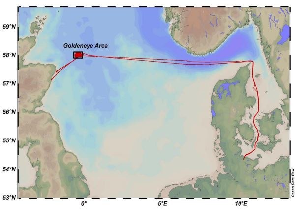
The keystone of STEMM-CCS was a novel experiment to simulate a sub-seafloor CO2 leak under real-life conditions in the North Sea. Over a period of two weeks in spring 2019, CO2 gas - augmented with inert chemical tracers - was injected into seafloor sediments at a carefully chosen experimental site near Shell's Goldeneye complex (a proposed CCS storage site), located approximately 100 km north-east of Peterhead. The consequences of this CO2 release were carefully monitored by a sophisticated array of chemical sensors, acoustic devices, visual observations and seismic surveys operated by scientists aboard research vessels RRS James Cook (Cruise JC180) and RV Poseidon (Cruise POS527).
The use of two research vessels was critical to the experiment's success. Whilst the main CO2 release experiment was executed and monitored in the near-field by RRS James Cook, the German vessel RV Poseidon carried out parallel water column surveys in the far-field in order to determine the lateral spread of CO2 away from the release site.
Data Activity or Cruise Information
Cruise
| Cruise Name | JC180 |
| Departure Date | 2019-04-25 |
| Arrival Date | 2019-05-30 |
| Principal Scientist(s) | Douglas Connelly (National Oceanography Centre, Southampton) |
| Ship | RRS James Cook |
Complete Cruise Metadata Report is available here
Fixed Station Information
Fixed Station Information
| Station Name | STEMM-CCS Goldeneye Area |
| Category | Offshore area |
| Latitude | 58° 1.44' N |
| Longitude | 0° 21.12' W |
| Water depth below MSL | 100.0 m |
Fixed Station - STEMM-CCS Project - Goldeneye Area
Four cruise campaigns were conducted as part of the Strategies for Environmental Monitoring of Marine Carbon Capture and Storage (STEMM-CCS) project, funded under EU Horizon 2020 grant reference 654462. The cruises conducted experiments in the direct vicinity of the decommissioned Goldeneye platform in the North Sea, approximately 80 nm offshore of Aberdeen.
The area is within a depleted gas field witihn North Sea block 14/29, and has been earmarked to become a large-scale offshore CO2 storage site. It exhibits many kinds of gas-related structures such as numerous seafloor pockmark features, shallow gas below ~100m sediment depths, and abandoned wells.
Cruises POS518 and POS527 aboard GEOMAR's RV Poseidon vessel collected the necessary oceanographic and geochemical baseline data within the area. Cruises JC180 and POS534 were later on site simultaneously; the RRS James Cook installed the CO2 tracer-release experiment at the seafloor, and the RV Poseidon performed detection and monitoring of the bottom waters during and after release.
Sampling History
| POS518 (Sept-Oct 2017) | POS527 (Aug-Sept 2018) | JC180 (Apr-May 2019) | POS534 (Apr-May 2019) | |
|---|---|---|---|---|
| ROV video/photography/CTD | Y | N | Y | N |
| Shipboard Multibeam Bathymetry | Y | Y | Y | N |
| CTD data | Y | Y | N | Y |
| Lab-on-chip (LOC) sensors | N | N | Y | N |
| AUV Sub-bottom profiling | N | N | Y | N |
| ROV Sub-bottom profiling | N | N | Y | N |
| Echsounder - water column bubbles | Y | N | N | Y |
| Push Cores | Y | Y | Y | N |
| Box cores | N | Y | N | N |
| Gravity cores | Y | Y | N | Y |
| Multi-cores | Y | N | Y | Y |
| Benthic landers | Y | Y | Y | Y |
| Water CO2+CH4 partial pressure | Y | Y | N | Y |
| Atmospheric CO2+CH4 | Y | Y | N | Y |
| Mass spectrometry | N | N | N | Y |
Related Fixed Station activities are detailed in Appendix 1
BODC Quality Control Flags
The following single character qualifying flags may be associated with one or more individual parameters with a data cycle:
| Flag | Description |
|---|---|
| Blank | Unqualified |
| < | Below detection limit |
| > | In excess of quoted value |
| A | Taxonomic flag for affinis (aff.) |
| B | Beginning of CTD Down/Up Cast |
| C | Taxonomic flag for confer (cf.) |
| D | Thermometric depth |
| E | End of CTD Down/Up Cast |
| G | Non-taxonomic biological characteristic uncertainty |
| H | Extrapolated value |
| I | Taxonomic flag for single species (sp.) |
| K | Improbable value - unknown quality control source |
| L | Improbable value - originator's quality control |
| M | Improbable value - BODC quality control |
| N | Null value |
| O | Improbable value - user quality control |
| P | Trace/calm |
| Q | Indeterminate |
| R | Replacement value |
| S | Estimated value |
| T | Interpolated value |
| U | Uncalibrated |
| W | Control value |
| X | Excessive difference |
SeaDataNet Quality Control Flags
The following single character qualifying flags may be associated with one or more individual parameters with a data cycle:
| Flag | Description |
|---|---|
| 0 | no quality control |
| 1 | good value |
| 2 | probably good value |
| 3 | probably bad value |
| 4 | bad value |
| 5 | changed value |
| 6 | value below detection |
| 7 | value in excess |
| 8 | interpolated value |
| 9 | missing value |
| A | value phenomenon uncertain |
| B | nominal value |
| Q | value below limit of quantification |
Appendix 1: STEMM-CCS Goldeneye Area
Related series for this Fixed Station are presented in the table below. Further information can be found by following the appropriate links.
If you are interested in these series, please be aware we offer a multiple file download service. Should your credentials be insufficient for automatic download, the service also offers a referral to our Enquiries Officer who may be able to negotiate access.
| Series Identifier | Data Category | Start date/time | Start position | Cruise |
|---|---|---|---|---|
| 2027100 | Bathymetry | 2018-08-18 07:43:00 | 57.945 N, 0.587 W | Poseidon PO527 |
