Metadata Report for BODC Series Reference Number 2049931
Metadata Summary
Problem Reports
Data Access Policy
Narrative Documents
Project Information
Data Activity or Cruise Information
Fixed Station Information
BODC Quality Flags
SeaDataNet Quality Flags
Metadata Summary
Data Description |
|||||||||||||||||||||||||||||||||||||||||||||
|
|||||||||||||||||||||||||||||||||||||||||||||
Data Identifiers |
|||||||||||||||||||||||||||||||||||||||||||||
|
|||||||||||||||||||||||||||||||||||||||||||||
Time Co-ordinates(UT) |
|||||||||||||||||||||||||||||||||||||||||||||
|
|||||||||||||||||||||||||||||||||||||||||||||
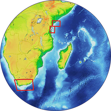
Spatial Co-ordinates | |||||||||||||||||||||||||||||||||||||||||||||
|
|||||||||||||||||||||||||||||||||||||||||||||
Parameters |
|||||||||||||||||||||||||||||||||||||||||||||
|
|||||||||||||||||||||||||||||||||||||||||||||
Definition of BOTTFLAG | |||||||||||||||||||||||||||||||||||||||||||||
| BOTTFLAG | Definition |
|---|---|
| 0 | The sampling event occurred without any incident being reported to BODC. |
| 1 | The filter in an in-situ sampling pump physically ruptured during sample resulting in an unquantifiable loss of sampled material. |
| 2 | Analytical evidence (e.g. surface water salinity measured on a sample collected at depth) indicates that the water sample has been contaminated by water from depths other than the depths of sampling. |
| 3 | The feedback indicator on the deck unit reported that the bottle closure command had failed. General Oceanics deck units used on NERC vessels in the 80s and 90s were renowned for reporting misfires when the bottle had been closed. This flag is also suitable for when a trigger command is mistakenly sent to a bottle that has previously been fired. |
| 4 | During the sampling deployment the bottle was fired in an order other than incrementing rosette position. Indicative of the potential for errors in the assignment of bottle firing depth, especially with General Oceanics rosettes. |
| 5 | Water was reported to be escaping from the bottle as the rosette was being recovered. |
| 6 | The bottle seals were observed to be incorrectly seated and the bottle was only part full of water on recovery. |
| 7 | Either the bottle was found to contain no sample on recovery or there was no bottle fitted to the rosette position fired (but SBE35 record may exist). |
| 8 | There is reason to doubt the accuracy of the sampling depth associated with the sample. |
| 9 | The bottle air vent had not been closed prior to deployment giving rise to a risk of sample contamination through leakage. |
Definition of Rank |
|
|
Problem Reports
No Problem Report Found in the Database
Data Access Policy
Open Data
These data have no specific confidentiality restrictions for users. However, users must acknowledge data sources as it is not ethical to publish data without proper attribution. Any publication or other output resulting from usage of the data should include an acknowledgment.
If the Information Provider does not provide a specific attribution statement, or if you are using Information from several Information Providers and multiple attributions are not practical in your product or application, you may consider using the following:
"Contains public sector information licensed under the Open Government Licence v1.0."
Narrative Documents
SEAL Analytical QuAAtro colorimetric autoanalyser
The SEAL QuAAtro high Performance Microflow Analyzer is the latest generation of the original world-class TechniconTM Segmented Flow Analysis (SFA) systems.
A basic SFA system consists of an autosampler, a peristaltic pump, a chemistry manifold, a detector and data acquisition software. Sample and reagents are pumped continuously through the chemistry manifold. Air bubbles are introduced at regular intervals forming unique reaction segments which are mixed using glass coils. Glass is ideal, as it is inert, stays clean and enables easy visual checks.
In SFA, reactions run to completion and the ratio of sample to reagents in the detector reaches a constant maximum value. This results in ultra-low detection limits and exceptional reproducibility. Variations in reaction time, temperature and sample matrix do not affect the results as they do in other colorimetric techniques, such as flow injection analysis, where the reaction is not brought to completion.
QuAAtro is a microflow SFA system, the internal diameter of all glassware being 1 mm. This reduces reagent consumption and increases throughput, with most methods running at 100 - 120 samples hour. The integrated enclosed manifold and detector are heated to 37 °C. Flow stability is ensured as the optimal bubble frequency for each method is programmed by silent air valves. Automatic start-up, method changeover and shutdown allows true unattended operation and overnight running. QuAAtro checks its own performance, with automatic monitoring of noise, drift, bubble pattern and light energy, before and during a run.
Up to four methods can run at the same time on one console, and there is a special 5-channel version for nutrients in seawater. Two consoles can be combined to give an 8-channel system.
Further details can be found in the manufacturer's specification sheet.
Niskin Bottle
The Niskin bottle is a device used by oceanographers to collect subsurface seawater samples. It is a plastic bottle with caps and rubber seals at each end and is deployed with the caps held open, allowing free-flushing of the bottle as it moves through the water column.
Standard Niskin
The standard version of the bottle includes a plastic-coated metal spring or elastic cord running through the interior of the bottle that joins the two caps, and the caps are held open against the spring by plastic lanyards. When the bottle reaches the desired depth the lanyards are released by a pressure-actuated switch, command signal or messenger weight and the caps are forced shut and sealed, trapping the seawater sample.
Lever Action Niskin
The Lever Action Niskin Bottle differs from the standard version, in that the caps are held open during deployment by externally mounted stainless steel springs rather than an internal spring or cord. Lever Action Niskins are recommended for applications where a completely clear sample chamber is critical or for use in deep cold water.
Clean Sampling
A modified version of the standard Niskin bottle has been developed for clean sampling. This is teflon-coated and uses a latex cord to close the caps rather than a metal spring. The clean version of the Levered Action Niskin bottle is also teflon-coated and uses epoxy covered springs in place of the stainless steel springs. These bottles are specifically designed to minimise metal contamination when sampling trace metals.
Deployment
Bottles may be deployed singly clamped to a wire or in groups of up to 48 on a rosette. Standard bottles and Lever Action bottles have a capacity between 1.7 and 30 L. Reversing thermometers may be attached to a spring-loaded disk that rotates through 180° on bottle closure.
SOLSTICE-WIO AP06 Dissolved Nutrient samples from CTD bottles
Originator's Protocol for Data Acquisition and Analysis
Nutrient samples were collected at all stations during Angra Pequena cruise AP06. Seawater samples were collected by CTD Niskin deployment from 6 standard depths throughout the cruise. At each station, seawater was collected into sterile 50 ml centrifuge tubes and pasteurised at 80°C for 2 hours (Daniel et al., 2012) before storage in dark containers and shipment to the UK for analysis.
Samples were analysed for silicate (Si), phosphate (PO4), total nitrate (NO3 +NO2) and nitrite (NO2) content using a Seal Analytics Quaatro autoanalyzer in conjunction with the established methods and certified reference materials (Kanso, Japan) outlined by Hydes et al. 2010. Concentrations are reported in units of µmol L-1.
References Cited
Daniel, A., Kerouel, R., Aminot, A., 2012. Pasteurization: a reliable method for preservation of nutrient in seawater samples for inter-laboratory and field applications. Mar. Chem. 128-129, 57-63.
Hydes, D.J., Aoyama, M., Aminot, A., Bakker, K., Becker, S., Coverly, S., Daniel, A., Dickson, A.G., Grosso, O., Kerouel, R., van Ooijen, J., Sato, K., Tanhua, T., Woodward, E.M.S., Zhang, J.Z., 2010. Determination of Dissolved Nutrients (N, P, Si) in Seawater with High Precision and Inter-comparability Using Gas-Segmented Continuous Flow Analysers. The GO-Ship Repeat Hydrography Manual: A Collection of Expert Reports and Guidelines, IOCCP Report No. 14, ICPO Publication Series No. 134. Version 1, 2010, pp. 1-87.
Instrumentation Description
SEAL Analytical QuAAtro Autoanalyser
BODC Data Processing Procedures
Data were submitted in an .xlsx spreadsheet containing dissolved nutrient sample measurements of silicate, phosphate, nitrate+nitrite, nitrite and nitrate data. Additional metadata such as station, date, time, CTD cast number, CTD bottle number and depth (m) were also included in the file.
The data were reformatted and assigned BODC parameter codes and quality control checks were made. The data were then loaded into the BODC database using established BODC data banking procedures.
A parameter mapping table is provided below:
| Originator's Parameter | Unit | BODC Parameter Code | BODC Unit | Comments |
|---|---|---|---|---|
| NO3+NO2 | µmol L-1 | NTRZAATX | µmol L-1 | - |
| NO2 | µmol L-1 | NTRIAATX | µmol L-1 | - |
| NO3 | µmol L-1 | CHEMM012 | µmol L-1 | - |
| Si | µmol L-1 | SLCAAATX | µmol L-1 | - |
| PO4 | µmol L-1 | PHOSAATX | µmol L-1 | - |
Data Quality Report
BODC performed quality control checks on the data. Any data values which were below the detection limit of the instrument were applied a '<' flag. In addition, the originator highlighted that some concentrations of NO3(CHEMM01) that were calculated from the NTRIAATX and NTRZAATX were below the detection limit and the originator chose the most likely concentration. The 'L' flags have applied to these values.
Project Information
SOLSTICE-WIO: Sustainable Oceans, Livelihoods and food Security Through Increased Capacity in Ecosystem research in the Western Indian Ocean
Introduction
SOLSTICE-WIO is a four-year collaborative project funded by the UK Global Challenges Research Fund (GCRF). Launched in October 2017, it brings together recent advances in marine technologies, local knowledge and research expertise to address challenges facing the Western Indian Ocean region in a cost-effective way via state-of-the-art technology transfer, collaborative environmental and socio-economic research and hands-on training.
Over 100 million people in the Western Indian Ocean (WIO) region live within 100km of the coast, with over 1 million working in the fisheries sector. The WIO is highly dependent on the ocean for economic stability, food security, and social cohesion. In recent years, the region has seen dramatic and often poorly understood reductions in key fisheries, due to the combined effects of climate change, natural ecosystem variability, overfishing and degradation of key marine habitats. Until the mechanisms behind the collapse are understood, there is little potential for aiding recovery or guiding adaptation. The key to stability of living marine resources lies in an ecosystem approach to fisheries (EAF), which sees human-natural systems as a whole, integrated entity rather than separately considering individual target species. Understanding and managing WIO fisheries and the impacts of recent and future changes requires a mature capacity to implement an ecosystem approach to fisheries management (EAF) that is built on sound environmental and socio-economic information.
The core strength of SOLSTICE-WIO lies in its integral approach to food security, drawing on UK expertise in physical oceanography, marine ecology, autonomous observations, environmental economics and the human dimension,and WIO expertise in fisheries, the marine economy and regional policy development. SOLSTICE will provide the region with the state-of-the-art technology to deliver cost-effective marine research and provide the information needed to achieve maximum potential from the region's living marine resources. In the UK marine robotics, ocean models and novel data products from satellite observations have developed rapidly in the last decade, and now underpin Blue Economies and Ocean Governance in Europe. These technologies are highly agile and ready to be applied in the developing world as cost-effective ways to maximise understanding and sustainable exploitation of living marine resources. Such "technology leapfrogging" can overcome the severe lack of research ships in the WIO and save decades of effort in developing predictive modelling systems from scratch.
Scientific Objectives
SOLSTICE-WIO main objectives are to:
- Grow marine environmental research capability to address challenges facing the WIO region in a cost-effective way via state-of-the-art technology transfer, collaborative environmental and socio-economic research, and hands-on training.
- Strengthen the capacity of UK marine scientists to apply leading-edge technologies in developing countries, and work with regional and local experts to ensure that their research addresses local and regional needs.
- Strengthen the ability of WIO scientists to effectively deliver evidence-based environmental and socio-economic information to support policy development and implementation at national and regional levels.
- Ensure future sustainability of marine research capability in the region by training and mentoring early career scientists and post-graduate students from the WIO and by developing on-line resources for use in distance learning and hands-on training of marine scientists outside the partner organisations and beyond the duration of the project.
- Ensure on-going support for an Ecosystem Approach to Fisheries in the WIO by building lasting strategic research partnerships between UK marine science and regional centres of excellence, between these centres and other WIO research organisations, and between marine scientist and government agencies and NGOs mandated to deliver sustainable development and exploitation of marine living resources in the WIO.
Fieldwork
SOLSTICE-WIO will demonstrate its approach to strengthening research capacity through three case studies in Kenya, Tanzania and South Africa. These have been selected by SOLSTICE-WIO partners in each of the three countries.
-
Tanzania Case Study: Pemba Channel small pelagic fishery under climate threat.
The small pelagic fishery is important for local communities in Zanzibar and mainland Tanzania as a source of food security, nutrition and livelihood support. This diverse group includes mackerel, sardines and anchovies â?? found in schools over the continental shelf, in bays and deep lagoons with nutrient rich waters. They are more abundant during the southeast monsoon, when stronger winds drive upwelling that brings nutrient rich water to the surface.
Despite its importance for coastal economies, there is a lack of data and information about the fishery, which hampers effective management. Using robotics, modelling, remote sensing, field observations and socio-economic studies, SOLSTICE will identify key environmental and anthropogenic drivers of the main species and address climatic pressures on this fishery.
-
Kenya Case Study: Emerging fishery of the North Kenya Bank, an opportunity for coastal populations.
The North Kenya Bank fishery is expected to spur economic growth for local communities. If well managed, it could help achieve national development goals, including poverty alleviation and wealth creation. Sustainability requires informed management interventions, but there is only scant information on the ecological status and drivers of the fishery.
Using modelling, remote sensing, field observations and socio-economic studies, SOLSTICE will explore processes related to productivity and resilience of the ecosystems supporting the fishery, identify the main drivers of variability and change, and advise the fishery and government on how to optimise use of this important resource.
-
South Africa Case Study: Environmental drivers and socio-economic consequences of the South African Chokka squid fishery collapsing.
The collapse of the Chokka squid fishery in 2013 had a devastating effect on the Eastern Cape, one of the poorest provinces in South Africa. The reasons for the collapse are unknown, although local fishermen believe it happened as a result of environmental change.
SOLSTICE will address key environmental and anthropogenic factors controlling the ecosystem dynamics of the Agulhas Bank. The results will help explain why the fishery collapsed, and inform the fishery and government as to whether the current recovery is stable, or whether similar collapses are likely in the future.
Project Collaborators
The science delivered as part of SOLSTICE-WIO is greatly enhanced by the collaboration of the following institutions:
- National Oceanography Centre (NOC)
- Plymouth Marine Laboratory (PML)
- Scottish Association for Marine Science (SAMS)
- Heriot-Watt University
- Imperative Space
- Nelson Mandela University (NMU)
- South African Squid Management Industry Association
- Rhodes University
- South African Environmental Observation Network
- University of Cape Town
- Institute of Marine Sciences (IMS)
- Western Indian Ocean Marine Science Association
- Tanzania Fisheries Research Institute (TAFIRI)
- Environment for Development - Tanzania (EfDT)
- WWF Tanzania
- Kenya Marine and Fisheries Research Institute (KMFRI)
- Coastal Oceans Research and Development â?? Indian Ocean
- University of Seychelles
- Mozambique National Institute of Fisheries Research
- Institut Halieutique et des Sciences Marines (IH.SM)
SOLSTICE-WIO Leadership Team
Directors
- Prof Mike Roberts (Nelson Mandela University (NMU), South Africa)
- Dr Katya Popova (National Oceanography Centre (NOC), UK)
Members
- Prof Julius Francis (Western Indian Ocean Marine Science Association (WIOMSA), Tanzania)
- Dr Yohana W. Shaghude (Institute of Marine Sciences (IMS), Tanzania)
- Dr Baraka Sekadende (Tanzania Fisheries Research Institute (TAFIRI), Tanzania)
- Dr Joseph Kamau (Kenya Marine and Fisheries Research Institute (KMFRI), Kenya)
- Prof Warwick Sauer (Rhodes University (Rhodes), South Africa)
- Dr Eleni Papathanasopoulou (Plymouth Marine Laboratory (PML), UK)
- Dr Matthew Palmer (National Oceanography Centre (NOC), UK)
- Dr Val Byfield (National Oceanography Centre (NOC), UK)
- Sofia Alexiou (National Oceanography Centre (NOC), UK)
Funding
This is a NERC funded research project. The total value of the grant is £6,934,488 and the period of award is from September 4th 2017 to March 3rd 2020. NERC Reference: NE/P021050/1
Data Activity or Cruise Information
Data Activity
| Start Date (yyyy-mm-dd) | 2019-07-03 |
| End Date (yyyy-mm-dd) | Ongoing |
| Organization Undertaking Activity | National Oceanography Centre, Southampton |
| Country of Organization | United Kingdom |
| Originator's Data Activity Identifier | AP06_CTD_CTD_AP06_017 |
| Platform Category | lowered unmanned submersible |
BODC Sample Metadata Report for AP06_CTD_CTD_AP06_017
| Sample reference number | Nominal collection volume(l) | Bottle rosette position | Bottle firing sequence number | Minimum pressure sampled (dbar) | Maximum pressure sampled (dbar) | Depth of sampling point (m) | Bottle type | Sample quality flag | Bottle reference | Comments |
|---|---|---|---|---|---|---|---|---|---|---|
| 1814507 | 10.00 | 1 | 1 | 150.00 | Niskin bottle | No problem reported | ||||
| 1814510 | 10.00 | 2 | 2 | 100.00 | Niskin bottle | No problem reported | ||||
| 1814513 | 10.00 | 3 | 3 | 75.00 | Niskin bottle | No problem reported | ||||
| 1814516 | 10.00 | 4 | 4 | 50.00 | Niskin bottle | No problem reported | ||||
| 1814519 | 10.00 | 5 | 5 | 25.00 | Niskin bottle | No problem reported | ||||
| 1814522 | 10.00 | 6 | 6 | 5.00 | Niskin bottle | No problem reported |
Please note:the supplied parameters may not have been sampled from all the bottle firings described in the table above. Cross-match the Sample Reference Number above against the SAMPRFNM value in the data file to identify the relevant metadata.
Related Data Activity activities are detailed in Appendix 1
Cruise
| Cruise Name | AP06 |
| Departure Date | 2019-06-29 |
| Arrival Date | 2019-07-09 |
| Principal Scientist(s) | Stuart Painter (National Oceanography Centre, Southampton) |
| Ship | Angra Pequena |
Complete Cruise Metadata Report is available here
Fixed Station Information
No Fixed Station Information held for the Series
BODC Quality Control Flags
The following single character qualifying flags may be associated with one or more individual parameters with a data cycle:
| Flag | Description |
|---|---|
| Blank | Unqualified |
| < | Below detection limit |
| > | In excess of quoted value |
| A | Taxonomic flag for affinis (aff.) |
| B | Beginning of CTD Down/Up Cast |
| C | Taxonomic flag for confer (cf.) |
| D | Thermometric depth |
| E | End of CTD Down/Up Cast |
| G | Non-taxonomic biological characteristic uncertainty |
| H | Extrapolated value |
| I | Taxonomic flag for single species (sp.) |
| K | Improbable value - unknown quality control source |
| L | Improbable value - originator's quality control |
| M | Improbable value - BODC quality control |
| N | Null value |
| O | Improbable value - user quality control |
| P | Trace/calm |
| Q | Indeterminate |
| R | Replacement value |
| S | Estimated value |
| T | Interpolated value |
| U | Uncalibrated |
| W | Control value |
| X | Excessive difference |
SeaDataNet Quality Control Flags
The following single character qualifying flags may be associated with one or more individual parameters with a data cycle:
| Flag | Description |
|---|---|
| 0 | no quality control |
| 1 | good value |
| 2 | probably good value |
| 3 | probably bad value |
| 4 | bad value |
| 5 | changed value |
| 6 | value below detection |
| 7 | value in excess |
| 8 | interpolated value |
| 9 | missing value |
| A | value phenomenon uncertain |
| B | nominal value |
| Q | value below limit of quantification |
Appendix 1: AP06_CTD_CTD_AP06_017
Related series for this Data Activity are presented in the table below. Further information can be found by following the appropriate links.
If you are interested in these series, please be aware we offer a multiple file download service. Should your credentials be insufficient for automatic download, the service also offers a referral to our Enquiries Officer who may be able to negotiate access.
| Series Identifier | Data Category | Start date/time | Start position | Cruise |
|---|---|---|---|---|
| 2050366 | Water sample data | 2019-07-03 06:55:31 | 5.2042 S, 39.395 E | Angra Pequena AP06 |
