BODC Cruise Metadata Report for RV Cirolana (74CZ) cruise CIR4B/96
Introduction
This report collates information from the BODC cruise inventory and oceanographic databases. It presents
- Cruise Inventory Information
- A summary of BODC data holdings for the cruise from the
- References - including cruise tracks and cruise reports
Cruise Inventory Information
| Long name | RV Cirolana (74CZ) cruise CIR4B/96 |
|---|---|
| Short name | CIR4B/96 |
| Objectives and Narrative |
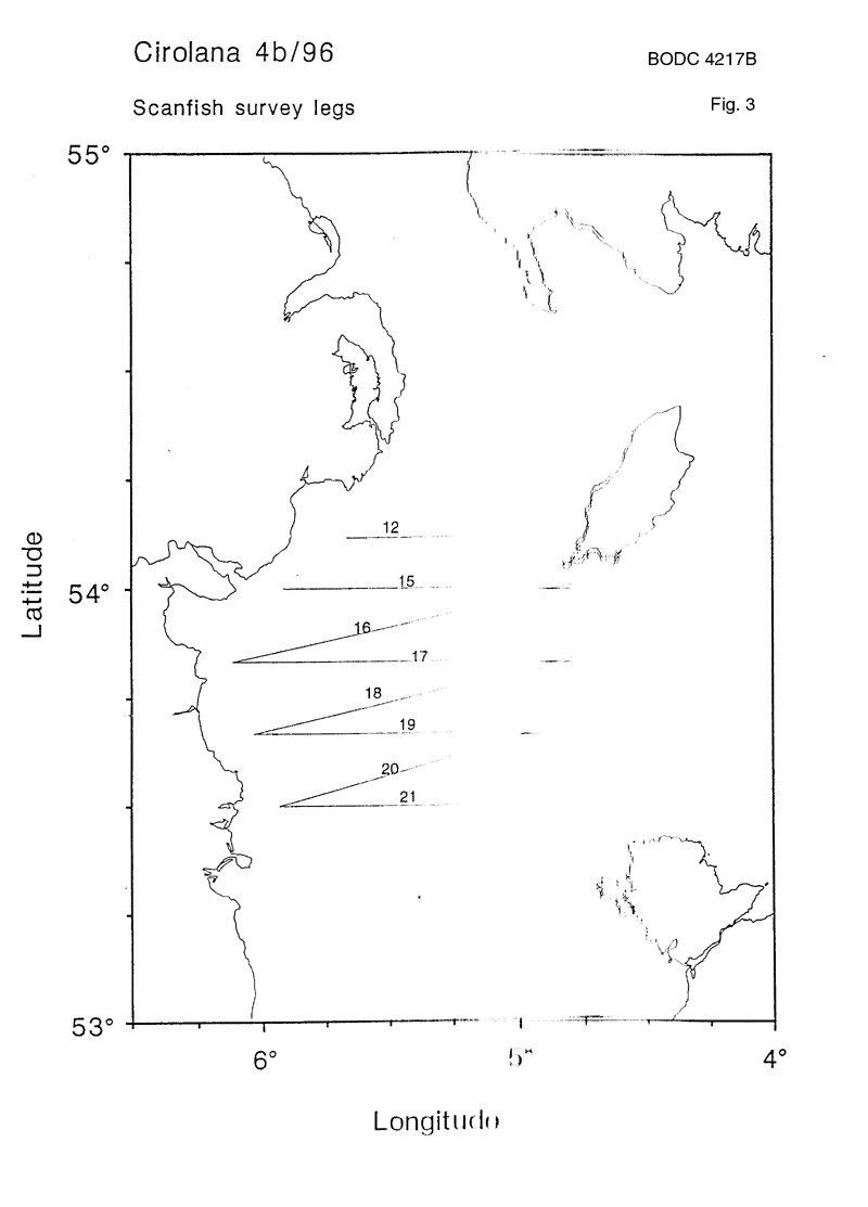
1. To carry out SCANFISH trials and a survey of the NW Irish Sea plus, if time and weather permit, extend this out to the Malin Shelf.
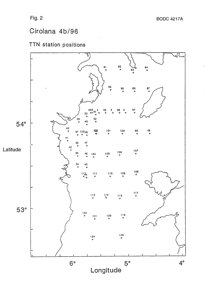
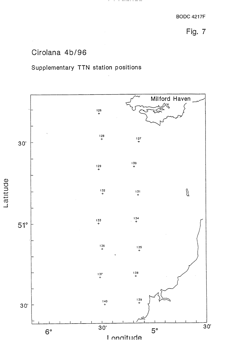
2. To collect simultaneous OPC (optical plankton counter) and net samples of plankton for comparison of size spectra. 3. To carry out a TTN (Tin Tow Net) grid of the NW Irish Sea. 4. To estimate primary and secondary production rates in different domains. 5. To maintain continuous records of T, S, chlorophyll and measure surface nutrient levels. 6. To deploy instruments at DANI mooring Station 45 (NW Irish Sea). 7. To recover ARGOS buoys deployed during the previous half of the cruise. 8. Following the Sea Empress oil spill, complete a TTN grid south from Milford Haven and across the Bristol Channel to provide an indication of egg and larvae distributions and enable comparison with previous years. |
| Ship | RV Cirolana |
| Departure Port | Liverpool, United Kingdom |
| Departure Date | 1996-04-12 |
| Arrival Port | Lowestoft, United Kingdom |
| Arrival Date | 1996-04-26 |
| Principal Scientist(s) | Juan Brown (Ministry of Agriculture, Fisheries and Food Lowestoft Fisheries Laboratory) |
| Responsible Organisation | Ministry of Agriculture, Fisheries and Food Lowestoft Fisheries Laboratory |
| Associated Project(s) | |
| IHB Sea Areas Visited | Irish Sea and St. George's Channel |
| Marsden Squares Visited | 181;1/181;2 |
| Work Area Description | Irish Sea and Bristol Channel |
| Unable to lookup cruise bounds at this time | |
| Work Area Bounding Polygon | |
| Southern Limit | unknown |
| Northern Limit | unknown |
| Western Limit | unknown |
| Eastern Limit | unknown |
Cruise Inventory Datasets
| Physical oceanography | |
|---|---|
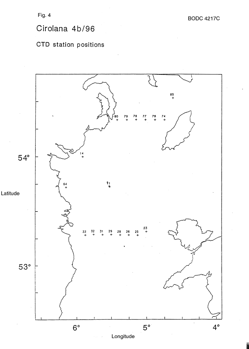
| CTD stations |
Quantity:
number of stations =
20
Description: |
| Other physical oceanographic measurements |
Quantity:
track kilometres =
583
Description: undulating CTD |
| Surface drifters/drifting buoys |
Quantity:
number of deployments =
4
Description: satellite-tracked buoys |
| Surface measurements underway (T,S) |
Quantity:
activity duration in days =
15
Description: continous |
| Water bottle stations |
Quantity:
number of stations =
129
Description: underway samples at 4m 1 with T only |
| Chemical oceanography | |
| Ammonia |
Quantity:
number of samples =
132
Description: 16 profiles and 116 underway samples at 4m |
| Nitrate |
Quantity:
number of samples =
143
Description: 16 profiles and 127 underway samples at 4m |
| Nitrite |
Quantity:
number of samples =
143
Description: 16 profiles and 127 underway samples at 4m |
| Phosphate |
Quantity:
number of samples =
143
Description: 16 profiles and 127 underway samples at 4m |
| Silicate |
Quantity:
number of samples =
143
Description: 16 profiles and 128 underway samples at 4m |
| Biology and fisheries | |
| Other biological/fisheries measurement | Description: primary/secondary production rates |
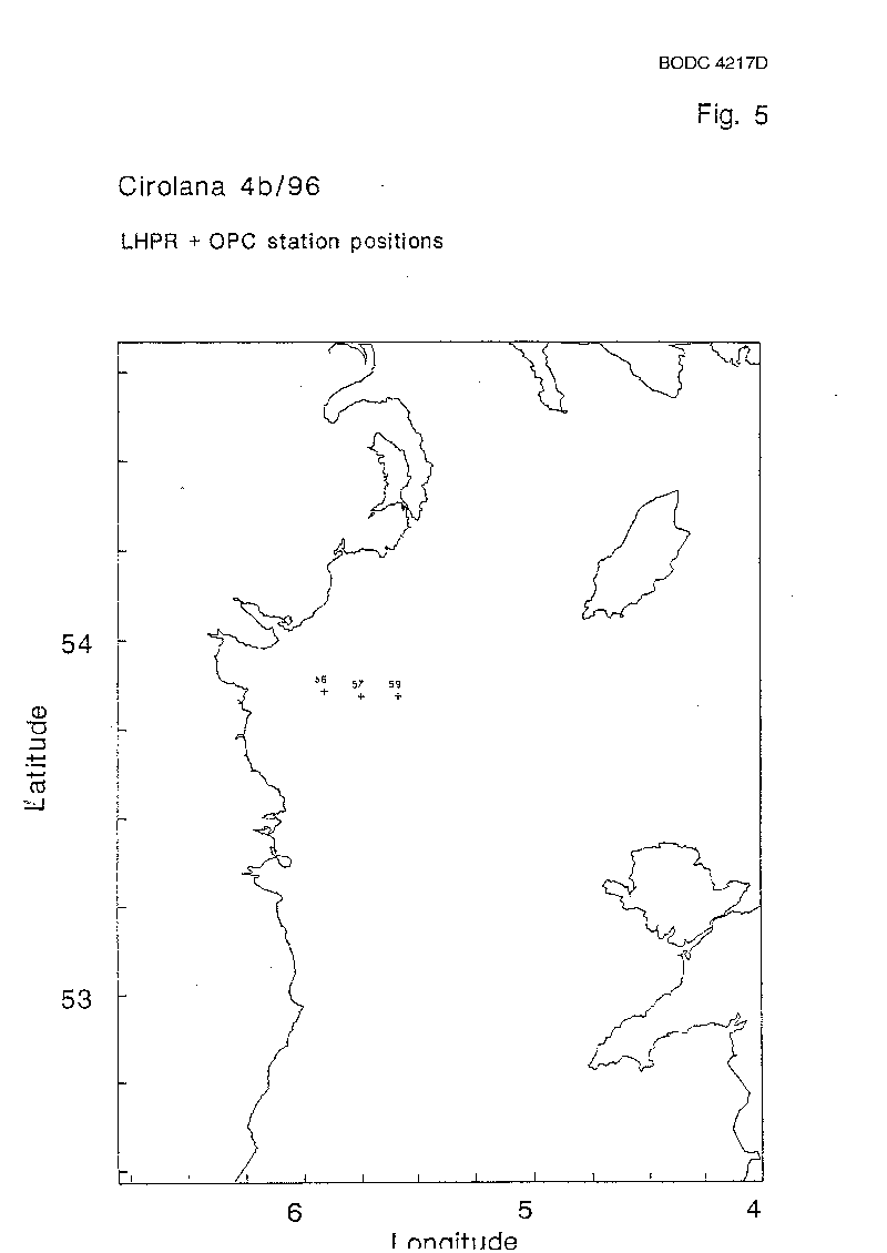
| Phytoplankton |
Quantity:
number of hauls =
74
Description: plankton survey |
| Phytoplankton pigs (eg chlorophyll, fluorescence) |
Quantity:
number of stations =
20
Description: |
| Zooplankton |
Quantity:
number of hauls =
74
Description: plankton survey |
Cruise Inventory Mooring/Buoy Operations
No information on datasets is currently available
Summary of BODC Data Holdings for the Cruise
National Oceanographic Database
Summary
| # Series | Instrument Description | Parameters |
|---|---|---|
| 1 | CTD/STD cast |
Salinity of the water column Temperature of the water column Vertical spatial coordinates |
| 15 | CTD/STD cast |
Concentration of suspended particulate material in the water column Salinity of the water column Temperature of the water column Transmittance and attenuance of the water column Vertical spatial coordinates |
Note: Parameter terms are taken from the BODC Parameter Discovery Vocabulary XML (SKOS)
Full List
| BODC Reference | Instrument Description | Date/Time | Location | |
|---|---|---|---|---|
| 599384 | CTD/STD cast | 1996-04-14 19:57Z | 53° 43' N, 5° 31' W | Click for more |
| 599396 | CTD/STD cast | 1996-04-15 17:09Z | 54° 0' N, 5° 55' W | Click for more |
| 599403 | CTD/STD cast | 1996-04-17 12:46Z | 53° 16' N, 5° 0' W | Click for more |
| 599415 | CTD/STD cast | 1996-04-17 13:51Z | 53° 16' N, 5° 7' W | Click for more |
| 599427 | CTD/STD cast | 1996-04-17 14:53Z | 53° 16' N, 5° 15' W | Click for more |
| 599439 | CTD/STD cast | 1996-04-17 16:06Z | 53° 16' N, 5° 22' W | Click for more |
| 599440 | CTD/STD cast | 1996-04-17 16:53Z | 53° 17' N, 5° 30' W | Click for more |
| 599452 | CTD/STD cast | 1996-04-17 18:04Z | 53° 17' N, 5° 37' W | Click for more |
| 599464 | CTD/STD cast | 1996-04-17 18:48Z | 53° 17' N, 5° 45' W | Click for more |
| 599476 | CTD/STD cast | 1996-04-17 19:34Z | 53° 16' N, 5° 52' W | Click for more |
| 599488 | CTD/STD cast | 1996-04-20 17:22Z | 54° 19' N, 4° 52' W | Click for more |
| 599507 | CTD/STD cast | 1996-04-20 18:14Z | 54° 19' N, 5° 1' W | Click for more |
| 599519 | CTD/STD cast | 1996-04-20 19:13Z | 54° 19' N, 5° 9' W | Click for more |
| 599520 | CTD/STD cast | 1996-04-20 20:09Z | 54° 19' N, 5° 16' W | Click for more |
| 599532 | CTD/STD cast | 1996-04-20 21:01Z | 54° 19' N, 5° 25' W | Click for more |
| 599544 | CTD/STD cast | 1996-04-21 04:06Z | 54° 31' N, 4° 37' W | Click for more |
Project Database
No data currently held for this cruise in the BODC Project Database
