Metadata Report for BODC Series Reference Number 1918053
Metadata Summary
Problem Reports
Data Access Policy
Narrative Documents
Project Information
Data Activity or Cruise Information
Fixed Station Information
BODC Quality Flags
SeaDataNet Quality Flags
Metadata Summary
Data Description |
|||||||||||||||||||||||||
|
|||||||||||||||||||||||||
Data Identifiers |
|||||||||||||||||||||||||
|
|||||||||||||||||||||||||
Time Co-ordinates(UT) |
|||||||||||||||||||||||||
|
|||||||||||||||||||||||||
Spatial Co-ordinates | |||||||||||||||||||||||||
|
|||||||||||||||||||||||||
Parameters |
|||||||||||||||||||||||||
|
|||||||||||||||||||||||||
|
|||||||||||||||||||||||||
Problem Reports
No Problem Report Found in the Database
Data Access Policy
Open Data
These data have no specific confidentiality restrictions for users. However, users must acknowledge data sources as it is not ethical to publish data without proper attribution. Any publication or other output resulting from usage of the data should include an acknowledgment.
If the Information Provider does not provide a specific attribution statement, or if you are using Information from several Information Providers and multiple attributions are not practical in your product or application, you may consider using the following:
"Contains public sector information licensed under the Open Government Licence v1.0."
Narrative Documents
Teledyne RDI's Workhorse Monitor ADCP
The Workhorse Monitor acoustic doppler current profler (Teledyne RD Instruments) is a long-range and long-term self contained ADCP. It has a patented four beam signal (300, 600 or 1200 kHz) and a standard depth rating of 200m or 600m. It operates effectively between temperatures of -5°C and 45°C and has a velocity accuracy of ±1% ±5mm/s.
JR16005 DynOPO CTD Data: Instrumentation
A Sea-Bird 911 plus CTD system was used on cruise JR16005. This was mounted on a SBE-32 carousel water sampler that was modified with four ChiPod instruments (two facing up, and two facing down) installed on the speed frame. The majority of the niskin bottles (1-6, and 13-24) were removed from the CTD frame in order to reduce the turbulence caused by the CTD to improve the quality of the ChiPods. The CTD was fitted with the following scientific sensors:
| Sensor unit | Serial Number | Calibration Date | Comments |
|---|---|---|---|
| Sea-Bird SBE 911plus CTD | 0458 | Whole cruise | |
| Paroscientific Digiquartz depth sensor | 0771 | 18/05/2016 | Whole cruise |
| Sea-Bird SBE 3plus (SBE 3P) temperature sensor 1 | 5623 | 19/05/2016 | Whole cruise |
| Sea-Bird SBE 3plus (SBE 3P) temperature sensor 2 | 4874 | 19/05/2016 | Whole cruise |
| Sea-Bird SBE 4C conductivity sensor 1 | 2813 / 4087 | 26/07/2016 / 20/05/2016 | 2813: Casts 001-003 / 4087: Casts 004-End |
| Sea-Bird SBE 4C conductivity sensor 2 | 3248 | 26/07/2016 | Whole cruise |
| Sea-Bird SBE 5T Pump 1 | 7966 / 2400 | 7966: Casts 001-092 / 2400: Cast 093-End | |
| Sea-Bird SBE 5T Pump 2 | 1807 | Whole cruise | |
| Sea-Bird SBE 35 Standards Thermometer | 0051 | 08/08/2016 | Whole cruise |
| WETLabs C-Star Transmissometer | CST-1505DR | 21/06/2016 | Whole cruise |
| Sea-Bird SBE 43 Dissolved Oxygen Sensor | 0620 / 0242 | 14/06/2016 / 25/05/2016 | 0620: Casts 001-039 / 0242: Casts 040-End |
| Biospherical QCP2350 photosynthetically active radiation (PAR) sensor | 70636 | 08/04/2016 | Whole cruise |
| Chelsea Technologies Group Aquatracka III fluorometer | 12-8513-003 | 26/04/2016 | Whole cruise |
| Tritech PA-200 Altimeter | 26993 | 04/05/2016 | Whole cruise |
| Teledyne RDI 300kHz Workhorse Monitor direct-reading ADCP Master | 14443 | Whole cruise | |
| Teledyne RDI 300kHz Workhorse Monitor direct-reading ADCP Slave | 14897 | Whole cruise | |
| CTD swivel linkage | 1961018 | Whole cruise | |
| Sea-Bird SBE 32 Pylon | 1106 | Whole cruise |
Some calibration dates are not available.
JR16005 Lowered Acoustic Doppler Current Profiler data: Originators Processing
Sampling Strategy
The LADCP was deployed on 85 CTD sampling stations and 10 Tow-yo stations during JR16005. CTD Sampling commenced on 20/03/2017 at 16:15 and ended on 01/05/2017 at 10:55. For all CTD casts, two RDI 300 kHz Workhorse Lowered Acoustic Doppler Current Profiler (LADCP) units were fitted to the CTD frame. The CTD frame holds one LADCP in a downward-facing (master) orientation and the other one upward facing (slave) orientation. Both LADCPs were configured to have 25 x 8 m bins, a 0 m blank-to-surface, one ping per ensembles and two ensembles per burst in narrowband mode. Further information on the LADCP instrument and configuration can be found on page 54 in the cruise report. In addition, deployment information can be found on pages 55 to 61.
The LADCP slave failed to record on three casts. These where casts 81, 92 and 95. According to page 40 of the cruise report, the issue appeared to be caused by a break/short circuit in the synchronisation lines linking the master and slave. The cables were removed from the master and slave, cleaned, had fresh silicone applied to it and the connectors were reinstalled. The 25 casts following cast 95 had no faults or failures on the slave or master.
Data Processing
All data were processed using the latest version of the Lamont-doherty Earth Observatory (LDEO) (IdeaIX) software which calculates velocity using an inverse method.
The binary files recorded by the instrument were downloaded onto the local computer after each cast. All data were processed using MATLAB code developed at LDEO. This package was also used to monitor the health of the beams on the instrument.
The originator compiled all 85 LADCP mounted CTD casts into a structure array containing downcast data. The tow-yo files were complied by the origionator into a separate structure array.
Further information on the LADCP processing can be found in pages 61 to 63 of the cruise report.
JR16005 Lowered Acoustic Doppler Current Profiler data: Processing by BODC
The LADCP data were supplied to BODC in a MATLAB .MAT file and the raw data files have also been supplied. The file contains an ladcp structure array, an ladcp_w structure array, a towyo structure array and a towyo_w structure array. Of these arrays, the ladcp structure array was processed as per the originator's instructions. The array contains the variables u,v,d for processing as outlined by the originator. These variables are the eastward and northward velocities and depth respectively. The ladcp array contains 85 separate LADCP mounted CTD upcast and downcast data.
The table below shows how the variables in the .MAT files were mapped to the appropriate BODC parameter codes.
| Originator's Parameter Name | Units | BODC Parameter Code | Units | Comments |
|---|---|---|---|---|
| d | m | ADEPZZ01 | m | - |
| u | m s-1 | LCEWLW01 | cm s-1 | Units converted by multiplying by 100. |
| v | m s-1 | LCNSLW01 | cm s-1 | Units converted by multiplying by 100. |
The reformatted data were visualised using the in-house EDSERPLO software. Suspect data were marked by adding any appropriate quality control flag, absent data were assigned the absent data value and flagged accordingly.
Project Information
Dynamics of Orkney Passage Outflow (DynOPO)
DynOPO is a five year research project that aims to understand how Antarctic Bottom Water is exported and modified through the Orkney Passage, the overflow's controlling dynamics, and its downstream impact on the Atlantic Ocean abyss.
Introduction
Mooring data collected for the DynOPO project are a component of a long term time series, in association with the Ocean Regulation of Climate by Heat and Carbon Sequestration and Transports (ORCHESTRA) project, led by Emily Shuckburgh (British Antarctic Survey) since 2016. The time series originally started out as part of the British Antarctic Survey's Long-Term Monitoring and Survey (LTMS) programme. Moorings were deployed on RRS James Clark Ross cruise JR20150309 (JR310 and JR272D) which ran from 09 March to 14 April 2015. RRS James Clark Ross cruise JR16005 ran from 17 March to 08 May 2017 and was the primary fieldwork element of the DynOPO project. The cruise had two main goals: (1) to conduct measurements of the hydrographic properties, velocity and turbulent processes of the Antarctic Bottom Water outflow along its pathway through the Orkney Passage region; and (2) to turn around a set of long-term moorings deployed in the area by British Antarctic Survey (BAS) and Lamont-Doherty Earth Observatory (LDEO) scientists, including recovery of additional instruments on some of the moorings deployed by JR20150309.
Project Collaborators
The project was led by the University of Southampton, and is an international collaboration with;
- UK: British Antarctic Survey (BAS), UK Meteorological Office, University of East Anglia and Newcastle University;
- Europe: University of Gothenburg (Sweden), University of Paris 6 (France);
- Australia: University of Tasmania;
- US: Lamont Doherty Earth Observatory, Woods Hole Oceanographic Institute, NOAA, University of California, Washington State University and Princeton University
Funding
The project was funded by the Natural Environment Research Council and ran from March 2015 to November 2018.
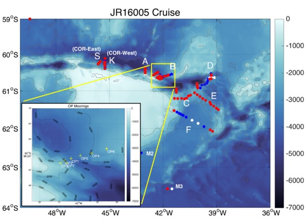
Data Activity or Cruise Information
Cruise
| Cruise Name | JR16005 |
| Departure Date | 2017-03-17 |
| Arrival Date | 2017-05-08 |
| Principal Scientist(s) | Alberto C Naveira Garabato (University of Southampton School of Ocean and Earth Science), Povl Abrahamsen (British Antarctic Survey) |
| Ship | RRS James Clark Ross |
Complete Cruise Metadata Report is available here
Fixed Station Information
No Fixed Station Information held for the Series
BODC Quality Control Flags
The following single character qualifying flags may be associated with one or more individual parameters with a data cycle:
| Flag | Description |
|---|---|
| Blank | Unqualified |
| < | Below detection limit |
| > | In excess of quoted value |
| A | Taxonomic flag for affinis (aff.) |
| B | Beginning of CTD Down/Up Cast |
| C | Taxonomic flag for confer (cf.) |
| D | Thermometric depth |
| E | End of CTD Down/Up Cast |
| G | Non-taxonomic biological characteristic uncertainty |
| H | Extrapolated value |
| I | Taxonomic flag for single species (sp.) |
| K | Improbable value - unknown quality control source |
| L | Improbable value - originator's quality control |
| M | Improbable value - BODC quality control |
| N | Null value |
| O | Improbable value - user quality control |
| P | Trace/calm |
| Q | Indeterminate |
| R | Replacement value |
| S | Estimated value |
| T | Interpolated value |
| U | Uncalibrated |
| W | Control value |
| X | Excessive difference |
SeaDataNet Quality Control Flags
The following single character qualifying flags may be associated with one or more individual parameters with a data cycle:
| Flag | Description |
|---|---|
| 0 | no quality control |
| 1 | good value |
| 2 | probably good value |
| 3 | probably bad value |
| 4 | bad value |
| 5 | changed value |
| 6 | value below detection |
| 7 | value in excess |
| 8 | interpolated value |
| 9 | missing value |
| A | value phenomenon uncertain |
| B | nominal value |
| Q | value below limit of quantification |
