- Resources
- Products
- Data
- External products
- Celtic seas
In this section
Celtic seas bathymetry

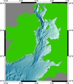
The Centre for Environment, Fisheries and Aquaculture Science (CEFAS) has produced a 1 km by 1 km gridded bathymetry data set for the Irish Sea, Celtic Sea and North Channel areas. The work was funded by the then Department for Transport and the Regions (DETR), contract reference CW0753, with the condition that the data be made available via BODC.
The data are stored in a simple ASCII format and are distributed by BODC via ftp download.
The data set is available free of charge for academic research purposes only.
To order the data set please download, fill in and return our order form and academic user data licence agreement form.
Compilation of the Celtic seas bathymetry
The data set is based largely on data taken from Admiralty fair sheets or, where these data were not available, from Admiralty Charts from the UK Hydrographic Office. The data from these sources were adjusted for the state of the tide from Lowest Astronomical Tide to Mean Sea Level. The gridded values are at intervals of 30 seconds of latitude and one minute of longitude.
A full account of the data sources used in the preparation of the data
set can be found in the accompanying documentation. A copy of the documentation
is available here. ![]() (2.5 MB)
(2.5 MB)


