- Resources
- Help and hints
- Errata
- GEBCO
- GEBCO one min
In this section
- Errata
- ARABESQUE CDROM
- Biogeochemical Ocean Flux Study (BOFS) North Atlantic Data Set CDROM
- GEBCO 30 arc-second grid bathymetric data set
- GEBCO One Minute Grid bathymetric data set
- Land-Ocean Interaction Study — Shelf Edge Study (LOIS SES) CDROM
- Land-Ocean Interaction Study — Rivers, Atmosphere and Coasts (LOIS RACS) CDROM
- North Sea Project CDROM
- Ocean Margin Exchange phase I (OMEX I) CDROM
- PROcesses of Vertical Exchange in Shelf Seas (PROVESS) CDROM
GEBCO bathymetric data sets — GEBCO One Minute Grid

The information on this page relates to reported problems for the GEBCO One Minute Grid. The grid was first published in April 2003 and version 2.0 was released in November 2008. Follow the links below for more information.
- A table of reported problems in the GEBCO One Minute Grid
- Grid patches and grid patch software for version 1.0 of the GEBCO One Minute Grid
The following grid patches are available for download for version 1.0 of the GEBCO One Minute Grid. Please note that these bugs have been fixed in version 2.0 of the grid.
Fixes to problems associated with the CDROM interface software are provided in our software update section.
If you find any bugs in the GEBCO Digital Atlas data sets that are not reported on this page then please contact Pauline Weatherall the GEBCO Digital Atlas manager.
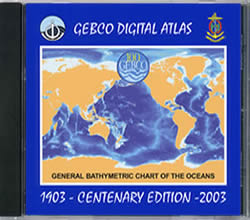
The GEBCO One Minute Grid is included as part of the Centenary Edition of the GEBCO Digital Atlas.
Reported problems for the GEBCO One Minute Grid
Please note that the GEBCO One Minute Grid is based largely on the bathymetric contours contained within the GEBCO Digital Atlas. Generally, the shallowest contours are either at a depth of 100 m or 200 m, i.e. it is essentially a deeper water data set and does not include detailed bathymetry for shallow shelf waters.
When building the grid, additional information was used in some shallow water areas and semi-enclosed seas, largely to help constrain the gridding process and to prevent overshoots. Users should be aware of this when using the data set in shallower water regions and proceed with caution.
The bugs reported for the Hudson Bay area and region off the west coast of Africa have been fixed in version 2.0 of the GEBCO One Minute Grid, released in November 2008.
For ease, the reported problems have been divided into the following areas
North Atlantic | South Atlantic | North Pacific | South Pacific | Indian Ocean | Mediterranean Sea | Other areas
| North Atlantic | ||
|---|---|---|
| Specific area | Problem(s) reported | Grid patches |
| Northeast Atlantic | i. Depths greater than 3000 m are shown between the 2900 m and 3000 m bathymetric contours in the region 14°W to 12°W, 54°N to 55°N. This 'hole' is the result of the gridding algorithm allowing the surface to overshoot the deepest contour in the region. ii. There is a line of discontinuity in the gridded data set from 10°W to 5°E at 65°N. |
Not yet available |
| Hudson Bay area | i. There is a line of discontinuity in the gridded data set from 90°W to 77°W at 60°N. ii. There is a line of discontinuity in the gridded data set from 60°N to 51°N at 80°W. Please note that this bug has been fixed in version 2.0 of the GEBCO One Minute Grid. |
Grid patch 1 |
| Around the Azores | i. Within the Azores Archipelago area, 29°W to 24° 54'W, 39° 3'N to 36° 47'N there is a discrepancy between the position of the coastline included in the digital bathymetric contour data set and the coastline used in the development of the GEBCO One Minute Grid. In some areas in this region, this has led to a number of nodes being wrongly assigned to a value above zero. |
Not yet available |
| South Atlantic | ||
| Specific area | Problem(s) reported | Grid patches |
| Off the west coast of Africa | i. There is a line of discontinuity in the gridded data set between 13°E and 13°30'E at 10°S. Please note that this bug has been fixed in version 2.0 of the GEBCO One Minute Grid. |
Grid patch 2 |
| North Pacific | ||
| Specific area | Problem(s) reported | Grid patches |
| No problems reported | ||
| South Pacific | ||
| Specific area | Problem(s) reported | Grid patches |
| Arafura Sea | i. A number of nodes have been erroneously set to a value of 1 m in the shallower water regions of the Gulf of Carpentaria in the region 15°S 136° 35'E. |
Not yet available |
| Coral Sea | i. There is a line of discontinuity in the gridded data set from 158°E to 159°E at 20°S. Grid nodes on the top of bank features in the region of the Lord Howe Seamount Chain have been set to a single value, giving a 'flat topped' effect to the feature. This occurs for Capel Bank, Kelso Bank, Argo Bank and Nova Bank (from 158° 40'E, 20°S to 159° 36'E, 25° 31'S) and for Lansdowne Bank at 161°E, 20°S. ii. There is a line of discontinuity in the gridded data set from 9°S to 12°S at 142°E |
Not yet available |
| North of New Zealand | i. There is a line of discontinuity in the gridded data set from 160°E to 180°E at 30°S. |
Not yet available |
| Indian Ocean | ||
| Specific area | Problem(s) reported | Grid patches |
| Straits of Hormuz | i. There is a line of discontinuity in the gridded data set at approximately 57°E, 26°N. |
Not yet available |
| Mediterranean Sea | ||
| Specific area | Problem(s) reported | Grid patches |
| No problems reported | ||
| Other areas | ||
| Specific area | Problem(s) reported | Grid patches |
| Caspian Sea | i. North of 40°N there are errors in the grid in the Caspian Sea region. ii. A discontinuity is shown along a line at 40°N between approximately 47°E and 53°E in this region. |
Not yet available |
| Celtic Sea — Southwest of the Isles of Scilly | i. There is a line of discontinuity in the grid at 49° 30'N between 8° 6'W and 7°W. ii. In the region 49° 30'N - 50°N between 8° 30'W and 5° 32'W there are a number of erroneous positive and negative features shown in the grid. |
Not yet available |
Grid patches for version 1.0 of the GEBCO One Minute Grid
To fix some of the bugs reported in the global grid file we have made available a series of grid patches. These netCDF patches are sections of grid file which correct the GEBCO One Minute Grid for a particular geographic area. The patches are made available under the same terms and conditions as the data sets contained within the GEBCO Digital Atlas.
We are providing software, designed to run in a Microsoft Windows environment, to apply the patches to the global GEBCO One Minute Grid file. The software will overwrite your copy of the grid file with the grid patch. You must make backups yourself, if required, before applying the patch as backups are not automated in the patching process.
Version 1.0 of the GEBCO One Minute Grid was released with the Centenary Edition of the GEBCO Digital Atlas CDROM set. During the patching process the version number of your grid file will be updated. To ensure correct versioning you must apply all available grid patches in the order supplied below.
Please read the user guide before applying the grid patch. ![]() (162 KB)
(162 KB) ![]() (114 KB)
(114 KB)
Grid patch software
Download the grid patch software — gebco_gridfix.exe (1545 KB)
Available grid patches for version 1.0 of the GEBCO One Minute Grid
1. Hudson Bay area
This patch fixes two lines of discontinuity in the grid from 90°W to 77°W at 60°N and from 60°N to 51°N at 80°W. The patch file is in netCDF and covers the area 94°W to 76°W; 50°N to 61°N. The data file is supplied in the form of a self-extracting compressed file. The uncompressed grid file is approximately 1397 KB in size.
Download the grid patch file gebco_gridpatch1.exe (480 KB)
Once this grid patch is applied your copy of the GEBCO One Minute Grid will be updated to version 1.01.
Please note that this bug has been fixed in version 2.0 of the GEBCO One Minute Grid.
2. Off the west coast of Africa
This patch fixes a line of discontinuity in the gridded data set between 13°E and 13°30'E at 10°S. The patch file is in netCDF and covers the area 12°E to 15°E; 11°S to 8°S. The data file is supplied in the form of a self-extracting compressed file. The uncompressed grid file is approximately 65 KB in size.
Download the grid patch file gebco_gridpatch2.exe (72 KB).
Once this grid patch is applied your copy of the GEBCO One Minute Grid will be updated to version 1.02.
Please note that this bug has been fixed in version 2.0 of the GEBCO One Minute Grid.


