Metadata Report for BODC Series Reference Number 2222367
Metadata Summary
Problem Reports
Data Access Policy
Narrative Documents
Project Information
Data Activity or Cruise Information
Fixed Station Information
BODC Quality Flags
SeaDataNet Quality Flags
Metadata Summary
Data Description |
|||||||||||||||||||||||||||||||||||||||||||||||||||||||||||||
|
|||||||||||||||||||||||||||||||||||||||||||||||||||||||||||||
Data Identifiers |
|||||||||||||||||||||||||||||||||||||||||||||||||||||||||||||
|
|||||||||||||||||||||||||||||||||||||||||||||||||||||||||||||
Time Co-ordinates(UT) |
|||||||||||||||||||||||||||||||||||||||||||||||||||||||||||||
|
|||||||||||||||||||||||||||||||||||||||||||||||||||||||||||||
Spatial Co-ordinates | |||||||||||||||||||||||||||||||||||||||||||||||||||||||||||||
|
|||||||||||||||||||||||||||||||||||||||||||||||||||||||||||||
Parameters |
|||||||||||||||||||||||||||||||||||||||||||||||||||||||||||||
|
|||||||||||||||||||||||||||||||||||||||||||||||||||||||||||||
|
|||||||||||||||||||||||||||||||||||||||||||||||||||||||||||||
Problem Reports
No Problem Report Found in the Database
Data Access Policy
Open Data
These data have no specific confidentiality restrictions for users. However, users must acknowledge data sources as it is not ethical to publish data without proper attribution. Any publication or other output resulting from usage of the data should include an acknowledgment.
If the Information Provider does not provide a specific attribution statement, or if you are using Information from several Information Providers and multiple attributions are not practical in your product or application, you may consider using the following:
"Contains public sector information licensed under the Open Government Licence v1.0."
Narrative Documents
Teledyne RDI Workhorse Sentinel 600 kHz Acoustic Doppler Current Profiler (ADCP)
The Workhorse Sentinel is a self-contained ADCP that can be used either on a mooring or mounted in the hull of a moving vessel. Its 4-beam design provides a redundant data source (in case of a blocked or damaged beam), an independent data quality measure (error velocity) and reduces the variance in data, thereby improving data reliability, quality and accuracy.
Real-time data can be transmitted to shore via a cable link or acoustic modem or they can be stored internally. Sensors for bottom tracking, pressure and directional wave measurements can be added to the instrument and a special casing is available for deeper applications.
Specifications
| Typical range | 50 m |
| Number of depth cells | 1 to 128 |
| Typical ping rate | 2 Hz |
| Standard depth rating | 200 to 6000 m |
| Beam angle | 20 ° |
| Echo intensity profile | |
| Dynamic range | 80 dB |
| Precision | ± 1.5 dB |
| Velocity | |
| Accuracy | 0.3% of the water velocity relative to the ADCP ± 0.3 cm s-1 |
| Resolution | 0.1 cm s-1 |
| Range | ± 5 m s-1 (default) ± 20 m s-1 (maximum) |
| Vertical resolution | Range / Std Dev |
| for 0.5 m | 39 m / 12.9 cm s-1 |
| for 1 m | 43 m / 6.1 cm s-1 |
| for 2 m | 47 m / 3.0 cm s-1 |
| for 4 m | 52 m / 2.0 cm s-1 |
| Long Range mode | |
| Range | 70 m |
| Depth cell size | 4 m |
| Std Deviation | 4.2 cm s-1 |
| Temperature | |
| Operating temp. | -5 to 45 °C |
| Precision | ± 0.4 °C |
| Resolution | 0.01 °C |
| Tilt | |
| Range | ± 15 ° |
| Accuracy | ± 0.5 ° |
| Precision | ± 0.5 ° |
| Resolution | 0.01 ° |
| Compass | |
| Accuracy | ± 2 ° |
| Resolution | 0.01 ° |
| Maximum tilt | ± 15 ° |
| Precision | ± 0.5 ° |
Further details can be found in the manufacturer's specification sheet.
Processing by BODC of Moored ADCP data at the Whittard Canyon
The data arrived at BODC in .txt format containing data collected from three 75kHz downward-looking Acoustic Doppler Current Profilers (ADCPs) and three 600 kHz upward-looking ADCPs deployed on the Whittard mooring during cruises DY103, DY116 and DY130. The data were reformatted to BODC's internal NetCDF format. The following table shows the mapping of the variables received to appropriate BODC parameter codes:
| Originator's Variable | Originator's Units | BODC Parameter Code | BODC Units | Comment |
|---|---|---|---|---|
| Ens | Counts | PNGCNT01 | Counts | - |
| YR | Years | AADYAA01 | Years | Combined with MO and DA to form a date during transfer |
| MO | Months | AADYAA01 | Months | Combined with YR and DA to form a date during transfer |
| DA | Days | AADYAA01 | Days | Combined with YY and MM to form a date during transfer |
| HH | Hours | AAFDZZ01 | Hours | Combined with MM and SS to form a time during transfer |
| MM | Minutes | AAFDZZ01 | Minutes | Combined with YY and MM to form a date during transfer |
| SS | Seconds | AAFDZZ01 | Seconds | Combined with HH and MM to form a date during transfer |
| Pit | Degrees | - | - | Ancillary data not transferred, available upon request |
| Rol | Degrees | - | - | Ancillary data not transferred, available upon request |
| Hea | Degrees | - | - | Ancillary data not transferred, available upon request |
| Tem | degC | TEMPPR01 | degC | - |
| Dep | Metres | DBINAA01 | Metres | - |
| Ori | Degrees | - | - | Ancillary data not transferred, available upon request |
| BIT | Counts | - | - | Data not transferred, available upon request |
| Bat | Counts | - | - | Data not transferred, available upon request |
| EA1 | Counts | ASAMAP00 | Decibels | - |
| EA2 | Counts | ASAMAP02 | Decibels | - |
| EA3 | Counts | ASAMAP03 | Decibels | - |
| EA4 | Counts | ASAMAP04 | Decibels | - |
| EAV | Counts | ASAMAPAV | Decibels | - |
| Eas | mm/s | LCEWAP01 | cm/s | Conversion from mm/s to cm/s (/10) |
| Nor | mm/s | LCNSAP01 | cm/s | Conversion from mm/s to cm/s (/10) |
| Ver | mm/s | LRZAAP01 | cm/s | Conversion from mm/s to cm/s (/10) |
| Err | mm/s | LERRAP01 | cm/s | Conversion from mm/s to cm/s (/10) |
| Mag | mm/s | LCSAAP01 | cm/s | Conversion from mm/s to cm/s (/10) |
Channels that were not transferred are available in the originator's format upon request.
The reformatted data were visualised using the in-house EDSERPLO software. Suspect data were marked by adding an appropriate quality control flag, and missing data were set to an appropriate value and flagged. The DY130 moored 600 kHz ADCP series was split by year to reduce file size.
Processing by Originator of Whittard Canyon Mooring 75kHz and 600 kHz ADCP data for RRS Discovery Cruises DY103, DY116 and DY130
Upward Looking 75 kHz ADCP setup
An upward looking 75 kHz 4-beam Teledyne Workhorse Long Range Acoustic Doppler Current Profiler (ADCP) was deployed on a single-point mooring at Whittard Canyon during RRS Discovery cruises DY103, DY116, and DY130. Data were processed from raw .000 files in WinADCP, outputting only data that includes water column measurements. The ADCP was deployed and data were recorded for each cruise as follows:
| Variable | Deployment DY103 | Deployment DY116 | Deployment DY130 |
|---|---|---|---|
| Instrument | 75kHz 4-beam Teledyne Workhorse Long Range | 75kHz 4-beam Teledyne Workhorse Long Range | 75kHz 4-beam Teledyne Workhorse Long Range |
| Serial Number | 22791 | 5575 | 22791 |
| Deployment location | Whittard Canyon 48.626° N, 10.004° W | Whittard Canyon 48.626° N, 10.004° W | Whittard Canyon 48.626° N, 10.004° W |
| Deployment start date/time (dd/mm/yyyy hh:mm:ss) | 08/07/2019 06:22:00 | 13/11/2020 12:05:00 | 29/03/2021 11:58:00 |
| Deployment end date/time (dd/mm/yyyy hh:mm:ss) | 12/11/2020 11:35:00 | 29/03/2021 09:53:00 | 02/05/2022 15:38:00 |
| Instrument depth | 1546 m | 1535 m | 1546 m |
| System specific frequency | 66.8 kHz | 66.8 kHz | 66.8 kHz |
| Processing software | WinADCP | WinADCP | WinADCP |
| Seafloor depth | 1577 m | 1577 m | 1577 m |
| Ensemble interval | 871 seconds | 1800 seconds | 663 seconds |
| Ping interval | 02:30:00 | 00:05:00 | 00:05:00 |
| Pings per ensemble | 12 | 20 | 10 |
| Data quality comments | None noted by originator | None noted by originator | None noted by originator |
Downward Looking 600 kHz ADCP setup
A downward looking 600 kHz 4-beam Teledyne Workhorse Acoustic Doppler Current Profiler (ADCP) was deployed on a single-point mooring at Whittard Canyon during RRS Discovery cruises DY103, DY116, and DY130. Data were processed from raw .000 files in WinADCP, outputting only data that includes water column measurements. The ADCP was deployed and data were recorded for each cruise as follows:
| Variable | Deployment DY103 | Deployment DY116 | Deployment DY130 |
|---|---|---|---|
| Instrument | 600 kHz 4-beam Teledyne Workhorse | 600 kHz 4-beam Teledyne Workhorse | 600 kHz 4-beam Teledyne Workhorse |
| Serial Number | 21071 | 21072 | 2107 |
| Deployment location | Whittard Canyon 48.626° N, 10.004° W | Whittard Canyon 48.626° N, 10.004° W | Whittard Canyon 48.626° N, 10.004° W |
| Deployment start date/time (dd/mm/yyyy hh:mm:ss) | 08/07/2019 06:22:00 | 13/11/2020 12:05:00 | 29/03/2021 11:58:00 |
| Deployment end date/time (dd/mm/yyyy hh:mm:ss) | 12/11/2020 11:35:00 | 29/03/2021 09:53:00 | 02/05/2022 15:38:00 |
| Recovery Cruise | RRS Discovery DY116 | RRS Discovery DY130 | RRS James Cook JC231 |
| Instrument depth | 1552 m | 1540 m | 1552 m |
| System specific frequency | 614.4 kHz | 614.4 kHz | 614.4 kHz |
| Processing software | WinADCP | WinADCP | WinADCP |
| Seafloor depth | 1577 m | 1577 m | 1577 m |
| Ensemble interval | 130 seconds | 180 seconds | 29 seconds |
| Ping interval | 00:04:00 | 00:00:05 | 00:00:04 |
| Pings per ensemble | 75 | 10 | 23 |
| Data quality comments | Occasional blanking of data where either fast speeds (>3 m/s) and/or high suspended sediment occurred which created localised and short-lived attenuation of the ADCP data. | Occasional blanking of data where either fast speeds (>3 m/s) and/or high suspended sediment occurred which created localised and short-lived attenuation of the ADCP data. | Occasional blanking of data where either fast speeds (>3 m/s) and/or high suspended sediment occurred which created localised and short-lived attenuation of the ADCP data. |
Additional information on mooring deployments can be found in the DY103, DY116, DY130 and JC231 cruise reports.
Project Information
Marine LTSS: CLASS (Climate Linked Atlantic Sector Science)
Introduction
CLASS is a five year (2018 to 2023) programme, funded by the Natural Environment Research Council (NERC) and extended until March 2024.
Scientific Rationale
The ocean plays a vital role in sustaining life on planet Earth, providing us with both living resources and climate regulation. The trajectory of anthropogenically driven climate change will be substantially controlled by the ocean due to its absorption of excess heat and carbon from the atmosphere, with consequent impacts on ocean resources that remain poorly understood. In an era of rapid planetary change, expanding global population and intense resource exploitation, it is vital that there are internationally coordinated ocean observing and prediction systems so policy makers can make sound evidence-based decisions about how to manage our interaction with the ocean. CLASS will underpin the UK contribution to these systems, documenting and understanding change in the marine environment, evaluating the impact of climate change and effectiveness of conservation measures and predicting the future evolution of marine environments. Over the five-year period CLASS will enhance the cost-effectiveness of observing systems by migrating them towards cutting edge autonomous technologies and developing new sensors. Finally, CLASS will create effective engagement activities ensuring academic partners have transparent access to NERC marine science capability through graduate training partnerships and access to shipborne, lab based and autonomous facilities, and modelling capabilities.
Data Activity or Cruise Information
Data Activity
| Start Date (yyyy-mm-dd) | 2021-03-29 |
| End Date (yyyy-mm-dd) | 2022-05-02 |
| Organization Undertaking Activity | National Oceanography Centre, Southampton |
| Country of Organization | United Kingdom |
| Originator's Data Activity Identifier | WCM_032021 |
| Platform Category | subsurface mooring |
Whittard Canyon Mooring - March 2021 Instrument Rig Configuration: WCM_032021
This rig was deployed as a contribution to the Climate Linked Atlantic Section Science (CLASS) project's sustained observations and marine protected area studies, supported by the UK Natural Environment Research Council (grant number NE/R015953/1).
| Deployment cruise | RRS Discovery Cruise DY130 |
|---|---|
| Recovery cruise | RRS Discovery Cruise JC231 |
| Rig position | 48.626°N 9.996°W |
| Water depth | 1577 m |
| Deployment date | 29 March 2021 |
| Recovery date | 02 May 2022 |
The Whittard Canyon mooring deployed on DY130 was anchored by a 1T Sinker and kept buoyant with 3 glass spheres.
Instruments deployed on the rig
| Instrument | Serial Number | Nominal Depth |
|---|---|---|
| Sea-Bird SBE 37-SMP MicroCAT CTD | 7298 | 1512 m |
| Teledyne RDI Workhorse Long-Ranger ADCP 75 kHz ADCP | 22791 | 1546 m |
| Teledyne RDI Workhorse Sentinel 600 kHz ADCP | 2107 | 1552 m |
| McLane Parflux 78H-21 Sediment Trap | 111804-06 | 1565 m |
| Sea-Bird SBE 37-SMP MicroCAT CTD | 7297 | 1570 m |
Upon recovery of the two MicroCAT sensors during the RRS James Cook JC231 cruise, it was noted that Sea-Bird SBE 37 SN: 7297 was not logging data due to depleted battery pack. Sea-Bird SBE 37 SN: 7297 instrument had a sample interval of 10s rather than the expected interval of 1800s, causing battery pack depletion. The Sea-Bird SBE 37 SN: 7298 was still logging data upon recovery at an interval of 1800s. The data passed to BODC for Sea-Bird SBE 37 SN: 7297 had a sampling interval of 10 seconds, and ended on 7th April 2021 09:40:03 due to battery pack depletion.
Related Data Activity activities are detailed in Appendix 1
Cruise
| Cruise Name | DY130 |
| Departure Date | 2021-03-25 |
| Arrival Date | 2021-04-14 |
| Principal Scientist(s) | Susan E Hartman (National Oceanography Centre, Southampton) |
| Ship | RRS Discovery |
Complete Cruise Metadata Report is available here
Fixed Station Information
Fixed Station Information
| Station Name | Whittard Canyon - The Canyons Marine Conservation Zone |
| Category | Offshore area |
| Latitude | 48° 6.00' N |
| Longitude | 10° 18.00' W |
| Water depth below MSL | 3600.0 m |
Fixed Station - Whittard Canyon - The Canyons Marine Conservation Zone
The Canyons MCZ is located in the far south-west corner of the UK continental shelf, more than 330 km from Land's End, Cornwall. It encompasses the steep part of the shelf break where the seabed drops from a depth of 100 m to the oceanic abyssal plain at 2000 m. It is unique within the context of England's largely shallow seas due to its depth, sea-bed topography and the coral features it contains.
There are two large canyons within the site, which add to its topographic complexity: the Explorer Canyon to the north and the Dangaard Canyon below it. The wider Whittard Canyon area encapsulates the Canyons MCZ and also includes a network of submarine canyons to the West. The MCZ, also known as a Marine Protected Area (MPA), was designated in November 2013 under the Marine and Coastal Access Act (2009). The Canyons MCZ covers an area of 661 km2, which extends to approximately 5200 km2 when Whittard Canyon is included.
On the northernmost wall of the Explorer Canyon is a patch of live Cold-water coral reef (Lophelia pertusa) and Coral gardens, both of which are a OSPAR threatened and/or declining habitat. This is the only known example of living Cold-water coral reef recorded within England's seas, making it unique in these waters.
Cold-water corals and Coral gardens typically support a range of other organisms. The coral provides a three-dimensional structure and a variety of microhabitats that provide shelter and an attachment surface for other species. Both Cold-water corals and Coral gardens can be long-lived but are extremely slow growing (at about 6 mm a year), making protection important for their conservation. Another reef-forming cold-water coral, Madrepora oculata, is also present in the site.
The variety of deep-sea bed communities present are indicative of the range of substrates found in and around the canyons, including bedrock, biogenic reef, coral rubble, coarse sediment, mud and sand. These biological communities include cold-water coral communities (Lophelia pertusa and Madrepora oculata), Coral gardens, feather star (Leptometra celtica) assemblages and Sea-pen and burrowing megafauna communities (including, burrowing anemone fields, squat lobster (Munida sp.) assemblages, barnacle assemblages and deep-sea sea-pen (Kophobelemnon sp.) fields).
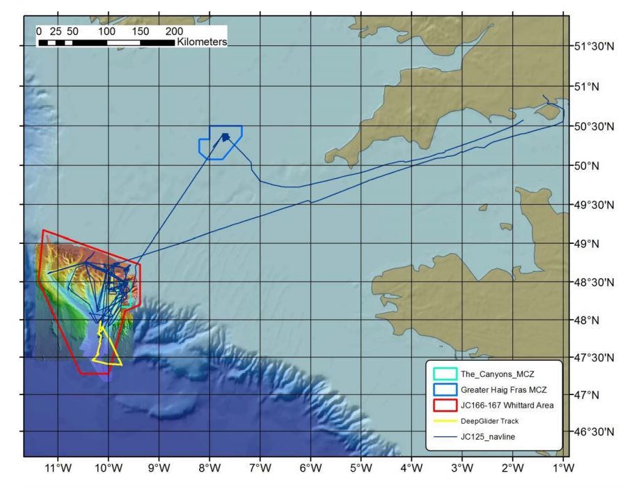
Sampling History
| JC035 (2009) | JC125 (2015) | JC166/7 (2018) | |
|---|---|---|---|
| ROV video/photography | Y | Y | Y |
| AUV video/photography | N | Y | Y |
| Shipboard Multibeam Bathymetry | Y | Y | Y |
| AUV Multibeam Bathymetry | N | Y | Y |
| AUV Sidescan Sonar | N | Y | Y |
| TOBI Sidescan Sonar | Y | Y | Y |
| ROV vibrocorer | N | Y | N |
| CTD casts | N | Y | N |
| SAPS | N | Y | N |
Related Fixed Station activities are detailed in Appendix 2
BODC Quality Control Flags
The following single character qualifying flags may be associated with one or more individual parameters with a data cycle:
| Flag | Description |
|---|---|
| Blank | Unqualified |
| < | Below detection limit |
| > | In excess of quoted value |
| A | Taxonomic flag for affinis (aff.) |
| B | Beginning of CTD Down/Up Cast |
| C | Taxonomic flag for confer (cf.) |
| D | Thermometric depth |
| E | End of CTD Down/Up Cast |
| G | Non-taxonomic biological characteristic uncertainty |
| H | Extrapolated value |
| I | Taxonomic flag for single species (sp.) |
| K | Improbable value - unknown quality control source |
| L | Improbable value - originator's quality control |
| M | Improbable value - BODC quality control |
| N | Null value |
| O | Improbable value - user quality control |
| P | Trace/calm |
| Q | Indeterminate |
| R | Replacement value |
| S | Estimated value |
| T | Interpolated value |
| U | Uncalibrated |
| W | Control value |
| X | Excessive difference |
SeaDataNet Quality Control Flags
The following single character qualifying flags may be associated with one or more individual parameters with a data cycle:
| Flag | Description |
|---|---|
| 0 | no quality control |
| 1 | good value |
| 2 | probably good value |
| 3 | probably bad value |
| 4 | bad value |
| 5 | changed value |
| 6 | value below detection |
| 7 | value in excess |
| 8 | interpolated value |
| 9 | missing value |
| A | value phenomenon uncertain |
| B | nominal value |
| Q | value below limit of quantification |
Appendix 1: WCM_032021
Related series for this Data Activity are presented in the table below. Further information can be found by following the appropriate links.
If you are interested in these series, please be aware we offer a multiple file download service. Should your credentials be insufficient for automatic download, the service also offers a referral to our Enquiries Officer who may be able to negotiate access.
| Series Identifier | Data Category | Start date/time | Start position | Cruise |
|---|---|---|---|---|
| 2206761 | Hydrography time series at depth | 2021-03-29 12:10:33 | 48.626 N, 9.996 W | RRS Discovery DY130 |
| 2206773 | Hydrography time series at depth | 2021-03-29 12:13:06 | 48.626 N, 9.996 W | RRS Discovery DY130 |
| 2222355 | Currents -subsurface Eulerian | 2021-03-29 12:24:51 | 48.626 N, 9.996 W | RRS Discovery DY130 |
| 2222379 | Currents -subsurface Eulerian | 2022-01-01 00:25:32 | 48.626 N, 9.996 W | RRS Discovery DY130 |
Appendix 2: Whittard Canyon - The Canyons Marine Conservation Zone
Related series for this Fixed Station are presented in the table below. Further information can be found by following the appropriate links.
If you are interested in these series, please be aware we offer a multiple file download service. Should your credentials be insufficient for automatic download, the service also offers a referral to our Enquiries Officer who may be able to negotiate access.
| Series Identifier | Data Category | Start date/time | Start position | Cruise |
|---|---|---|---|---|
| 2026920 | Bathymetry | 2009-06-09 00:00:00 | 47.1792 N, 11.2483 W | RRS James Cook JC035 |
| 2026932 | Bathymetry | 2009-06-09 00:00:00 | 48.4273 N, 11.2343 W | RRS James Cook JC035 |
| 2202723 | CTD or STD cast | 2009-06-22 14:25:05 | 48.15317 N, 10.53967 W | RRS James Cook JC036 |
| 2202735 | CTD or STD cast | 2009-07-09 18:58:19 | 48.81283 N, 11.15917 W | RRS James Cook JC036 |
| 2202747 | CTD or STD cast | 2009-07-10 23:22:15 | 48.2835 N, 10.314 W | RRS James Cook JC036 |
| 2202759 | CTD or STD cast | 2009-07-12 00:52:48 | 48.26533 N, 10.182 W | RRS James Cook JC036 |
| 2202760 | CTD or STD cast | 2009-07-18 05:48:17 | 48.60333 N, 9.9665 W | RRS James Cook JC036 |
| 2202772 | CTD or STD cast | 2009-07-26 03:59:18 | 48.653 N, 10.033 W | RRS James Cook JC036 |
| 2202803 | CTD or STD cast | 2015-08-13 21:32:12 | 47.9595 N, 10.217 W | RRS James Cook JC125 (JC124, JC126) |
| 2027020 | Bathymetry | 2015-08-14 01:23:00 | 47.5404 N, 11.2236 W | RRS James Cook JC125 (JC124, JC126) |
| 2027032 | Bathymetry | 2015-08-15 02:05:00 | 48.4621 N, 9.9608 W | RRS James Cook JC125 (JC124, JC126) |
| 2202815 | CTD or STD cast | 2015-08-15 15:56:36 | 48.38949 N, 9.99615 W | RRS James Cook JC125 (JC124, JC126) |
| 2202827 | CTD or STD cast | 2015-08-16 17:12:56 | 48.65512 N, 10.03444 W | RRS James Cook JC125 (JC124, JC126) |
| 2202839 | CTD or STD cast | 2015-08-20 03:56:28 | 48.65348 N, 10.03337 W | RRS James Cook JC125 (JC124, JC126) |
| 2202840 | CTD or STD cast | 2015-08-20 10:30:09 | 48.76099 N, 10.4609 W | RRS James Cook JC125 (JC124, JC126) |
| 2202852 | CTD or STD cast | 2015-08-25 10:31:46 | 48.46176 N, 9.63347 W | RRS James Cook JC125 (JC124, JC126) |
| 2202864 | CTD or STD cast | 2015-08-25 12:17:30 | 48.46583 N, 9.63871 W | RRS James Cook JC125 (JC124, JC126) |
| 2202876 | CTD or STD cast | 2015-08-25 13:59:18 | 48.4682 N, 9.64339 W | RRS James Cook JC125 (JC124, JC126) |
| 2202888 | CTD or STD cast | 2015-08-26 10:01:43 | 48.47488 N, 9.6532 W | RRS James Cook JC125 (JC124, JC126) |
| 2202907 | CTD or STD cast | 2015-08-26 13:34:15 | 48.46164 N, 9.63353 W | RRS James Cook JC125 (JC124, JC126) |
| 2202919 | CTD or STD cast | 2015-08-26 15:00:47 | 48.46574 N, 9.63858 W | RRS James Cook JC125 (JC124, JC126) |
| 2202920 | CTD or STD cast | 2015-08-26 18:36:18 | 48.46819 N, 9.64337 W | RRS James Cook JC125 (JC124, JC126) |
| 2202932 | CTD or STD cast | 2015-08-26 20:04:18 | 48.47199 N, 9.64881 W | RRS James Cook JC125 (JC124, JC126) |
| 2202944 | CTD or STD cast | 2015-08-26 21:54:21 | 48.48103 N, 9.6606 W | RRS James Cook JC125 (JC124, JC126) |
| 2202956 | CTD or STD cast | 2015-08-26 23:32:10 | 48.49106 N, 9.67511 W | RRS James Cook JC125 (JC124, JC126) |
| 2202968 | CTD or STD cast | 2015-09-01 08:36:10 | 48.47488 N, 9.65322 W | RRS James Cook JC125 (JC124, JC126) |
| 2202981 | CTD or STD cast | 2015-09-06 02:27:13 | 48.65368 N, 10.03353 W | RRS James Cook JC125 (JC124, JC126) |
| 2202993 | CTD or STD cast | 2015-09-06 12:37:15 | 48.48615 N, 10.04908 W | RRS James Cook JC125 (JC124, JC126) |
| 2026993 | Bathymetry | 2018-06-23 23:02:00 | 47.4704 N, 10.586 W | RRS James Cook JC166 (JC167) |
| 2027007 | Bathymetry | 2018-06-24 19:43:00 | 48.2761 N, 9.8577 W | RRS James Cook JC166 (JC167) |
| 2205929 | Hydrography time series at depth | 2019-07-08 06:25:09 | 48.62615 N, 10.00373 W | RRS Discovery DY103 |
| 2222318 | Currents -subsurface Eulerian | 2019-07-08 06:55:00 | 48.62615 N, 10.00373 W | RRS Discovery DY103 |
| 2222306 | Currents -subsurface Eulerian | 2019-07-08 07:00:00 | 48.62615 N, 10.00373 W | RRS Discovery DY103 |
| 2205917 | Hydrography time series at depth | 2019-07-08 07:12:21 | 48.62615 N, 10.00373 W | RRS Discovery DY103 |
| 2222343 | Currents -subsurface Eulerian | 2020-11-13 12:18:00 | 48.626 N, 10.004 W | RRS Discovery DY116 |
| 2222331 | Currents -subsurface Eulerian | 2020-11-13 12:30:00 | 48.626 N, 10.004 W | RRS Discovery DY116 |
| 2205930 | Hydrography time series at depth | 2020-11-13 13:00:01 | 48.3756 N, 10.024 W | RRS Discovery DY116 |
| 2205942 | Hydrography time series at depth | 2020-11-13 13:00:01 | 48.3756 N, 10.024 W | RRS Discovery DY116 |
| 2206761 | Hydrography time series at depth | 2021-03-29 12:10:33 | 48.626 N, 9.996 W | RRS Discovery DY130 |
| 2206773 | Hydrography time series at depth | 2021-03-29 12:13:06 | 48.626 N, 9.996 W | RRS Discovery DY130 |
| 2222355 | Currents -subsurface Eulerian | 2021-03-29 12:24:51 | 48.626 N, 9.996 W | RRS Discovery DY130 |
| 2222379 | Currents -subsurface Eulerian | 2022-01-01 00:25:32 | 48.626 N, 9.996 W | RRS Discovery DY130 |
| 2225469 | Bathymetry | 2022-07-10 00:00:00 | 47.8623 N, 10.8343 W | RRS Discovery DY152 |
| 2225494 | Bathymetry | 2022-08-06 00:00:00 | 48.1325 N, 10.6492 W | RRS James Cook JC237 |
| 2202483 | CTD or STD cast | 2022-08-08 01:20:25 | 47.89354 N, 10.17301 W | RRS James Cook JC237 |
| 2202495 | CTD or STD cast | 2022-08-09 16:07:10 | 48.25988 N, 9.67387 W | RRS James Cook JC237 |
| 2202502 | CTD or STD cast | 2022-08-11 14:57:43 | 48.68134 N, 10.05642 W | RRS James Cook JC237 |
| 2202514 | CTD or STD cast | 2022-08-12 10:37:52 | 48.6533 N, 10.03587 W | RRS James Cook JC237 |
| 2202526 | CTD or STD cast | 2022-08-15 09:51:34 | 48.75935 N, 10.4597 W | RRS James Cook JC237 |
| 2202538 | CTD or STD cast | 2022-08-19 06:12:55 | 48.39767 N, 9.83574 W | RRS James Cook JC237 |
| 2202551 | CTD or STD cast | 2022-08-19 07:32:08 | 48.3976 N, 9.83558 W | RRS James Cook JC237 |
| 2202563 | CTD or STD cast | 2022-08-19 08:45:47 | 48.3977 N, 9.83563 W | RRS James Cook JC237 |
| 2202575 | CTD or STD cast | 2022-08-19 10:03:47 | 48.39771 N, 9.83557 W | RRS James Cook JC237 |
| 2202587 | CTD or STD cast | 2022-08-19 11:32:18 | 48.39793 N, 9.83535 W | RRS James Cook JC237 |
| 2202599 | CTD or STD cast | 2022-08-19 13:46:18 | 48.398 N, 9.83528 W | RRS James Cook JC237 |
| 2202606 | CTD or STD cast | 2022-08-19 15:41:20 | 48.39802 N, 9.83522 W | RRS James Cook JC237 |
| 2202618 | CTD or STD cast | 2022-08-19 17:15:07 | 48.39802 N, 9.83522 W | RRS James Cook JC237 |
| 2202631 | CTD or STD cast | 2022-08-21 13:43:33 | 48.52944 N, 9.93624 W | RRS James Cook JC237 |
| 2202643 | CTD or STD cast | 2022-08-21 18:33:08 | 48.6527 N, 10.03528 W | RRS James Cook JC237 |
| 2202655 | CTD or STD cast | 2022-08-21 20:59:11 | 48.73153 N, 10.09842 W | RRS James Cook JC237 |
| 2202667 | CTD or STD cast | 2022-08-22 18:40:04 | 48.41286 N, 9.83279 W | RRS James Cook JC237 |
| 2202679 | CTD or STD cast | 2022-08-23 13:46:46 | 48.57121 N, 9.93517 W | RRS James Cook JC237 |
| 2202692 | CTD or STD cast | 2022-08-31 10:55:23 | 48.65286 N, 10.03526 W | RRS James Cook JC237 |
| 2202711 | CTD or STD cast | 2022-09-01 15:18:27 | 48.31993 N, 9.79096 W | RRS James Cook JC237 |
| 2243704 | Water sample data | 2023-05-07 11:43:02 | 48.6033 N, 9.9683 W | RRS James Cook JC247 |
| 2242910 | Bathymetry | 2023-06-18 00:00:00 | 48.02085 N, 11.15677 W | RRS Discovery DY166 |
| 2308640 | Water sample data | 2025-05-31 19:57:00 | 48.404 N, 9.695 W | RRS James Cook JC278 |
| 2308836 | Water sample data | 2025-05-31 19:57:00 | 48.404 N, 9.695 W | RRS James Cook JC278 |
| 2309089 | Water sample data | 2025-05-31 19:57:00 | 48.404 N, 9.695 W | RRS James Cook JC278 |
| 2308652 | Water sample data | 2025-06-01 05:56:36 | 48.4385 N, 9.74433 W | RRS James Cook JC278 |
| 2308848 | Water sample data | 2025-06-01 05:56:36 | 48.4385 N, 9.74433 W | RRS James Cook JC278 |
| 2309090 | Water sample data | 2025-06-01 05:56:36 | 48.4385 N, 9.74433 W | RRS James Cook JC278 |
| 2308664 | Water sample data | 2025-06-02 05:53:35 | 48.511 N, 9.93133 W | RRS James Cook JC278 |
| 2308861 | Water sample data | 2025-06-02 05:53:35 | 48.511 N, 9.93133 W | RRS James Cook JC278 |
| 2309108 | Water sample data | 2025-06-02 05:53:35 | 48.511 N, 9.93133 W | RRS James Cook JC278 |
